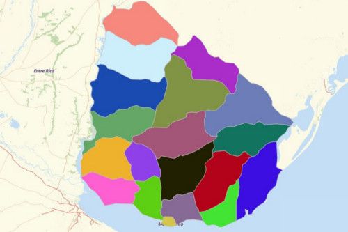
URUGUAY DEPARTMENTS
- Territory Guide
- URUGUAY DEPARTMENTS
Let your map of Uruguay Departments dynamically produce results. Whether you’re doing data analysis in business, education, or in health sector, you cannot go wrong in analyzing in department-level to fully understand the connection between locations.
What’s even better is that you get to overlay all the departments of Uruguay like a flash!
A CLOSER LOOKAT URUGUAY DEPARTMENTS
The Eastern Republic of Uruguay is located in South America. It shares borders with Argentina and Brazil. The country is considered to be the 2nd smallest country in South America next to Suriname. It is the home of more than 3.3 million people, more than half of which reside in its capital city, Montevideo.
Using Mapline, you can easily create a map of Uruguay departments. Uruguay is made up of 19 departments. Each department has a legislature where the mayor of each department serves as chief executive. A department holds the executive and legislative powers. The departments of Uruguay are further divided into small municipalities.
ADD URUGUAY DEPARTMENTS TO MAP
Here in Mapline, you can find the fastest ways to add territories!
Just clickt he ADD button on the left side of your map to locat MAPLINE’S REPOSITORY. When searching for a terriotry to add, you don’t need to scroll all the way down. It may take a while to do that. Instead, use the search bar and type URUGUAY. Then choose URUGUAY DEPARTMENTS.
With the department boundaries all mapped out, get ready to identify different opportunities as well as sociopolitical factors that directly or indirectly affect your business.


Pro Tip: Mapline provides territory boundaries of Uruguay like cities and departments.
CHOOSE DEPARTMENT COLORS
Unravel trends, patterns, and insights by simply choosing the fill colors for your territories.
Just one simple step to add but it will go a long way because it leads you to uncover time-sensitive information that you needs to be addressed right away.
Choose the color style that best fits your type of analysis. Choose from random, uniform, custom-color, or heat map. Then hit OK. How easy is that!

GET NEW TERRITORY INSIGHTS
That’s how easy it is to create a map of Uruguay departments! Once you have your map, you can create a map of Excel spreadsheet locations to overlay on top. Mapline also makes it simple to see summary information about the locations inside each department just by clicking on them! Sign up now to create a map of Uruguay departments.


