
Administrative Post Map of East Timor Helps to Make Data-Informed Decisions
Mapping Techniques to Uncover Data Insights
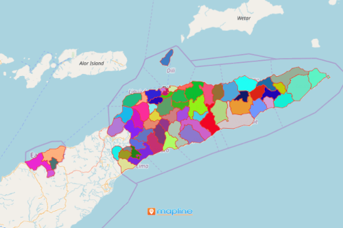
Small and big companies take advantage of using smart mapping tools as they analyze data on an administrative post map of East Timor. East Timor is an island country located in Southeast Asia. It is divided into 65 administrative posts. With data-based geographic insights, they are able to make better decisions, create plans, and implement them. Heat maps let you understand customer profiles in a targeted administrative post. It lets you see the locations in their perspectives whether they have more potential or more risks. Hence, a powerful mapping software is used in more focused data and territory analyses.
Other mapping features such as distance analysis and coverage networks can also be applied when analyzing East Timor administrative post map. The tools are useful when assessing market feasibility and discovering business growth opportunities. Applying these tools are used to gain location-based insights as they visualize chunks of data in a geographic context.
Uncover Data-Based Geographic Insights
Jump right in and build an administrative posts map of East Timor in a just a few clicks:
- Create a Mapline account and login.
- Click the orange “Add New Items” button.
- Select “New Map” on the drop down arrow.
- Give your map a name and click “OK.”
- Click the “Add” button from the left sidebar.
- Select the “Territories” option.
- Click “From Mapline’s Repository.”
- From the “Territories” select “East Timor Administrative Posts.” Use the search bar for quicker results.
- Select how you want your boundaries to be colored in “Fill Color” (Random Colors, Uniform Color, or Custom Colors From Spreadsheet).
- Click “OK.”
Save significant amount of time and money as you use Mapline’s Mapping Software in data analysis in an administrative post map of East Timor. Sign up now and experience first-hand how you can use all the powerful visualization tools available to help you discover all your data has to offer!