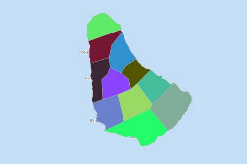
BARBADOS PARISHES
- Territory Guide
- BARBADOS PARISHES
If you want to be on top of the competition, then you better create a map of Barbados Parishes and let it do the works! Having a map with parish territories lets you understand different characteristics of each parish thereby letting you craft a stronger marketing approach for your business. Analyze parish locations seamlessly.
Make an informed decision because your next steps are crucial!
A CLOSER LOOK AT BARBADOS PARISHES
You can easily create a map of Barbados parishes using Mapline. Barbados is an island country located in the Americas, covering a total area of 432 square kilometers. The country is said to be the 53rd richest country in the world. It has a well-developed mixed economy and a moderately high standard of living.
Using Mapline, you can easily create a map of Barbados parishes. Barbados is divided into 11 parishes. The parish of Saint Philip is the largest in terms of size while Saint Michael parish is the most populous, with 88,529 in population. Bridgetown, the capital of Barbados, is located within the parish of Saint Michael. It is believed to be the next parish that may have its own district.
ADD BARBADOS PARISHES TO MAP
With the Barbados parishes added to your map, start growing your customer base, analyze parish trends, pinpoint the needs of your customers, and so much more!
To achieve that, click the ADD button on the left side of your map. Select TERRITORIES and FROM MAPLINE’S REPOSITORY. To add a new territory, use the search bar and type BARBADOS to choose BARBADOS PARISHES.
Woah, that was fast!


Pro Tip:
CHOOSE PARISH COLORS
Before we let you go, here’s a great way to analyze your territories and data. Learn custom territory styling fast! Colors help your map tell a compelling story.
Choose whether you want to appyly custom colors, static colors, or dynamic styling.
Once you click OK, you’ll be directed to your map of Barbados Parishes available to use.

GET NEW TERRITORY INSIGHTS
That’s how easy it is to create a map of Barbados parishes! Once you have your map, you can create a map of Excel spreadsheet locations to overlay on top. Mapline also makes it simple to see summary information about the locations inside each parish just by clicking on them! Sign up now to create a map of Barbados parishes.


