LOCAL GOVERNMENT AREAS OF AUSTRALIA
- Territory Guide
- LOCAL GOVERNMENT AREAS OF AUSTRALIA
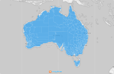
Unleash the full potential of a map of Local Government Areas in Australia! The geographic format does not only aim to provide boundaries. More than that, when you incorporate your data with Mapline features, you’ll be tapping local perspectives to improve your business!
When we say that, we’re not exaggerating. Let’s find out why and how.
A CLOSER LOOK AT AUSTRALIAN LOCAL GOVERNMENT AREAS
You can now create a map of local government areas in Australia. The local government in Australia is the lowest tier of government. Currently, there are 565 local councils in the country. The areas covered by local councils ranges from as small as 0.58 square miles (Shire of Peppermint Grove in metropolitan Perth) to 150,000 square miles (Shire of East Pilbara in Western Australia).
ADD LOCAL GOVERNMENT AREAS TO MAP
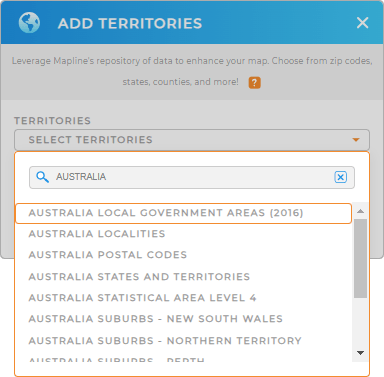
Start by adding this territory to your map. Make sure to use the search bar since Mapline’s Repository is packed full of territories available to overlay.
Type AUSTRALIA and choose LOCAL GOVERNMENT AREAS from the list. Just by doing this, you get to save tons of your time adding territory!
If you’re a sales or business professional, no doubt, you want to get the full use of your map to create marketing strategies and sales tactics around local government areas. When this territory is easily plotted on a map, it helps to get better visualization of key business opportunities to add impact to your business.


Pro Tip: Mapline provides a long list of territories of Australia to overlay on your map. Aside from the Local Government Areas, utilize other territories like Postal Codes, States and Territories, and Suburbs.
CHOOSE LOCAL GOVERNMENT AREA COLORS
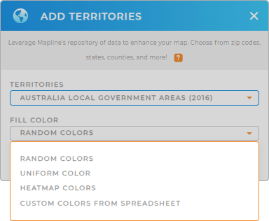
Cool, right? Now we’re getting on to the more exciting part – by making a color-coded map. By adding colors, you make your map visualizations so impactful that you’ll get to know communities, tap potential customers, and work smarter.
Whether you want to know about possible locations for your business, or finding out how to provide the best services for your customers, or understand political affiliations, adding colors to your boundaries is a big help to make informed decisions to achieve more success.
Choose the best type of territory colors that work best for your analysis – custom-color, heat map colors, uniform color, or random colors.

GET NEW TERRITORY INSIGHTS
With your new map in tow, you can:
- Create routes that optimize themselves
- Wow your audience with eye-catching presentations with heat maps
- Take your visualization and analysis up a notch by adding datasets to your map.
Your analysis will be so much more effective using these features.


