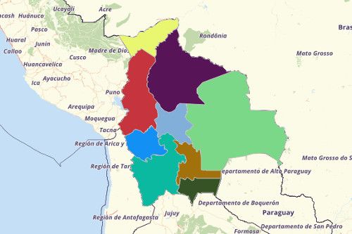
BOLIVIA DEPARTMENTS
- Territory Guide
- BOLIVIA DEPARTMENTS
Drive dramatic improvements to your marketing strategies and sales performance as you create a map of Bolivia Departments. A department-level analysis is a great help in maximizing your productivity while finding opportunities in each locality. This is what you can call successful territory management.
Why not start now to build a map and explore the many benefits it in your journey to successful territory management?
A CLOSER LOOK AT BOLIVIA DEPARTMENTS
You can easily create a map of Bolivia departments using Mapline. Bolivia is located at the heart of South America. One of the many interesting things about the country is that it has twice the size of the land area of France but its population is only a tenth of its population. It shares its borders with neighboring countries like Argentina, Paraguay, and Peru. Departments are the primary administrative unit in Bolivia. Each department is headed by 4 senators. Bolivia consists of 9 departments, and the departments are divided into 112 provinces which are further divided into 337 municipalities and 1374 cantones.
ADD BOLIVIA DEPARTMENTS TO MAP
To manage your territories well, the first step is to add Bolivia Departments yo your map. With the department boundaries clearly visualized, you can start analyzing the interrelationships between locations. As you gofurther, you get to deliver actionable insights just being familiar with the characteristics of each department boundary.
Click the ADD button to add territories from Mapline’s Repository. Just type even just the keyword BOLIVIA to the search bar and choose DEPARTMENTS from the selection.
Now here’s another step that can significantly improve your analysis.


Pro Tip: Aside from the department boundaries, you may find other Bolivia territories beneficial to your analysis. There’s provinces and municipalities that you can readily added to your map.
CHOOSE DEPARTMENT COLORS
With just a few clicks, you can improve the over-all look of your map just by adding colors ! And the best part is that with colors added, what used to take hours or even days to analyze, once you put colors, you can analyze only within minutes or even in a few seconds! Isn’t that so exciting?
When we say colors, we don’t just mean a dabble of colors. Mapline provides a careful selection of territory color styles. Whatever you choose, be assured that you’ll be having a sharper eye to detect patterns and connections and find the right solutions to manage your territories better.
Select the color style that’s fitting to your analysis – random colors, uniform color, custom color from spreadsheet, or heat map colors.

GET NEW TERRITORY INSIGHTS
That’s how easy it is to create a map of Bolivia departments! Once you have your map, you can create a map of Excel spreadsheet locations to overlay on top. Mapline also makes it simple to see summary information about the locations inside each department just by clicking on them! Sign up now to create a map of Bolivia departments.


