U.S. CENSUS TRACTS
- Territory Guide
- U.S. CENSUS TRACTS
Keep up with the most recent changes in U.S. Census Tracts. Areas and localities can change quickly before you know it. Make sure to rely on Mapline to make sure that what you add to your map is the latest version.
Dive right in and start to overlay census tract boundaries to your map at breakneck speed! Here are some quick steps to get you started.
A CLOSER LOOK AT U.S. CENSUS TRACTS
Created by the Bureau of Census, census tracts are used to analyze populations. Thus, they are designed to follow people instead of political boundaries. These tracts usually have a population size between 2,200 and 8,000. These areas are in census metropolitan areas with a core population of 50,000 or more. Census tracts are identified by an integer number up to 4-digits and may have an optional 2-digit suffix. Use a US census tract map to view your data in a different way to better inform sales and marketing strategies. With Mapline, you can find a US territory map that fits your needs or check out the steps below to create a US census tract map.
Mapline offers census tract territories in all US states to help you find exactly what works for your data set. To create a US census map, follow the simple steps below:
ADD U.S. CENSUS TRACTS TO MAP
Effortlessly add U.S. census tracts to your map so you can invest more of your time in data and territory analysis. What an awesome way to manage your time, right?
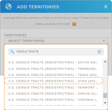
To do that, just add territories FROM MAPLINE’S REPOSITORY and type CENSUS TRACTS on the search bar. Make sure that you choose the most recent year.
Census tract boundaries are available by state. So just choose the state that you want from the drop down arrow.


Pro Tip: Mapline obtains census tract boundaries from the U.S. Census Bureau. The most recent census was in 2020. The next census will happen in 2030.
CHOOSE CENSUS TRACT COLORS
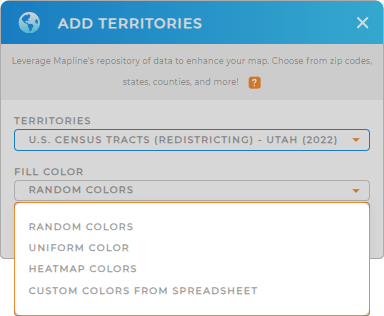
Oops there’s more… make your U.S. census map visually compelling! How? By simply adding a color style to your territories.
It’s more than just having a colorful map. It’s about getting the best out of it when used in site selection, market analysis, or sales territory management . Be empowered to uncover hidden opportunities and patterns from colored territories!
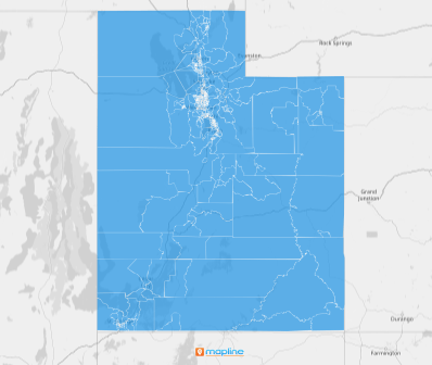
Lastly, click OK. Now, you have your map of U.S. census tracts in no time

GET NEW TERRITORY INSIGHTS
But it doesn’t stop there! Now, you can:
- Plan efficient delivery routes
- Customize sales marketing strategies as you identify growth opportunities for each territory
- Compare your sales data alongside U.S. Demographics data
Speed your analysis as you speed your way to more success with Mapline.


