Geographic business intelligence (or Geo BI) is the missing layer in most business analytics strategies. It uses location-based data to give teams better context, reveal hidden trends, and prioritize what actually matters. By visualizing data geographically, companies can align resources, optimize field operations, and forecast outcomes with unmatched precision. Geo BI isn’t just another dashboard—it’s a decision-making engine. When you add maps to your metrics, you give every department clearer insight into where success is happening and where opportunity lies.
Why GEographic Business Intelligence Matters
Most companies already track KPIs. But very few understand where those numbers are coming from or how geography plays a role. Location-based business intelligence brings spatial awareness to your business strategy, letting you connect performance to place. Instead of just knowing that churn increased, you can see where. Instead of guessing which territories need more coverage, you’ll know. This isn’t about adding complexity. It’s about adding context, so that your team can work smarter with the data they already have.
That’s why leading teams are turning to Geographic Business Intelligence (Geo BI) to take action faster, optimize outreach, and close the loop between insight and execution.
Here’s how it plays out across your organization:
Geo BI Lets You Map Business Performance at a Glance
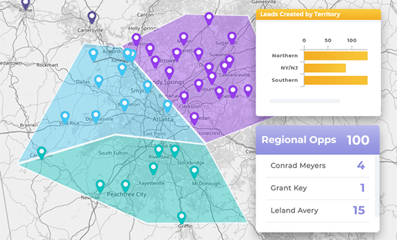
When performance is mapped instead of listed, you instantly spot what’s working. Geo BI lets you visualize sales, leads, support tickets, or deliveries by ZIP code, district, or custom territory. No extra digging. Just instant visibility into where your strategy is gaining ground—and where it needs backup.
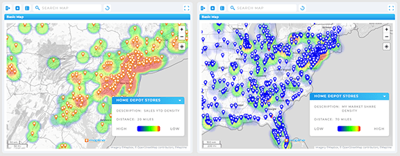
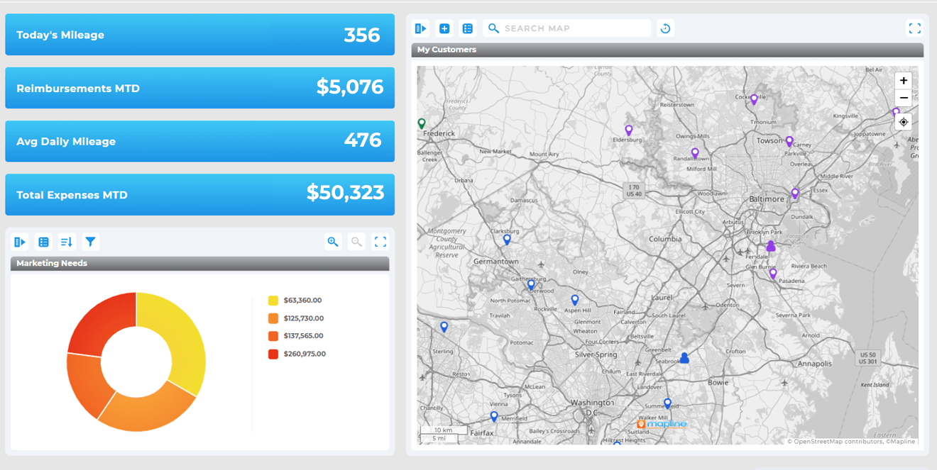
The Best Geographic Business Intelligence Visualizes KPIs in an Accessible Way
With KPI mapping, teams can see exactly where top reps are thriving, which regions are underperforming, and how market changes are impacting results. These visuals bring clarity to executive reports and help frontline teams act on insights faster. It’s a more intuitive, less manual way to track success.
Leverage Geographic Business Intelligence to Monitor Regional Business Performance
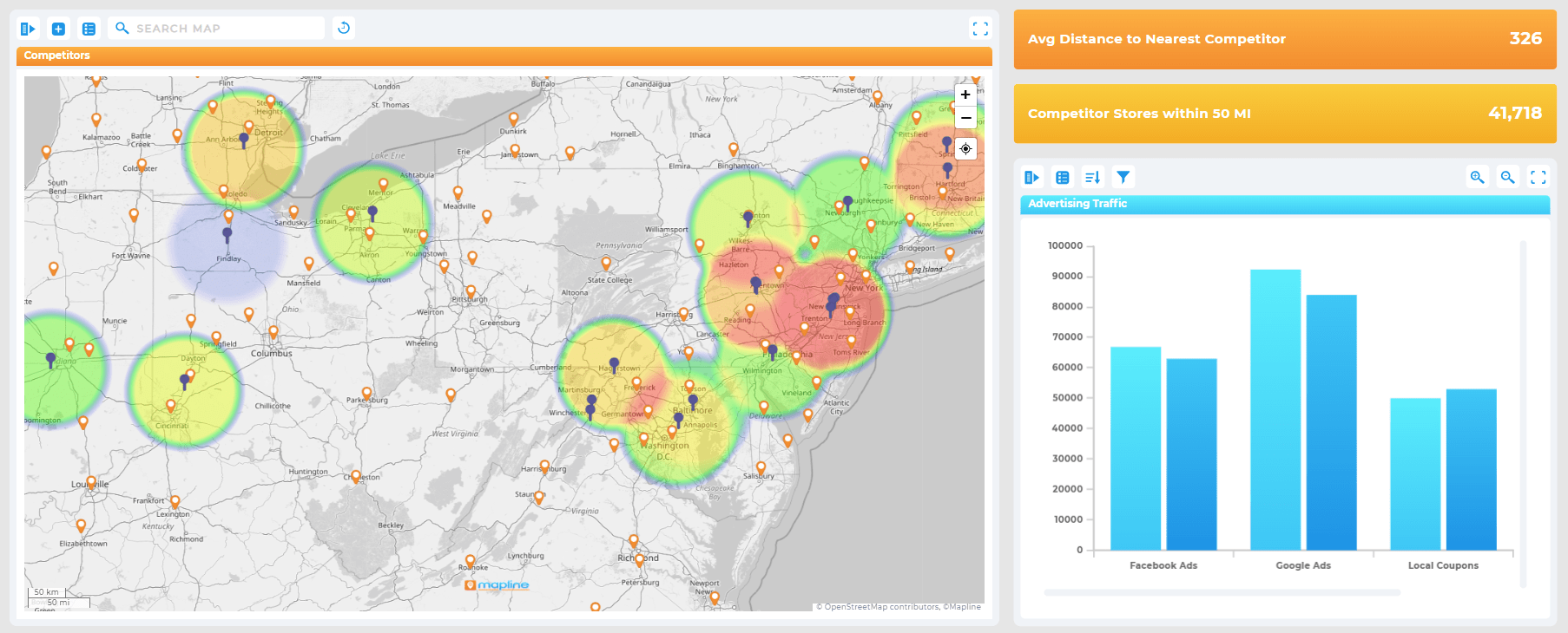
Whether you’re operating in five cities or fifty, regional business analysis makes it easier to manage growth. Overlay internal data with external factors like population, competition, or coverage to find underdeveloped markets and scale effectively. It’s one of the most practical, scalable uses of geo BI today.
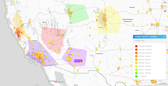

Pro Tip: Don’t settle for maps that just look good. Choose a platform that lets you act on your data. Mapline’s Geo BI gives you location intelligence, live dashboards, and territory control—all in one tool. Try it free and see why teams across industries trust Mapline to make smarter, faster decisions.
Key Benefits of Geo Business Analysis
When you move from generic dashboards to geo business analysis, you empower teams with spatial intelligence. This isn’t just helpful—it’s transformative. By analyzing performance in a geographic context, companies make better decisions, faster, with less waste and more accuracy.
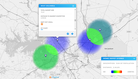
Spot High-Impact Opportunities with Location Analytics
Mapping data highlights which regions drive the most ROI—and which are lagging. Whether you’re tracking revenue, leads, or service volume, this visibility helps you double down on what’s working and pivot away from what’s not.
Balance Resources by Region
Geo BI helps leaders allocate staff, assets, and outreach more evenly across territories. Instead of reacting to problems, you can plan proactively, minimizing risk and maximizing output with each scheduling or dispatch decision.
Forecast Market Trends More Accurately with GIS-based Business Intelligence
By layering demographic or historical data over your operational maps, you can forecast with confidence. Whether it’s a seasonal trend or a shift in customer behavior, you’ll be ready—not blindsided.
In short, Geo BI replaces broad assumptions with precise, actionable intel tailored to your business footprint.
How Spatial BI Tools Work
Spatial BI tools use map layers and geospatial analytics to enhance traditional business intelligence dashboards. These platforms are built to help teams visualize relationships, trends, and performance patterns tied to geography. Unlike generic BI tools, spatial BI shows you not only what’s happening, but also where and why. The result is a more complete, more intuitive view of your business that bridges departments and empowers fast action.
Custom Territory Creation
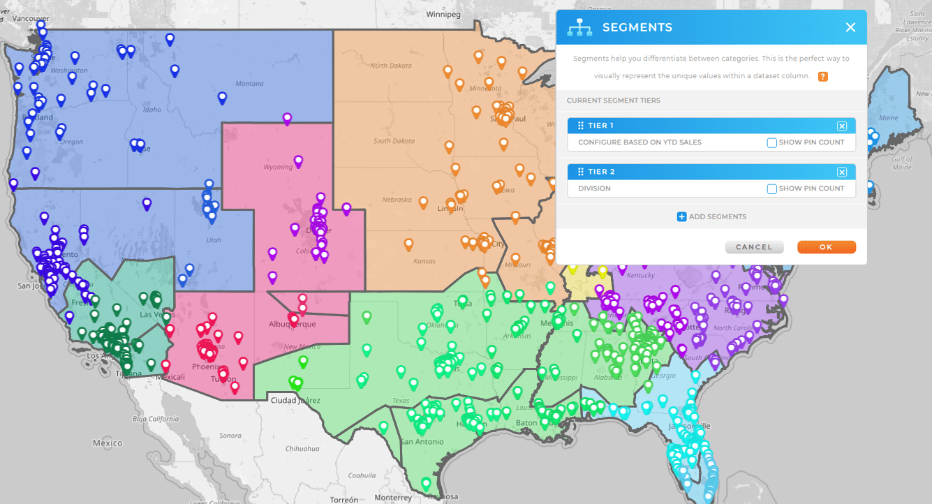
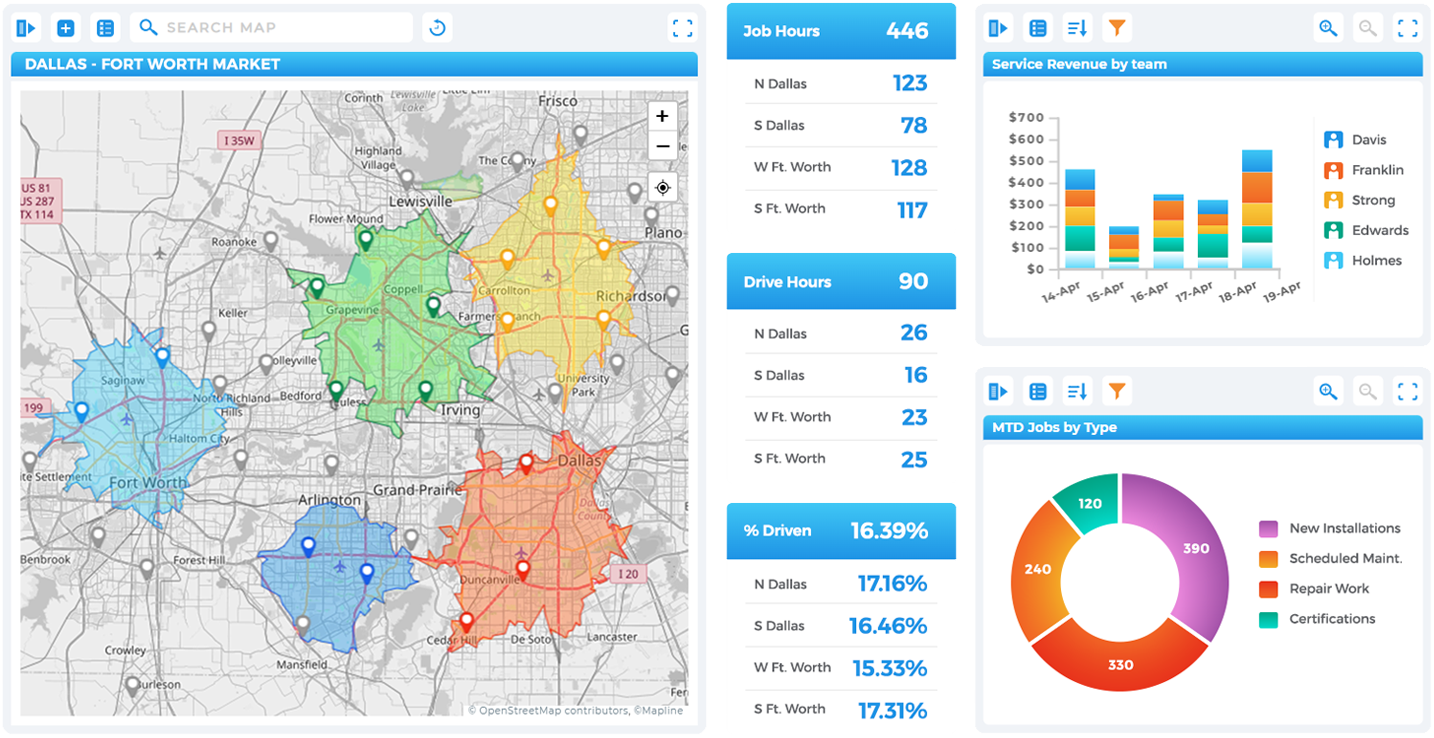
Draw or upload territories that match your business logic: sales regions, delivery zones, service areas, or coverage radiuses. No coding required. Mapline’s visual interface makes it easy for non-technical users to shape insights around real-world geography.
Dynamic Filters and Data Layers
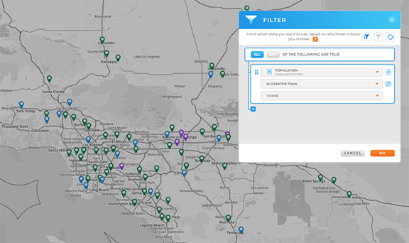
With dynamic filters, you can isolate performance trends by rep, product, or location. Add external data like population or median income to better understand how regional context impacts outcomes. The more layers you add, the clearer the picture becomes.
Live Updating Dashboards
Geo dashboards are interactive and update automatically as new data comes in. That means your leadership team, analysts, and field operators are always working from the most up-to-date view, no manual refresh needed.
These tools aren’t just nice to have. They’re how fast-moving companies gain ground without adding complexity.
Use Cases for Geographic Business Intelligence
Different teams use geo insights for business in different ways; but the common thread is clarity. Geo BI makes data make sense. Whether you’re in sales, marketing, ops, or leadership, it brings more transparency and agility to your day-to-day work.
Sales Team Territory Analysis
Build and balance sales territories with visual overlays. Track rep performance by region, identify coverage gaps, and expand into new markets with data-backed precision.
Marketing Campaign Targeting
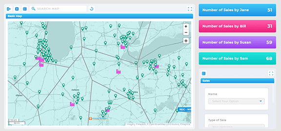
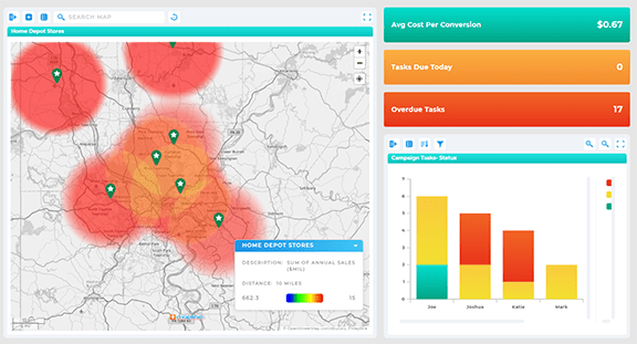
Layer customer demographics and behavior onto a map to target your ideal audiences by ZIP code, city, or custom region. Spend smarter by seeing which campaigns are converting—and where they’re falling flat.
Operations & Field Team Coordination
Dispatch smarter, avoid overlaps, and reduce drive time by assigning jobs based on territory logic and real-time location data. For service teams, Geo BI makes routing and scheduling seamless.
Whatever your role, Geo BI puts your data in motion, so your business can move faster with confidence.
How Mapline Stands Apart in Geographic Business Intelligence
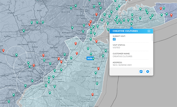
Most tools stop at visualization. Mapline goes further, connecting insights to action. It’s the only geo BI platform that combines mapping, territory management, performance dashboards, and real-time routing in one simple, no-code solution. Whether you need to manage teams across 5 territories or 500, Mapline scales without friction.
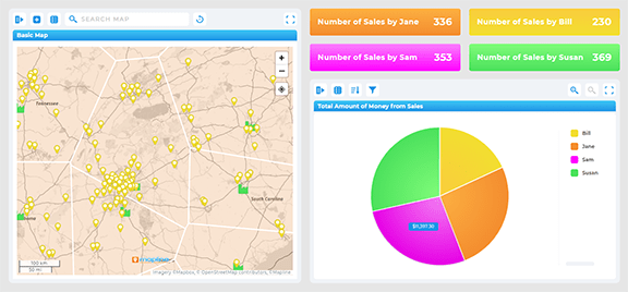
All-in-One Location Intelligence
Manage territories, visualize data, run reports, and even dispatch field teams, all in one place. Mapline consolidates the entire process into a single platform so you never have to jump between tools again.
Real-Time, Location-Driven Dashboards
Mapline’s dashboards let you track business performance live, filtering instantly by region, rep, or time. Add maps, charts, and filters with just a few clicks. No more waiting on analysts or dev teams.
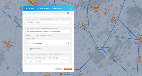
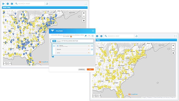
Data-Backed Territory Logic
Balance territories based on actual workload, revenue, or customer count—not just square mileage. With Mapline, your team can design smarter territories that boost productivity and morale.
It’s business intelligence built for the real world—not just the boardroom.
Get More From Geographic Business Intelligence
Location adds meaning to your data. With the right geographic business intelligence platform, you turn static dashboards into dynamic insight engines that power better decisions—across every level of the business. Ready to see what Geo BI can do? Mapline makes it easy to get started.
Geo BI uses map-based visualizations to help businesses analyze performance and make decisions based on location data. It’s a smarter, more intuitive way to manage operations, teams, and growth.
Traditional BI shows what happened—Geo BI also shows where, why, and how. It adds spatial context to your data, helping you identify patterns, trends, and inefficiencies that don’t show up in a spreadsheet.
Visualize sales by region, optimize territories, track field team performance, spot regional trends, and forecast growth—all through interactive maps that tie directly into your data sources.
Mapline is the only Geo BI platform that connects mapping, routing, scheduling, and territory logic in one easy-to-use solution. It’s fast, flexible, and made for businesses that move.


