
How to Use The Filter Option When Mapping Nigeria Local Government Areas
Dynamic Data Filtering Results Dynamic Results
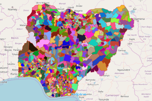
If you have hundreds or perhaps even thousands of data points, it is highly recommended to use the filter options when mapping Nigeria local government areas. Nigeria is divided into 774 local government areas (LGAs) which are further subdivided into wards. Recently, the country faced yet another surge of Covid-19 as the new variant, Omicron, has penetrated the population of some LGAs. Multi-sectors are joined together to address the situation. Hence, it is imperative to see and communicate information in a timely fashion. To do this, you need to filter your map to focus your analysis on the locations that matter the most.
Let your local government areas of Nigeria map dynamically produce results. Whether you’re doing data analysis for health sector, in business, or in any other industry, you cannot go wrong in analyzing data with filters. You cannot fully understand the connection between locations if there are tons of pins scattered everywhere on the map. Accurate data analysis requires filtering the pins so you can focus on analyzing one distinct characteristic. Filter the data by criteria not only for better visibility but to focus more on the right group of pins that you want to dive deeper into.
Filter Your Map to Speed Up Data Analysis
It only takes a few seconds to generate a local government area map of Nigeria. Then, add your Excel spreadsheet data. In just a few clicks, you can filter your pins and start to unravel trends, patterns, and insights that you may have overlooked before.
- Create a Mapline account and login.
- Click the orange “Add New Items” button.
- Select “New Map” on the drop down arrow.
- Give your map a name and click “OK.”
- Click the “Add” button from the left sidebar.
- Select the “Territories” option.
- Click “From Mapline’s Repository.”
- From the “Territories” select “Nigeria Local Government Areas.” Use the search bar for quicker results.
- Select how you want your boundaries to be colored in “Fill Color” (Random Colors, Uniform Color, Dynamic heat map colors, or Custom colors from spreadsheet).
- Click “OK.”
Mapping Nigeria Local Government Areas can lead you to uncover time-sensitive information and share it across all other sectors. Sign up now and start to experience how filtering and other dynamic mapping tools can help you unlock the full power of your data.