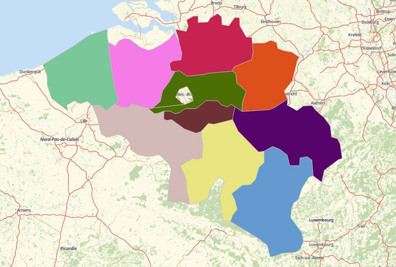
BELGIUM PROVINCES
- Territory Guide
- BELGIUM PROVINCES
What’s really going on in your business? Don’t get lost! Be in control with the ins and outs in your operation. See it visually as you start creating a map of Belgium Provinces.
Be in the know to identify opportunities that lie in each province boundary. Worry no more cause we’ll help you see it through!
A CLOSER LOOK AT BELGIUM PROVINCES
Although Belgium is divided into 3 regions – the Brussels-Capital Region (Brussels), the Flemish Region (Flanders), and the Walloon Region (Wallonia), its provinces are only subdivided into 2 regions. The Brussels-Capital Region originally took a small portion of a province. The Flanders have 5 provinces (Antwerp, Limburg, East Flanders, Flemish Brabant, and West Flanders.
ADD BELGIUM PROVINCES TO MAP
Experience the ease of adding Belgium provinces in easy steps as A-B-C.
- A – add territories from Mapline’s Repository
- B – BELGIUM is what you’ll type in the search bar
- C – choose PROVINCES
This serves as your guide when adding territories.
With all the provinces of Belgium added to your map, you’re a step ahead to start a thorough analysis to your territories and improve your location awareness.


Pro Tip: Aside from provinces, Mapline offers other territories for Belgium like arrondissements and regions.
CHOOSE PROVINCIAL COLORS
Now, start adding colors to the provincial boundaries. Doing so can make a huge difference First, it helps to easily detect patterns and trends. It also emphasizes valuable points to consider when creating or altering plans for operations.
Here in Mapline, we don’t just mean sprinkle with colors. What we mean is choosing from different types of color styling – random, uniform, custom color, or heat map colors.
With your color-coded territories, bring in more impact to your analysis. Dive deeper into getting more insights on local safety, health improvement, and more.

GET NEW TERRITORY INSIGHTS
That’s how easy it is to create a Belgium Provinces map! Once you have your map, you can create a map of Excel spreadsheet locations to overlay on top. Mapline also makes it simple to see summary information about the locations inside each province just by clicking on them! Sign up now to create a Belgium map of Provinces.


