VENEZUELA PARISHES
- Territory Guide
- VENEZUELA PARISHES
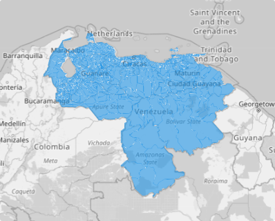
Elevate your marketing strategies with a powerful map of Venezuela parishes. Unlock the full potential of your data by leveraging a parish map to craft marketing strategies that are meticulously tailored to the unique needs and preferences of each community. Visualize your data within these boundaries to gain deep insights that empower you to design campaigns that truly resonate with your audience.
Let’s add these parish boundaries to your map and watch how you can elevate your analysis and shape your market! Be equipped with the strategic insights to drive engagement and stay ahead of the competition.
WHAT ARE VENEZUELA PARISHES?
Nestled on the northern coast of South America, Venezuela boasts a vibrant landscape that spans a continental landmass and countless islands in the Caribbean Sea. Administratively, the country is divided into 335 municipalities, further broken down into over 1,000 parishes—the smallest units of local governance. Managing such a vast and intricate network without a clear visual strategy can feel like navigating a labyrinth blindfolded. But when you map out Venezuela’s parishes, the picture changes. The data comes alive, and opportunities emerge.
Leverage this map into your analytics and unlock opportunities, one parish at a time!
ADD VENEZUELA PARISHES
With parish-level mapping, you’re not just reacting to market trends—you’re anticipating them. By visualizing precise boundaries, you gain a dynamic edge to optimize operations, seize opportunities, and lead with confidence.
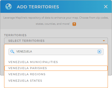
Let’s add these boundaries to your map quickly! First, add a new territory from Mapline’s repository. Type VENEZUELA in the search bar and select VENEZUELA PARISHES.


Pro Tip: Mapline’s extensive repository of territory boundaries empowers you to integrate Venezuela territories including Venezuela states, Venezuela regions, Venezuela municipalities, and parishes. Explore these territories to glean different levels of insight.
CHOOSE PARISH COLORS
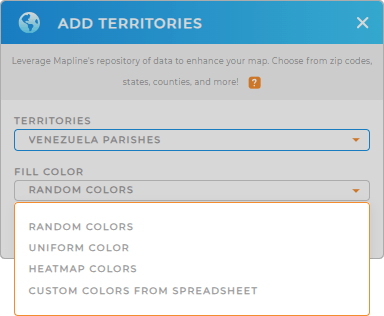
Enhance your insights with a color-coded parish map. Take your data visualization to the next level by customizing your territory map with colors. Color-coding your parish map not only provides a clear visual distinction between regions but also transforms your analysis into a dynamic, vibrant tableau of information.
Simply choose your preferred color styling, click OK, and watch your map transform into a powerful tool for strategic success.

GET NEW TERRITORY INSIGHTS
Leverage these Mapline capabilities to enhance your analytics on your map:
- Create winning sales territory maps
- Run distance calculations in a flash
- Monitor your team performance 24/7


