- Blog
- Geo Mapping
- 3 Easy Ways to Leverage Satellite Imagery to Improve Site Planning
Satellite view gives teams a clear picture of the site from above, ensuring decisions are grounded in reality. When you’re planning a site—whether it’s a new store, a distribution hub, or a field project—the right location determines everything. But spreadsheets and pin-drop maps only tell half the story. Satellite imagery reveals what’s actually on the ground: buildings, parking access, loading docks, terrain, vegetation, neighboring properties, and real obstructions. By comparing current conditions to future projections, teams eliminate guesswork and make decisions based on reality—not assumptions.
This guide shows how using satellite view transforms site planning by giving you visual context, clearer risk analysis, and faster decision-making. With Mapline, users can toggle between standard map views and real satellite images, add layers, and visualize data—without jumping between tools or exporting to design software.
Why Satellite Imagery is a Game-Changer for Site Planning
Satellite view unlocks details that traditional mapping tools miss. You can see the actual terrain, physical obstacles, parking lots, traffic patterns, and even construction changes over time. This visual context helps teams assess site accessibility, identify potential bottlenecks, and plan layout or routing strategies more accurately. Instead of relying on vendor-provided diagrams or outdated PDFs, satellite imagery gives you proof—what exists right now, in real life. For field teams and operations managers, that difference can prevent costly mistakes.
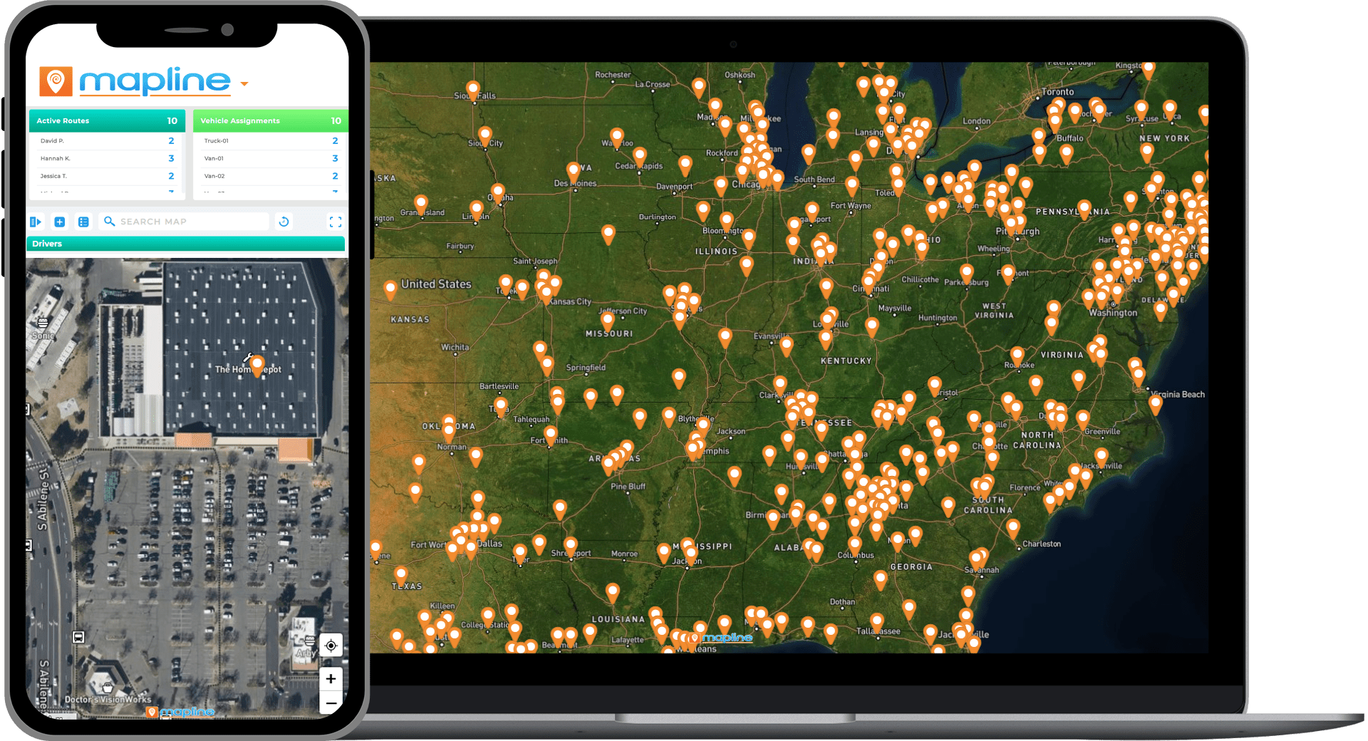

Pro Tip: Satellite view isn’t just for planning where you can go—it’s for eliminating where you shouldn’t. If satellite imagery shows obstacles, limited access, or poor infrastructure, eliminate the site before wasting time on quotes, walk-throughs, or landlord negotiations.
Understand Real-World Site Constraints
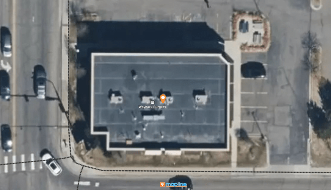
A site might look perfect on a traditional map but become a disaster during implementation. Satellite imagery shows what’s actually surrounding the location—fences, neighboring buildings, road access, overhead obstructions, or elevation changes. This protects teams from onboarding the wrong location or misjudging accessibility.
Validate Parking, Loading Access, and Traffic Flow
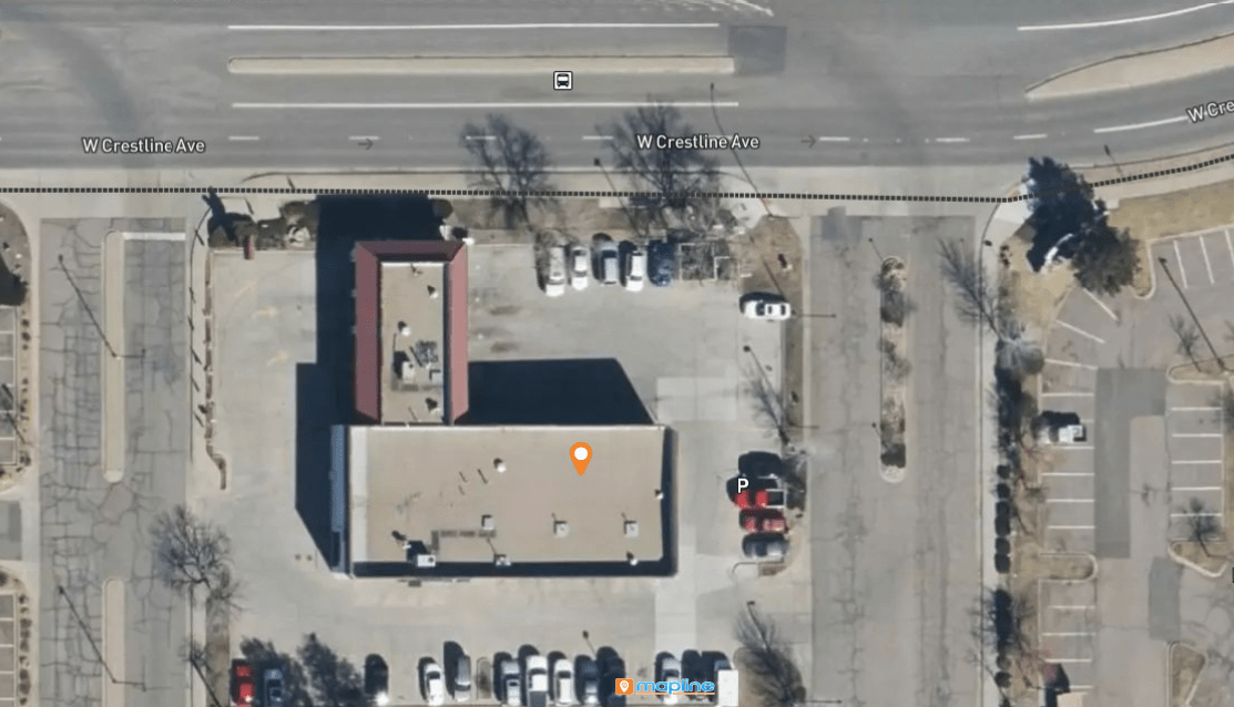
Satellite view allows you to see loading bays, rear entry points, vehicle turnaround space, and parking availability. It’s invaluable when evaluating whether a site supports semi-truck access, curbside pickup, or customer parking. These details simply aren’t visible in street maps or pin datasets.
Before & After: What Satellite View Reveals
Traditional map views present geographic boundaries and streets, which is helpful for organizing data—but not enough to make decisions. Satellite view reveals what’s happening on the ground right now. The “before and after” approach visually compares planning assumptions against real-world conditions, helping teams spot risks early. Whether you’re evaluating expansion potential, planning construction, or optimizing delivery access, satellite imagery turns abstract data into physical reality.
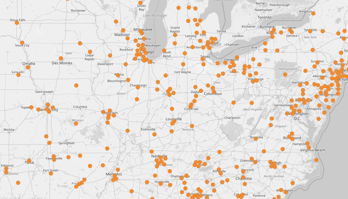
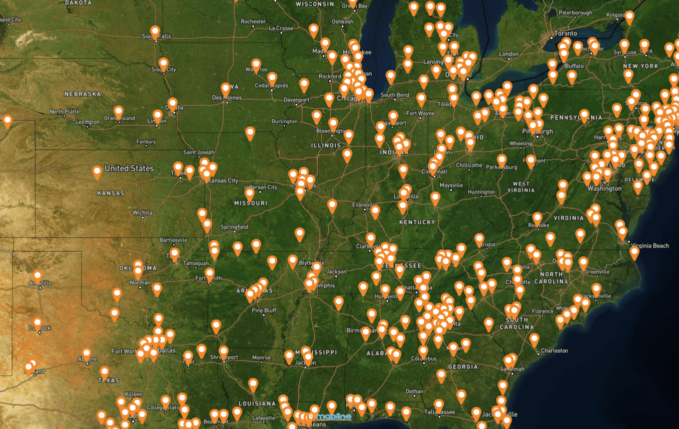
Before — Boundary & Pin Map
A boundary or pin view shows your target area and key locations. Great for strategic planning, but not operational readiness. On a normal map, a warehouse might appear perfectly placed between your existing facilities, but you can’t see environmental factors, access limitations, or traffic congestion.
After — Satellite Insight
By switching to satellite view, you may discover limited truck access, shared space with another business, blocked alleyways, or steep terrain. This transforms decision-making. You’re no longer planning based on assumptions—you’re planning based on ground truth. With Mapline, switching views is instant, so you can evaluate multiple locations rapidly.
How to Use Satellite View Imagery in Mapline
Mapline makes satellite imagery a functional part of site planning—not just a visual layer. Users can overlay data, shapes, and business insights directly on top of satellite view. This allows you to validate everything from service zones and customer density to loading access and walkable areas. Instead of exporting imagery into other tools, you can make decisions directly inside Mapline.
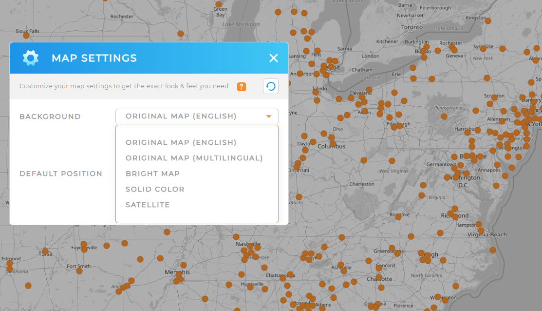
Step 1: Switch to Satellite View
Open your map and select Satellite Mode. Instantly, building shapes, parking lots, vehicle bays, and rooftop layouts become visible. Unlike static satellite screenshots, Mapline lets you keep all your layers visible—even in satellite imagery.
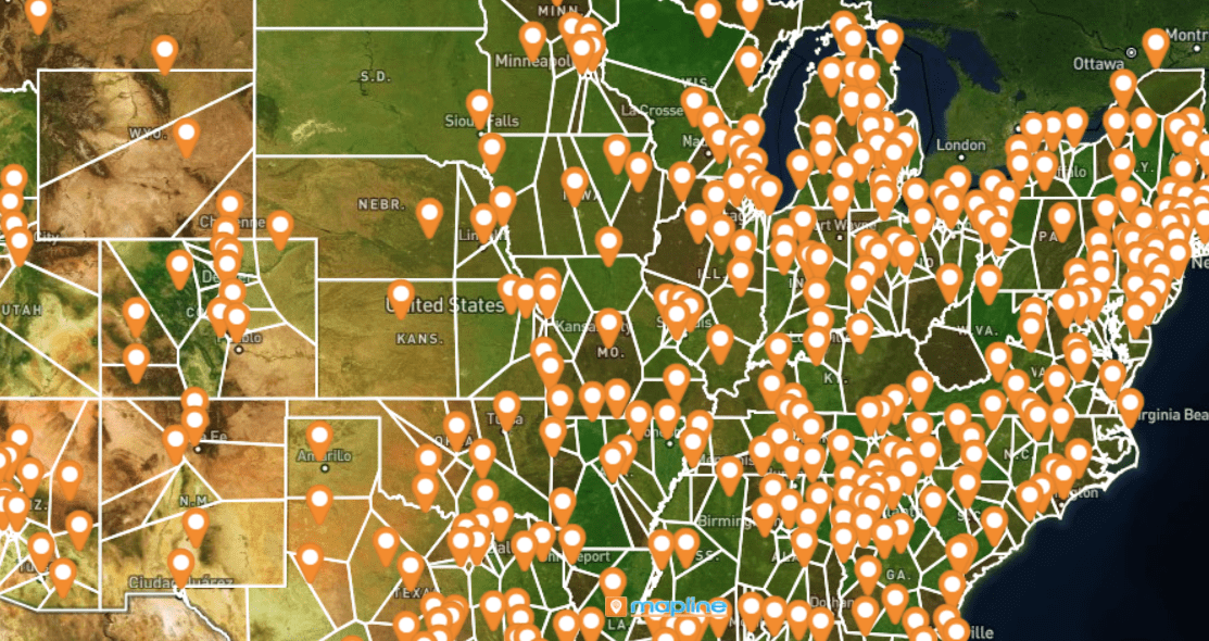
Step 2: Overlay Data & Boundaries
Add territories, pin groupings, or coverage circles on top of the satellite image. Overlaying business data helps reveal how the real-world environment impacts strategy. For example: a coverage circle might look strategic in street view, but satellite imagery could reveal an obstacle that limits access.
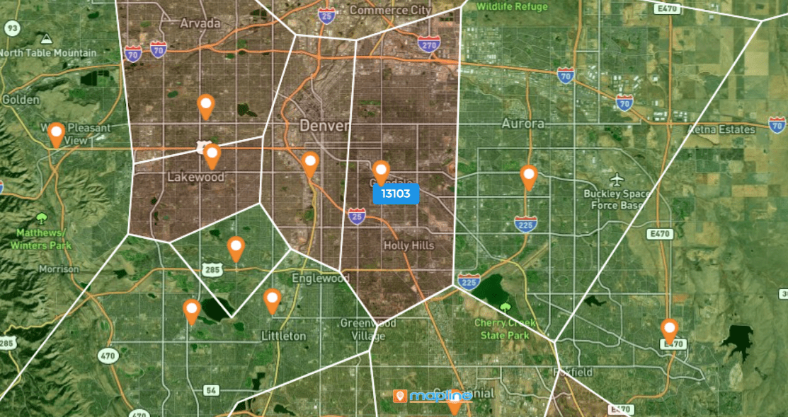
Step 3: Compare Multiple Sites
Use satellite view to evaluate potential locations. Quickly compare access, space, traffic flow, and surrounding properties. With Mapline’s layers and shapes, you can create a visual “scorecard” for each location and share it across your team.
Best Use Cases For Satellite View in Business Site Planning
Satellite imagery is useful in every phase of location analysis—from early research to final approvals. In Mapline, teams use satellite imagery not just for visualization, but for decision-making. Overlay customer density, service zones, or route accessibility directly on top of real imagery for instant clarity.
New Location or Facility Selection
Evaluate surrounding infrastructure, traffic flow, parking availability, and competitive presence without visiting every site.
Delivery or Field Ops Routing
Confirm that vehicles can access the location, especially for trucks or service vans requiring turnaround clearance or right-side delivery.
Franchise & Territory Planning Through Satellite View
Use satellite view to confirm land use, population density, and foot traffic patterns when determining territory boundaries.
Yes, Mapline keeps all pins, boundaries, and overlays visible in satellite mode.
Mapline uses enterprise-grade satellite data providers for updated imagery.
Yes. Satellite maps can be exported as high-resolution PNG files for slides and reports.
Yes—open multiple maps or duplicate layers to compare locations visually.


