FEDERATED STATES OF MICRONESIA
- Territory Guide
- FEDERATED STATES OF MICRONESIA
When you’re managing business operations across multiple islands, clarity is everything. A map of the Federated States of Micronesia helps you stay organized, pinpoint opportunities, and make informed decisions with confidence. Whether you’re analyzing service coverage, planning distribution routes, or identifying underserved areas, this map is a game-changer.
By visualizing state boundaries, you’ll gain a better understanding of how your data interacts with these unique geographies. Ready to get started? Let’s explore how to create your map of the Federated States of Micronesia’s states with Mapline.
WHAT ARE FEDERATED STATES OF MICRONESIA (FSM)?
The Federated States of Micronesia (FSM) is composed of four states: Yap, Chuuk, Pohnpei, and Kosrae. Spread across the western Pacific Ocean, these states are made up of hundreds of islands, each with its own logistical challenges and opportunities.
Mapping FSM’s states provides businesses with valuable insights into regional demand, distribution planning, and operational efficiency. From optimizing routes across islands to understanding customer trends, this map empowers you to take data-driven action across this unique region.
ADD FSM STATES
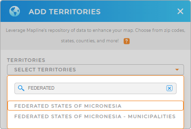
Map the Federated states of micronesia now and unlock a new level of geographic intelligence! Start your map by adding a new territory from Mapline’s repository. Open your map, click ADD, and choose FROM MAPLINE’S REPOSITORY. In the search bar, type MICRONESIA and select MICRONESIA STATES.
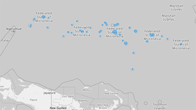
Once added, the state boundaries allow you to visualize your data in the context of FSM’s geographical layout, helping you identify opportunities and streamline your operations.


Pro Tip: Mapline’s extensive global territory repository empowers you to manage operations seamlessly across multiple countries. Perfect for growing brands and market expansion, this tool helps you navigate new opportunities with precision. Explore our repository to add the Federated States of Micronesia muncipalities empowers you to manage operations seamlessly ac—aligning your strategy with the right regions and unlocking powerful insights for smarter decision-making.
CHOOSE FSM STATE COLORS
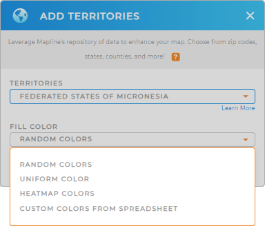
Bring your map to life by adding color styles to your states. Choose dynamic colors to highlight regions with real-time updates based on your data, or use static colors to focus on specific trends or areas.
Once you’ve chosen your preferred color styles, click OK to finalize your map of FSM’s states and unlock new levels of clarity and insight.

GET NEW TERRITORY INSIGHTS
With your map of FSM’s states, you can take advantage of Mapline’s powerful features to optimize your business operations. Here’s how you can make the most of your map:
- Overlay administrative boundaries to refine your analysis
- Highlight areas of interest with advanced color styling.
- Dive deeper into your data with Mapline’s Geo Analytics tools.


