SYRIA GOVERNORATES
- Territory Guide
- SYRIA GOVERNORATES
Mapping Syria governorates is a game-changing tool for businesses aiming to operate effectively in this diverse and complex country. Take charge with a territory map that transforms the way you see your business! Track sales performance, decode market trends, and map your customer base with pinpoint accuracy. Dive into the patterns that matter most — and turn insight into action, faster than ever.
With Mapline, you can quickly visualize administrative boundaries, helping you identify trends and opportunities to optimize your operations and strategies.
WHAT ARE SYRIA GOVERNORATES?
Syria is divided into 14 governorates, each representing a unique combination of economic, cultural, and geographic features. These governorates are key to understanding the country’s demographics, infrastructure, and market potential.
A governorate map allows businesses to identify high-potential areas, streamline operations, and adapt to regional challenges with precision. Imagine a map that doesn’t just show you where you are — it shows you where you can go. Visualize your sales, spot the shifts in the market, and find your customers in ways you’ve never seen before. This is your key to unlocking the full potential of every opportunity.
ADD GOVERNORATES
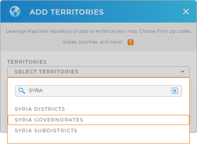
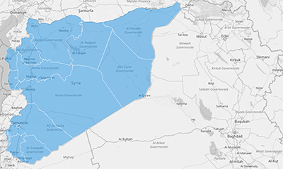
To create your map, add a new territory from Mapline’s repository. Search for “Syria” and select “Syria Governorates.” Once the governorates are added, your map will display all 14 boundaries, ready for data-driven analysis.
This clear visualization empowers you to focus on the areas that matter most to your business objectives.


Pro Tip: Explore related administrative boundaries available in Mapline’s repository insluding Syria Districts and Syria Subdistricts. With powerful territory maps that put your sales, market trends, and customer hotspots front and center, you’ll spot patterns, chase new leads, and crush your goals with energy and style.
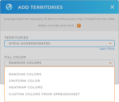
CHOOSE GOVERNORATE COLORS
Enhance your map’s functionality by applying color styles. Highlight strategic regions with static colors, or use dynamic colors to visualize data changes in real-time. A well-customized map helps you make informed decisions faster.
With Mapline, your map of Syria governorates becomes a powerful tool for achieving business success.

GET NEW TERRITORY INSIGHTS
Maximize the value of your Syria governorate map with Mapline’s powerful tools. Here’s how:
- Run a comprehensive market analysis in minutes
- Visualize trends and patterns in your data with geo-aware reporting
- Streamline your event planning and performance tracking, from task management to real-time metrics


