SOLOMON ISLANDS PROVINCES
- Territory Guide
- SOLOMON ISLANDS PROVINCES
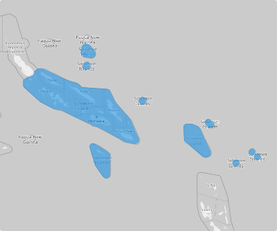
Unleash the power of mapping Solomon Islands provinces! Adding these boundaries to your map offers a crystal-clear view that’s perfect for strategic planning, market analysis, and boosting operational efficiency. Whether you’re decoding regional demographics, fine-tuning distribution networks, or crafting hyper-local marketing campaigns, you have the edge to visualize and conquer the geographic intricacies of the Solomon Islands.
This detailed map is an intuitive tool to help streamline your process, empowering you to harness geographic data with ease and precision. Armed with valuable location insights, you can make informed decisions that drive success and keep you ahead of the competition.
WHAT ARE SOLOMON ISLANDS PROVINCES?
The Solomon Islands, often called the Solomons, is a stunning island nation in Melanesia, part of Oceania, situated northeast of Australia. It comprises six major islands and over 900 smaller ones, offering breathtaking natural beauty and a rich cultural heritage. For local governance, the country is divided into ten administrative areas. Nine of these are provinces, each managed by elected provincial assemblies, while the capital city, Honiara, is uniquely administered by the Honiara Town Council. This structure ensures effective management and representation across the archipelago.
Take your business strategy to the next level by integrating a province-level map in your analytics. Unlock powerful insights to refine resource allocation, deepen customer engagement, and elevate overall performance in your target market.
ADD SOLOMON ISLANDS PROVINCES
Add province territory to your map in seconds! This is your gateway to understanding your target market and connecting with your customers. Establish customized marketing campaigns that resonate on a local level to build long-lasting relationships.
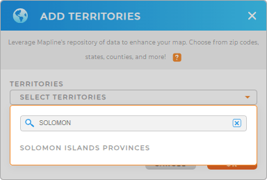
To do that, you need to add a new territory from Mapline’s repository. Type SOLOMON in the search bar and select SOLOMON ISLANDS PROVINCES.


Pro Tip: Mapline’s worldwide territory repository empowers you to combine regions from the Caribbean countries including Solomon Islands Provinces into your map, paving the way for you to find the most effective approach for business strategies.
CHOOSE PROVINCE COLORS
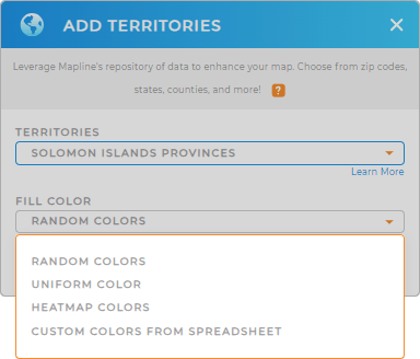
Now, elevate your analytics by adding colors. Color-coding your province territory map turns complex data into a vibrant, clear representation, empowering you to make sharper, more informed decisions at a glance.
Mapline provides the best color styles to maximize your map visualization. Choose the type of colors that match your level of analysis.
Lastly, click OK after configuring your settings.

GET NEW TERRITORY INSIGHTS
Now, boost your analytics and capture more powerful insights for decision-making by incorporating these advanced capabilities:
- Calculate anything about your data to extract more data values
- Visualize key data and analyze results with customized charts
- Create instant customer maps to monitor your customer connection


