SIERRA LEONE DISTRICTS
- Territory Guide
- SIERRA LEONE DISTRICTS
Analyze insights on a map of Sierra Leone districts—it’s a total game-changer! This isn’t just about seeing more; it’s about seeing smarter. With deeper spatial analysis, you’ll gain a crystal-clear view of your local reach, instantly visualizing how your business connects with each district. Pinpoint where your impact is strongest, uncover expansion opportunities, and refine strategies to meet local demands. This detailed insight empowers you to target specific areas, serve customers more effectively, and drive growth like never before.
Ready to harness these district-level insights and transform your approach? Adding these district boundaries to your map is quick and easy—let’s get started!
WHAT ARE SIERRA LEONE DISTRICTS?
Sierra Leone, located on the southwest coast of West Africa, is administratively divided into four provinces and the Western Area, which together comprise 14 districts. The Western Area, home to the capital city Freetown, is split into two districts. At the local governance level, these districts function as localities, each governed by a directly elected local district council. These councils are responsible for exercising authority and managing functions to address the needs of their communities, fostering development, and enhancing local-level decision-making across the country.
Supercharge your analysis by aligning your strategies with district boundaries! With this focused approach, you can quickly identify areas that need a boost, tailor your campaigns for maximum impact, and gain a deeper understanding of regional dynamics. This allows you to refine your strategy, direct resources where they’ll make the biggest difference, and drive both efficiency and growth. It’s time to make smarter decisions and see your efforts pay off faster than ever!
ADD SIERRA LEONE DISTRICTS
Visualize distint patterns within district boundaries and empower you to pinpoint regional performance to identify high-potential areas and address challenging regions with precision, adjust strategies for maximum efficiency and impact, and unlock actionable insights.
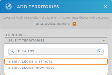
Create clear, visual narratives that drive smarter decisions by adding a new territory from Mapline’s repository. Type SIERRA LEONE in the search bar and choose SIERRA LEONE DISTRICTS to add to your map.
Now, you’re just one step away from unlocking the full potential of your map!


Pro Tip: Mapline’s Repository is your gateway to a world of territory boundaries from countries around the globe. This invaluable resource empowers you to elevate your territory analysis by seamlessly integrating diverse regions—like the Sierra Leone provinces and Sierra Leone districts into your map!
CHOOSE DISTRICT COLORS
Get ready to transform how you approach your strategy and make smarter, more impactful decisions! Color-coding your map is your key to navigating market complexities with confidence, empowering you to drive growth and seize opportunities like never before.
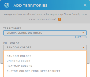
Mapline offers four powerful color styles to enhance your map visualization: heat map, custom colors, uniform color, or random colors. Choose the one that best fits your analysis and watch your data come to life!
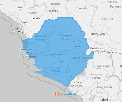
Now, your map of Sierra Leone districts is ready!

GET NEW TERRITORY INSIGHTS
Mapline offers these powerful capabilities to help you capture valuable insights:
- Segment your charts in seconds so you can take instant action
- Visualize trends and patterns and immediately adjust your strategies
- Set up a powerful system that analyzes market dynamics on demand


