FRANCE IRIS AREAS
- Territory Guide
- FRANCE IRIS AREAS
Adding territories like France IRIS Areas to your map can greatly enhance your analytics and optimize your operations. These territories help you analyze trends, understand market shifts, and evaluate potential opportunities. France IRIS areas are the perfect method for gaining real-time insight into your business operations within a specific region, enabling you to better manage, plan, and optimize your processes.
Whether you’re looking to fortify your presence in a specific region or amplify customer engagement nationwide, leveraging a map of France IRIS areas is the key to unlocking sustainable growth and long-term success. Check it out!
WHAT ARE FRANCE IRIS AREAS?
France IRIS Areas are subdivisions within French towns with over 5,000 inhabitants. IRIS stands for ‘Ilots Regroupees pour l’Information Statistique,’ or ‘aggregated units for statistical information.’ These areas vary greatly in population, ranging from areas with a population of 2 MIL +, like Paris, or smaller cities like Chambery, which as of 2024, has a population of 61,640. These areas include both residentail and business units, with 92% of IRIS units being residential, and 5% comprised of businesses (the other 3% is defined by the French government as ‘miscellanous,’ or uninhabitated).
These areas offer a detailed view of regional locations within France, helping you improve your data analytics and better manage sales, marekting, or logistics. It may not seem like it now, but a territory map of France IRIS areas can transform how you manage and adapt to market changes.
ADD IRIS AREAS TO MAP
Open doors to smarter strategies as you add these boundaries to your mpa now! This level of analysis enables you to refine product and service offerings. Imagine being empowered to meet the unique needs of each IRIS area!
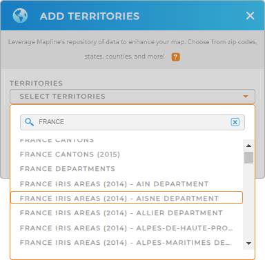
Seamlessly add France IRIS areas to your map in just a couple clicks of your mouse! First, add a new territory from Mapline’s repository and type FRANCE into the search bar. Select FRANCE IRIS AREAS and Boom! You’re done.
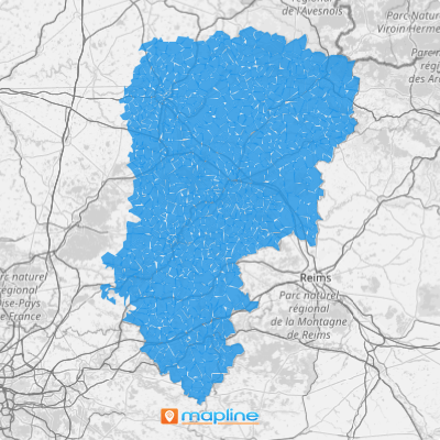
Let’s check out the final step and get your new territory map up and running!


Pro Tip: Mapline’s Repository offers the most recent IRIS boundaries available from the French government. Select the most recent year from the drop-down menu to get the most up-to-date territory boundaries.
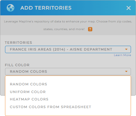
CHOOSE IRIS AREA COLORS
Using color styles for your IRIS Area map is crucial for business analytics and optimizing operations. It helps you visualize key data, identify trends, and make informed decisions at a glance.
Simply select your preferred type of color styling, then click OK when you’re done.
Now you’re ready to leverage your map of France IRIS areas and tap into new, never-before-seen business insights!

GET NEW TERRITORY INSIGHTS
Now, you have the power to unveil key insights hidden in your data. Let’s check out some powerful capabilities you can leverage to get the information you need:
- Extract valuable insights with comprehensive territory reports
- Make data-driven decisions with your team by sharing custom dashboards
- Generate and deliver bids to win new businesses


