SERBIA MUNICIPALITIES
- Territory Guide
- SERBIA MUNICIPALITIES
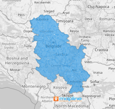
Bringing your insights to life on a map of Serbia municipalities sparks a powerful shift in perspective—turning raw numbers into clear, actionable intelligence that supercharges your decision-making. Since a municipality-level analysis brings in more granular insights, brands can customize their marketing strategies to meet the hyper-local needs of their customers. Incorporate municipality-level data analysis into your strategies and watch your customer connection drastically improve!
With just a few clicks, you can add Serbia municipalities to your map. Let’s dive into this process very quickly.
WHAT ARE SERBIA MUNICIPALITIES?
Serbia is located right at the borders of Central and Southeast Europe. The 145 municipalities serve as the basic entities of the country. Learn to understand your data context in a more granular view as you leverage Serbia municipalities into your analysis.
To illustrate, suppose you’re a big producer of fruits and looking for the most effective easy to trim down your logistics costs and delivery services while finding ways to improve your overall business operations. As you plot your customer locations on a map of Serbia municipalities, you can achieve significant insights that you previously thought may be irrelevant to your business operations. You may learn that as you deliver your produce in municipalities in Pcinja, which is the farthest district, there are a lot of restaurants, bakeries, and hotels, along the way that may need the exact products you offer!
This is one fantastic way to transform your analysis to grow your business towards more success!
ADD SERBIA MUNICIPALITIES
Get ready to tailor your strategies to meet the local demands of different municipalities! Strengthen your marketing campaigns and improve your supply chain efficiency as you add municipalities to your map.
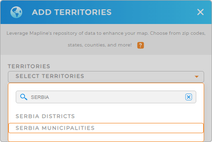
Doing that is so easy you only need to add a new territory from Mapline’s repository. Then, on the search bar, type SERBIA and choose to add SERBIA MUNICIPALITIES to your map.
See how fast it is?


Pro Tip: Leverage Mapline’s extensive list of territory boundaries to unlock valuable insights. Easily add Serbia districts and municipalities to your map to analyze and optimize your operations within Serbia.
CHOOSE MUNICIPALITY COLORS
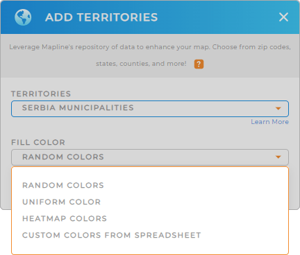
Fuel your territory analysis with colors to bring more location insights! Color-coding your municipality map is pivotal when highlighting key data points and revealing patterns and trends vital for decision-making.
Color-code your territory by choosing from Mapline’s color styling. Choose from random colors, uniform color, heat map, or custom colors, depending on the type of analysis you’re doing.
Once you have configured your settings, click OK.

GET NEW TERRITORY INSIGHTS
With your map of Serbia municipalities, you can unlock more valuable insights from your data analysis using these powerful capabilities:
- Boost sales route efficiency to streamline your operations
- Analyze competitor proximity to your stores to make informed decisions on defense strategies
- Harness the power of center points to elevate your business strategy


