AUSTRIA MUNICIPALITIES
- Territory Guide
- AUSTRIA MUNICIPALITIES
Enhance your analytics with a map of Austria municipalities. Gain insights to improve your operations in Austria. Why municipality boundary, you may ask. These boundaries provide more granular insights into local market dynamics. A municipality-level analysis helps fine-tune your business strategies leading to optimized operational efficiency.
Level up your analytics by making a map of municipality territory an important part of it!
WHAT ARE AUSTRIA MUNICIPALITIES?
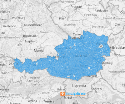
Austria is a landlocked country in Europe. On January 1, 2020, it was divided into 2,095 municipalities with a population ranging from around 50 to almost 2,000,000. Adding the municipalities to your map opens your eyes to granular insights to design strategies to improve your overall operational efficiency.
For instance, by visualizing the municipal boundaries, you may see opportunities in route planning. These insights allow you to plan effective distribution routes and reduce your transportation costs. What a great insight!
ADD AUSTRIA MUNICIPALITIES
There’s no better way to analyze how your business fares than to make a competitor analysis. This is where a map of Austria municipalities comes in. This territory map helps to identify municipalities with high competitor activity and assess your market position. Then target areas with high potential but low competitor presence. What a fantastic use of your territory map to advance your business ahead of the competition!
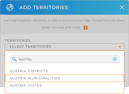
Adding these regions to your map is so simple all you need is to add a new territory from Mapline’s repository. Type AUSTRIA into the search bar to trim down the time searching for the right territory. Then choose AUSTRIA MUNICIPALITIES.


Pro Tip: Explore a vast selection of territory boundaries including Austria districts, Austria states and municipalities from Mapline’s worldwide territory repository. Adding territory boundaries to your map enhances your data analysis, leading to new possibilities to improve business operations.
CHOOSE MUNICIPALITY COLORS
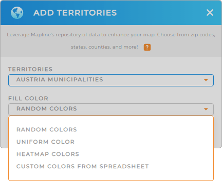
The next step is to fill your territory with colors. Mapline offers different color styles to match your type of analysis. Choose random colors to distinguish each municipality. Use uniform colors if you want to present your map with clarity. But if you want to unlock the full potential of your data, apply dynamic colors.
Customize your map with your preferred color styling that matches the analysis you’re doing. Once you have configured your color styles, click OK.
Now that’s your map of Austria municipalities!

GET NEW TERRITORY INSIGHTS
You can do much more with your Austria municipalities map to wring out more insights. Try applying these powerful capabilities to help you achieve that:
- Add geometric mid point to identify optimal meeting places
- Analyze territory-specific sales performance when you view territory report
- Customize your pins for quick identification


