IRELAND MUNICIPAL DISTRICTS
- Territory Guide
- IRELAND MUNICIPAL DISTRICTS
Explore the dynamics of Ireland municipal districts to unlock unique opportunities for growth. By analyzing your data within these boundaries, you gain the context needed to craft strategies that truly resonate with each region’s distinctive characteristics. Whether it’s refining your marketing approach, enhancing customer engagement, or optimizing your product offerings, this municipal-level insight empowers you to connect more effectively with your audience.
Embrace the power of municipal analysis and watch your strategies transform into high-impact initiatives that drive meaningful results!
WHAT ARE IRELAND MUNICIPAL DISTRICTS?
Ireland, an island in the North Atlantic Ocean in northwestern Europe, is home to 95 municipal districts that form the backbone of local development. These municipalities play a pivotal role in spatial planning, public transport management, and key investment programs, weaving together a dynamic framework that drives progress while preserving Ireland’s rich character and traditions.
Analyze data at the municipal level to gain a clearer understanding of local market dynamics, enabling you to make targeted, data-driven decisions that boost efficiency and growth. Unlock the power of granular insights and watch your business thrive with smarter strategies tailored to each municipal district!
ADD IRELAND MUNICIPAL DISTRICTS
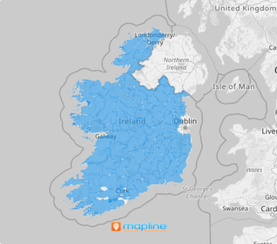
Take a closer look at the municipal district map and uncover the fine details that drive your business forward. Zoom in to reveal critical insights that empower you to streamline your supply chain, segment customers with precision, and plan smarter expansions.
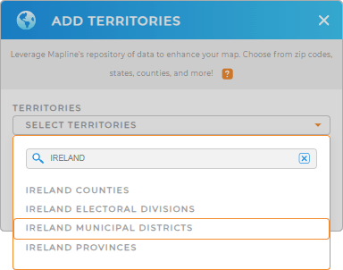
Here in Mapline, adding a new territory from Mapline’s repository is a no-frills process. Just type IRELAND in the search bar and select IRELAND MUNICIPAL DISTRICTS from the selections.
One last step and we’re done with your map creation.


Pro Tip: Integrate territories from Ireland including Ireland provinces, Ireland counties, Ireland electoral divisions, and municipal districts, into your map to enhance your global operational reach. This is made possible as you access territories from Mapline’s extensive repository of territory boundaries.
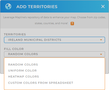
CHOOSE DISTRICT COLORS
Accelerate your analysis with the power of territory colors! Colors are more than just visual enhancements—they’re a game-changer for your analytical approach.
With Mapline, you can apply static colors to assign status-based distinctions, providing a clear and instant visual breakdown of your territories. Or you can choose to apply dynamic colors that adapt in real-time, directly tied to your data metrics for a deeper, more insightful analysis. Choose the color styles that best fit your analysis to achieve your goals.

GET NEW TERRITORY INSIGHTS
Analyze your data even further with these powerful capabilities:
- Create revenue-focused sales territories to optimize performance
- Craft spot-on marketing strategies to analyze your customers and locations in a flash
- Identify ways to connect with your customers with location-based campaigns


