MALTA LOCAL COUNCILS
- Territory Guide
- MALTA LOCAL COUNCILS
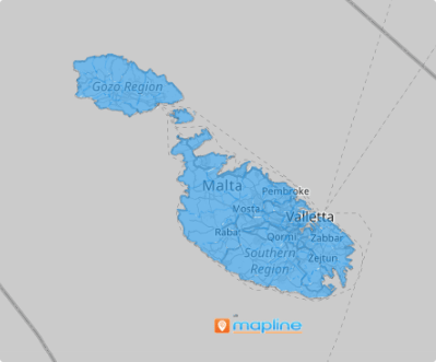
Unlock the power of a map of Malta local councils in seconds! Quickly integrate this map into your analytics to uncover how these detailed boundaries influence your business growth. With this granular approach, you’ll gain valuable insights into regional trends, customer distribution patterns, and sales drivers. This level of detail transforms your geospatial analysis, helping you make smarter, more informed decisions that propel your business forward.
Ready to elevate your strategy? Let Malta’s local councils guide you to smarter moves and bigger wins!
WHAT ARE MALTA LOCAL COUNCILS?
Malta, a small but strategically vital island nation in the heart of the Mediterranean, is divided into 68 localities, each governed by local councils since June 30, 1993. These councils oversee a diverse mix of municipalities, boroughs, villages, and towns, reflecting the unique character of Malta’s communities.
For businesses, mapping Malta’s local councils is a game-changing tool for understanding the island’s distinct markets. By visualizing perspectives within these boundaries, you can identify high-impact areas, refine strategies, and unlock local insights that fuel growth. Whether it’s pinpointing opportunities, optimizing operations, or tailoring initiatives to meet regional needs, Malta’s local councils provide the clarity and precision you need to drive business success.
ADD MALTA LOCAL COUNCILS
Want to fine-tune your sales territories? Curious about uncovering local market trends that others miss? A detailed map of Malta local councils puts all the answers at your fingertips, empowering you to make smarter, data-driven decisions.
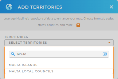
Ready to unleash the power of precision mapping? Let’s get started and watch your business soar! Add a new territory from Mapline’s Repository. Type MALTA in the search bar and choose MALTA LOCAL COUNCILS.


Pro Tip: Custom maps of Malta Islands and local councils, created using Mapline’s global territory repository, provide a detailed and visual representation of your operational landscape.
CHOOSE LOCAL COUNCIL COLORS
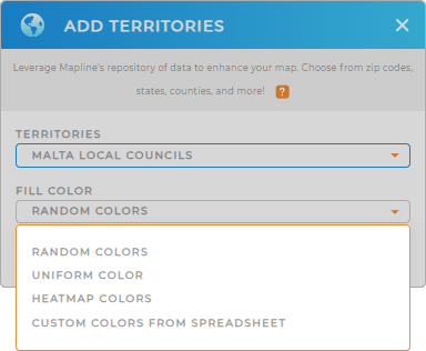
Now, bring your municipality map to life with color-coded territories! Mapline provides exceptional color styles to choose from: heat map to highlight intensity and trends with gradient shades, custom colors to match your unique needs, uniform color to keep your visualization clean and consistent, and random colors to add variety for easy differentiation.
Choose your ideal color styling to enhance your analytics. Configure your settings, then click OK.

GET NEW TERRITORY INSIGHTS
Leverage these powerful Mapline capabilities to unlock hidden insights:
- Customize charts to show off key data and analyze results at full speed
- Summarize a large data set in a visual form
- Unlock your business’ full sales potential with effective sales territory maps


