- Blog
- Geo Mapping
- Plotting Locations on a Map Isn’t Enough — Here’s What Leaders Do Differently
Many businesses start their journey into mapping by simply plotting locations on a map. It’s a valuable first step — seeing customer addresses, sales accounts, or delivery points pinned geographically creates clarity that spreadsheets can’t provide. But for leaders focused on growth, plotting alone isn’t enough. Without analysis, strategy, and optimization, pins are just dots on a screen. The real advantage comes when companies move beyond visualization to transform maps into tools for sales strategy, logistics efficiency, and customer growth.
The Limitations of Basic Map Plotting
When teams plot addresses on a map, they get immediate visibility into where customers or resources are located. However, basic plotting points on a map doesn’t reveal workload balance, revenue gaps, or logistical inefficiencies. For example, a rep may have dozens of accounts in one region while another area goes ignored. A delivery team may be driving extra miles because routes aren’t optimized. A free map creator with pins is a good start, but businesses that stop there miss out on critical insights that drive efficiency and profitability.


Pro Tip: Start by plotting locations on a map to gain quick visibility. But don’t stop there. Geo Mapping lets you evolve from pin plotting to advanced territory optimization, delivery route optimization, and sales strategy — all in one platform.
Why Leaders Go Beyond Pins
Plotting is only the foundation. The companies that succeed are the ones that analyze and act on the data behind the map. When leaders move from plot multiple addresses on map workflows into territory or routing strategies, they turn static maps into business intelligence. They start asking questions like: Which regions deliver the most ROI? Where are the biggest gaps? How can we reduce wasted travel? By using advanced platforms instead of mapping multiple locations on Google Maps, leaders turn visualizations into strategy.
Transforming Plotted Maps into Strategy
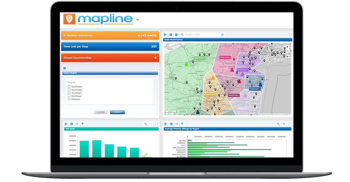
Modern mapping platforms go beyond plotting. They allow businesses to combine location data with performance metrics and create maps that drive action. Instead of stopping at a visual display of points, advanced platforms layer in sales data, customer demographics, and operational KPIs to uncover hidden opportunities. This transforms maps from static references into living tools that guide territory design, resource allocation, and growth strategies. By connecting maps to business goals, teams can prioritize high-value opportunities, streamline operations, and reduce wasted effort. The result is a strategy built not just on where things are, but on what those locations mean for the bottom line.
Smarter Sales Territory Mapping
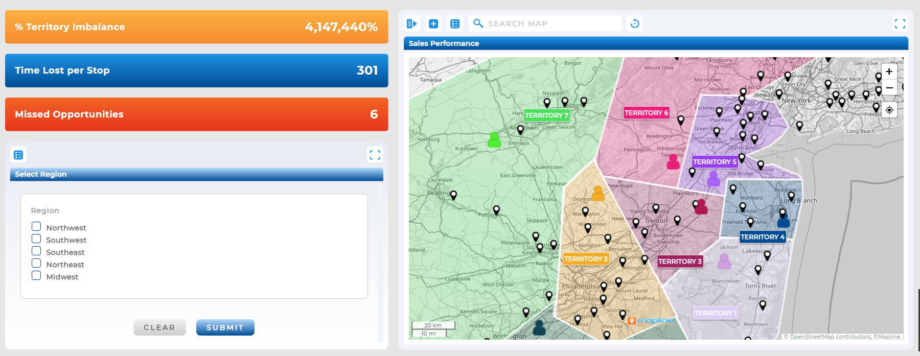
With sales territory mapping software, plotted points become the foundation for optimized territories. Instead of competing for the same accounts, sales reps are assigned fair, strategic regions. Tools like territory mapping software make it easy to design, adjust, and manage territories for maximum efficiency.

Delivery Route Optimization
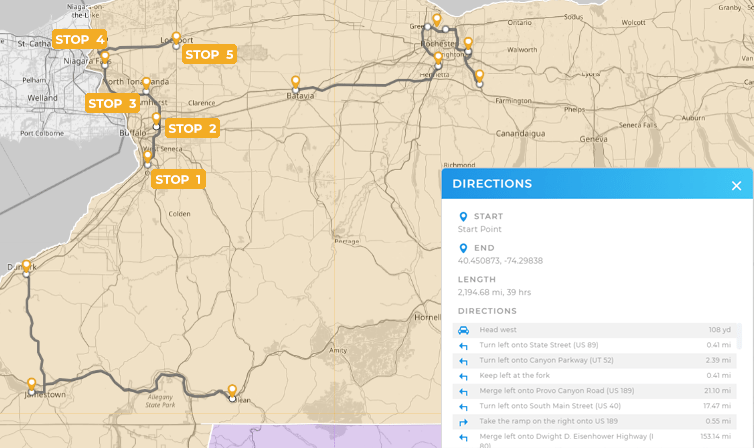
For logistics teams, plotting deliveries is just the beginning. By using delivery route planning software, managers can reduce mileage, lower fuel costs, and improve on-time performance. Delivery route optimization turns pins into efficient routes, cutting wasted time and resources.

Strategic Sales Rep Mapping
Plotted customer data allows managers to refine coverage. A sales rep territory map helps balance workloads, prevent burnout, and ensure every rep focuses on the right opportunities. With sales territory mapping, plotted pins turn into territory assignments that grow revenue instead of confusion.

It means placing addresses or data points onto a geographic map to visualize where customers, resources, or deliveries are located.
Yes. A free map creator with pins allows basic plotting, but advanced insights require specialized tools.
It provides visibility but no strategy. Without territory or route optimization, businesses miss efficiency gains and revenue opportunities.
Google Maps can handle simple plotting, but it lacks optimization and reporting features that enterprises need.
Plotted accounts help managers design and adjust territories, ensuring fair coverage and balanced workloads.
It transforms static pins into efficient routes that save time, fuel, and money.
No. Platforms like Mapline make it easy for business leaders to upgrade from visualization to strategy without GIS skills.


