ANDORRA PARISHES
- Territory Guide
- ANDORRA PARISHES
A detailed map of Andorra parishes is a powerful tool for any brand aiming to optimize logistics, tailor marketing, and streamline operations. Sales strategies become sharper when they’re built on regional behavior. Whether it’s identifying which parishes draw the most seasonal visitors or where residents have the highest purchasing power, a parish-level map provides the kind of local insight that drives real results. In a place where the difference between one valley and the next can mean a shift in customer needs or logistics challenges, this localized approach isn’t just smart—it’s a competitive edge.
Let’s dive in and see how it’s done.
WHAT ARE ANDORRA PARISHES?
Tucked into the soaring Pyrenees between France and Spain lies the pint-sized powerhouse of Andorra. This charming alpine nation is so compact that it qualifies as a “microstate”—a sovereign country divided into seven parishes. Andorra may be small, but it stands tall with its unique blend of mountain charm, cultural richness, and geopolitical curiosity.
Each parish offers different advantages: Escaldes-Engordany, for instance, buzzes with commercial activity and spa tourism, while Canillo thrives on winter sports and alpine accommodations. By pinpointing where target customers live, shop, and travel, businesses can deliver products faster, craft more relevant messaging, and make smarter decisions about where to open a store, launch a campaign, or expand service coverage.
ADD ANDORRA PARISHES
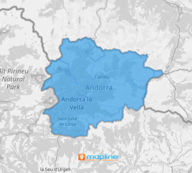
Unlock deeper regional understanding by layering in Andorra parishes to your map. Whether expanding operations, targeting new markets, or refining local strategies, Mapline gives you the tools to visualize success—one boundary at a time.
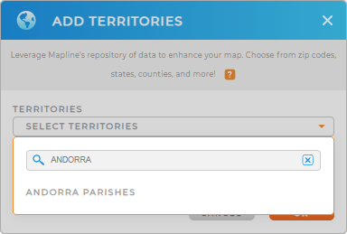
To add a new territory from Mapline’s repository, type ANDORRA into the search bar to easily select ANDORRA PARISHES.


Pro Tip: Mapline’s global repository is designed to empower users everywhere, which means offering a rich collection of territory boundaries, even for smaller, often-overlooked nations like Andorra. Dive into detailed insights with access to the country’s unique parishes—strategic local areas that serve as key hubs for governance and development.
CHOOSE PARISH COLORS
Supercharge your territory map by adding color-coded layers that bring insights to life at a glance. With clear visual distinctions between parish boundaries, colors transform your map into a powerful decision-making tool.
Choose the color styles that best aligns with your analysis goals—whether it’s random colors for quick distinction, a uniform shade for clean simplicity, a heat map to highlight intensity, or custom colors for full control.
Once you’ve made your selections, just click OK to bring your visualization to life.

GET NEW TERRITORY INSIGHTS
Take your analysis to the next level by diving into these advanced features:
- See exactly how close your competitors are to your business locations—and turn that knowledge into strategy.
- Instantly sync your Salesforce records with Mapline , bringing your sales operations to life on a dynamic, interactive map
- Carve out well-defined territories that are efficient and logical


