- Blog
- Geo Mapping
- Best Mapping Software for Business: Visualize, Plan, and Scale Smarter
From sales teams to logistics managers, businesses today rely on mapping software to turn static spreadsheets into powerful, interactive visuals. Whether you’re planning routes, assigning territories, or analyzing market coverage, modern mapping tools make complex data easier to understand and act on.
This guide explores key features and benefits of today’s most powerful business mapping tools—including visualization platforms, GIS layers, custom map builders, and territory planning software. If you’re still relying on manual maps or disjointed tools, it’s time to upgrade.
What Is Business Mapping Software?
Business mapping software transforms location data into interactive visual maps. It lets teams upload addresses, customer data, sales territories, and operational zones—then filter, layer, and analyze them to gain actionable insights.
Unlike general-use apps, these platforms are built for productivity and decision-making. Whether you’re managing a field team or optimizing delivery zones, mapping software helps you:
- Spot geographic trends and customer clusters
- Plan routes and field operations more efficiently
- Build, adjust, and analyze custom territories
Many platforms now offer browser-based access, mobile apps, and integrations with CRMs, ERPs, and logistics tools.


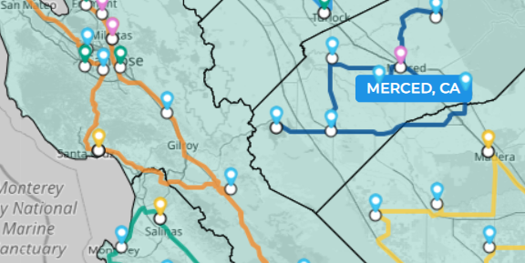
Pro Tip: Use field mapping software to track on-the-ground coverage! Field teams often miss key locations or waste time crisscrossing territories. Field mapping software lets you visualize which accounts have been visited and where reps should go next—making daily planning fast and data-driven.
Features of the Best Mapping Tools for Business
The best mapping tools blend usability with deep analytical power. They make it easy for users to upload data, visualize patterns, and take immediate action—all without needing a GIS background. Key features include drag-and-drop map creation, dynamic filtering, and layering tools that highlight trends by region, segment, or metric. These platforms also offer robust customization options so users can tailor maps to reflect territory boundaries, customer clusters, or operational zones. Integrations with CRMs, ERPs, and spreadsheets streamline workflows even further. Let’s break down the core capabilities that set them apart.
Online Mapping Tool and Map Visualization Platform
Online mapping tools and map visualization platforms make it easy to upload data and create interactive maps without specialized GIS training. They allow users to:
- Drop pins for addresses, customers, or assets
- Filter by category, value, or performance
- Style maps with color-coded layers and legends
This visual context helps teams spot opportunities, risks, and coverage gaps at a glance.
GIS Mapping Software
GIS mapping software (Geographic Information Systems) brings deeper analysis by layering spatial data such as demographics, traffic, zoning, and census boundaries. Businesses use GIS to:
- Compare customer data with market trends
- Assess location potential based on local variables
- Support regulatory and infrastructure planning
GIS features are especially useful in utilities, urban planning, retail, and environmental analysis.
Create and Customize Business Maps
Custom mapping is essential for teams with unique regional strategies, non-standard routes, or segmented customer bases. Today’s tools make this process simple and flexible, offering intuitive interfaces that let you build maps from spreadsheets, CRMs, or live databases. You can assign custom colors, icons, and labels to different data types, making patterns easier to interpret at a glance. Advanced tools also let you define and edit territory boundaries, add layers for demographic or sales data, and toggle views based on business needs. This level of control ensures that every map reflects your organization’s real-world operations—not just generic geographic data.
Create Custom Maps with Ease
Create custom maps by importing address data, then applying filters, labels, and color-coded rules. Common use cases include:
- Mapping customer tiers by revenue
- Visualizing store catchment zones
- Tracking on-site visits and sales activity
Some tools also offer shape-drawing tools, polygon mapping, and radius overlays for spatial targeting.
Territory Planning Software
Territory planning software lets sales, service, or support teams divide regions by workload, opportunity, or geography. Key benefits include:
- Balanced workloads and fair coverage
- Improved performance tracking by territory
- Faster onboarding and ramp-up for new team members
Territory maps can be adjusted live to reflect shifts in demand, staffing, or business goals.
Mapping for Sales, Operations, and Field Teams
Business mapping isn’t just about data—it’s about movement. These features support real-world execution across departments.
Feature | Use Case |
---|---|
Map Software for Sales Teams | Visualize leads, accounts, and territories to optimize rep outreach and prioritize follow-ups |
Field Mapping Software | Help field staff plan visits, track coverage, and report activity with GPS precision |
Route Planning Tool | Build optimized travel routes across multiple stops with sequencing and time window logic |
These tools reduce wasted mileage, improve accountability, and align strategy across sales, service, and delivery ops.
Free and Paid Options for Every Business
You don’t need a massive budget to start using mapping software. Many vendors offer free business mapping software with core features like data uploads, pin mapping, and simple styling tools.
As your needs grow, premium versions unlock more advanced features such as:
- Territory optimization and heat mapping
- CRM and data connector integrations
- Multi-user collaboration and dashboards
Whether you’re a small business or enterprise team, there’s a solution that fits your scope and scale.
It helps businesses visualize location-based data to make strategic decisions about sales, service, routing, and territory planning.
Yes. Many platforms offer route planning tools that optimize travel paths across multiple stops for drivers, techs, or reps.
GIS mapping software offers deeper spatial analysis (like demographics or zoning), while standard mapping tools focus on data visualization and business operations.
Not always. Many providers offer free business mapping software with essential features like address plotting and simple map creation.
They allow sales reps and managers to visualize pipelines, segment territories, and plan travel based on lead density or opportunity.