- Blog
- Geo Mapping
- Create Map from Excel Data: Is It Really Free?
Mapping spreadsheets in Excel sounds easy—until it’s not. Between formatting issues and visual limits, it’s hard to get the insights you need. And while it’s technically possible to get a basic map going, most users quickly realize that Excel’s mapping capabilities are limited—and true interactive mapping requires something more.
If you’ve ever tried to create a map from a spreadsheet, you’ve probably hit some friction. Whether it’s formatting issues, limitations in Excel, or the inability to group data by location, you’re not alone. So let’s break down what’s really free, what’s possible, and how to get the results you’re after without wasting time or budget.
Can You Create a Map in Excel? Yes—But It’s Limited
Many people turn to Excel when they need to visualize data, but while it’s possible to create a map in Excel, it comes with serious limitations. Excel’s map chart feature only supports color-coded filled or bubble maps based on countries, states, or regions. You can highlight your data and go to Insert > Maps to get a basic visualization, but that’s about it.
Here’s what Excel can and can’t do when it comes to mapping:
- No pin plotting by address or ZIP code
- No support for route planning or interactive filters
- Strict formatting requirements (full region names, clean data only)
- Unstable performance for large datasets
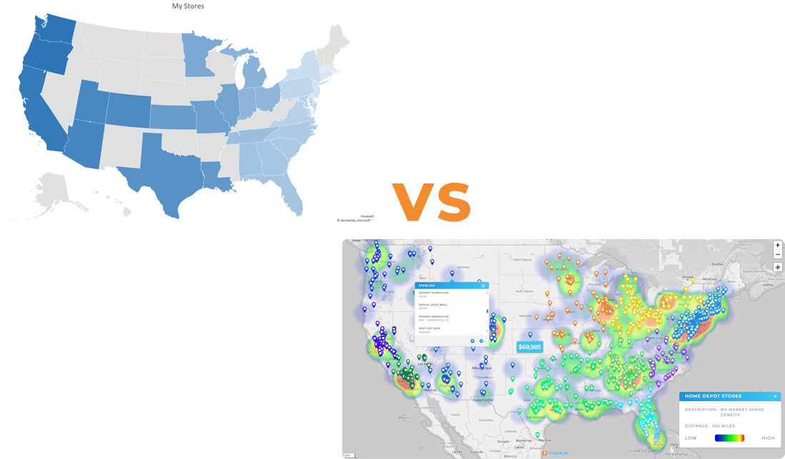
So yes, you can create a map in Excel, but for business-grade mapping or anything beyond a basic visual, it’s not the best tool for the job.
For example, if you’re trying to create a map in Excel using latitude and longitude, you’ll need to use scatter charts with manual formatting. And if you want to create a heat map in Excel that highlights patterns across ZIP codes or custom regions, you’re looking at a lot of workarounds, or settling for flat visuals.
Let’s explore the switch savvy teams are switching to—and why it’s still the best-kept secret in analytics.

Pro Tip: Mapline lets you build a fully functional map from Excel data in seconds— for free. And when you’re ready to unlock heat maps, territory planning, or bulk Geo Mapping logic, upgrades are seamless. Start simple. Scale fast.
Heat Maps in Excel: What’s Possible, What’s Not
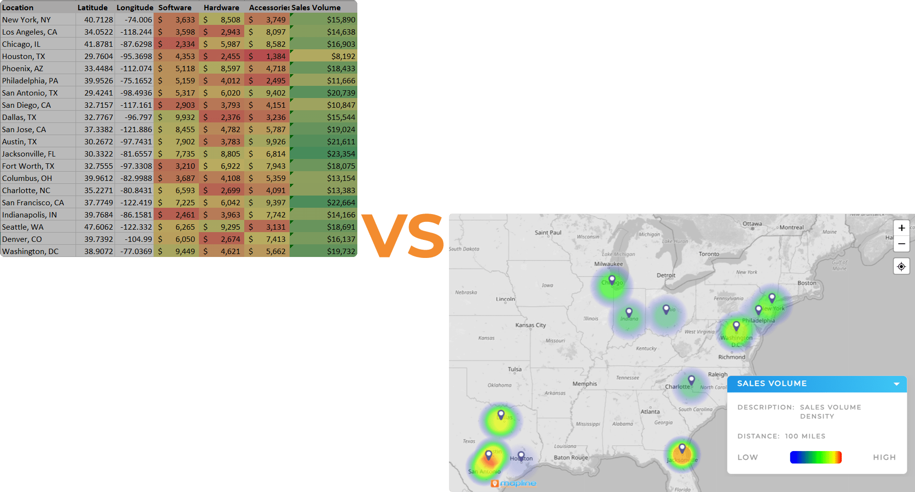
Many analytics teams are looking for heat maps to visually differentiate between key variables in their data. While it’s also possible to create a heat map in Excel using conditional formatting and pivot tables, it isn’t a true geographic heat map. You can color-code cells based on values, but you can’t display density by ZIP code, city, or geographic boundaries.
With Mapline, creating a heat map from your spreadsheet is just a few clicks away. You can:
- Visualize performance or density by location
- Customize color scales and pin styles
- Zoom in by ZIP code, region, or customer type
For teams that need fast insights from geographic data, Mapline’s heat mapping tools deliver results Excel simply can’t.
What Most People Actually Want
When users search how to create a map from a spreadsheet, they typically mean something far more dynamic than what Excel offers. They want the ability to:
- Create a map with pins from Excel
- Filter data by category, location, or status
- Zoom into specific regions or sales territories
- Track performance visually using an interactive map
This kind of mapping requires geospatial functionality—something Mapline handles in seconds. You simply upload your Excel or Google Sheets file, and pins populate automatically. From there, you can create a heat map, overlay territories, or build a shareable dashboard.
The Truth About “Free” Mapping Tools
Plenty of mapping tools advertise themselves as free. But most come with significant limitations, like row caps, watermarked exports, or locked-down features unless you upgrade.
Mapline offers a true free plan—Mapping Starter—which includes robust pin plotting, data filters, and customization without the usual roadblocks. Here’s how Mapline’s free version stacks up against other free options:
| Tool | Free Version? | Max Free Rows | Free Pin Mapping | Free Territories | Interactivity | Free Routing Capabilities |
|---|---|---|---|---|---|---|
| Mapline | Yes (Mapping Starter) | 500 (250 per dataset) | Yes | Yes | Yes | Yes – up to 50 locations (5 routes, 10 locations each) |
| Easy Map Maker | Yes | 250 | Yes | No | No | Yes – limited to 20 stops |
| Maptive | Yes | 250 | Yes | Yes (Paid) | Limited | Yes – limited to 25 locations |
| Caliper (Maptitude) | No | N/A | No | No | No | No |
Powerful Mapping. Zero Cost.
Mapline’s free Mapping Starter plan gives you access to professional-grade mapping features—no credit card required. Whether you’re plotting sales data, optimizing basic routes, or visualizing locations from Excel, Mapline makes it effortless. With the most user-friendly interface on the market, even first-time users can build interactive maps in seconds—no GIS experience needed. It’s real-world mapping made simple.

Map Creation

Pin Mapping

Color-Coded Pins

Basic Route Mapping
Spreadsheet Sync

Zoom & Pan Controls

Map Sharing

Embed Anywhere

Intuitive Interface

World-Class Support
What Sets Mapline Apart?
Most free mapping tools are either too basic or too technical. Mapline strikes the perfect balance. Built for real-world business needs, Mapline makes it effortless to turn raw spreadsheet data into powerful, actionable maps. Whether you’re managing sales territories, planning delivery routes, or just trying to visualize trends across locations, Mapline gives you the tools you need—without the learning curve.
What truly sets Mapline apart? It’s the only free mapping software that combines ease of use, data precision, and business-grade features in one intuitive experience. No code. No complexity. Just answers, fast.
Fastest Map Creation from Excel
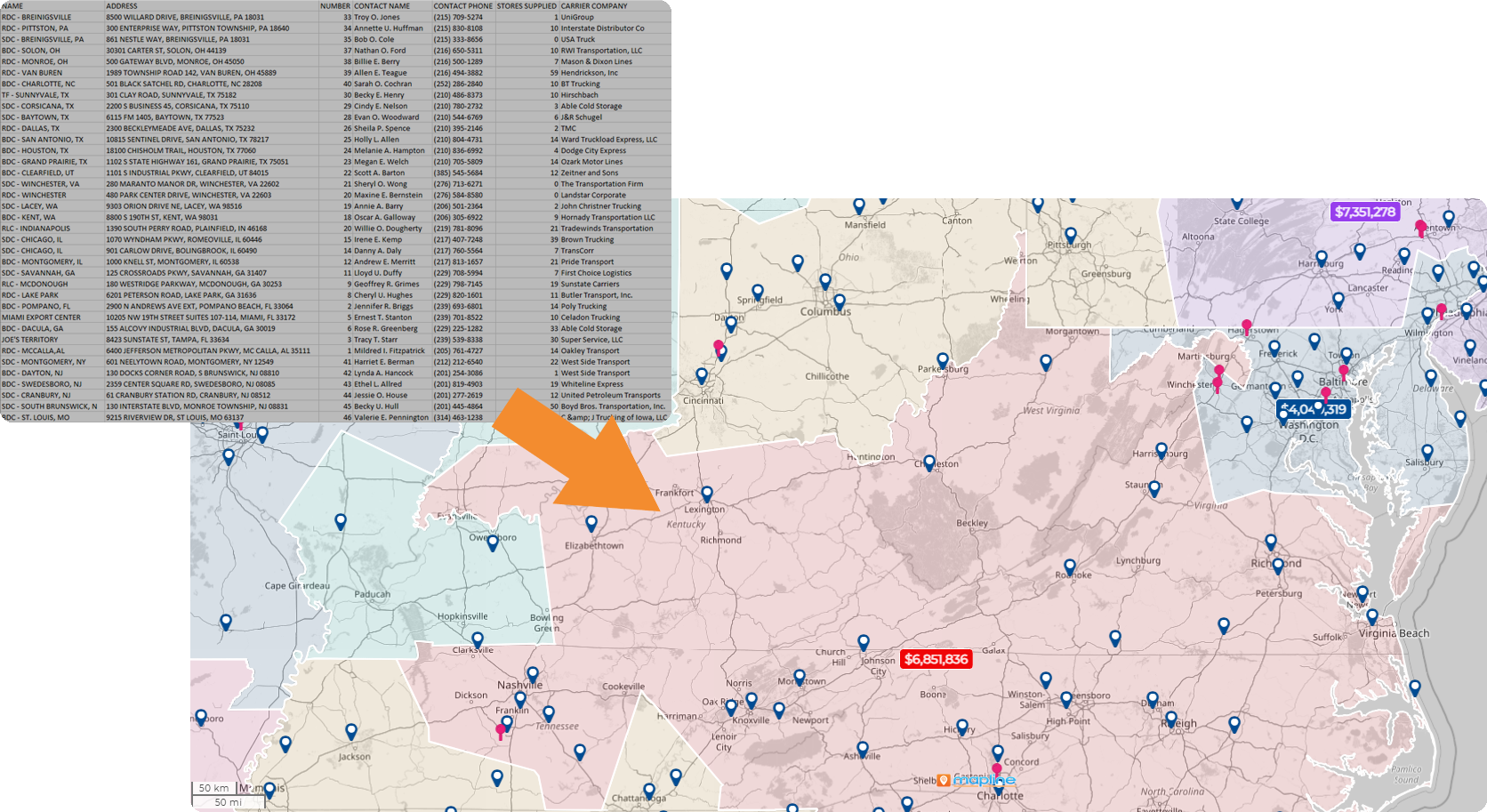
No complicated imports or setup—just copy, paste, map. Mapline makes it easy to create a map from Excel, turning spreadsheet data into a visual map in seconds, with built-in tools to filter, customize, and share instantly.
Simple, Business-Friendly Interface
Mapline is built for business users. Unlike clunky GIS tools, it’s clean, intuitive, and requires zero technical training to use.
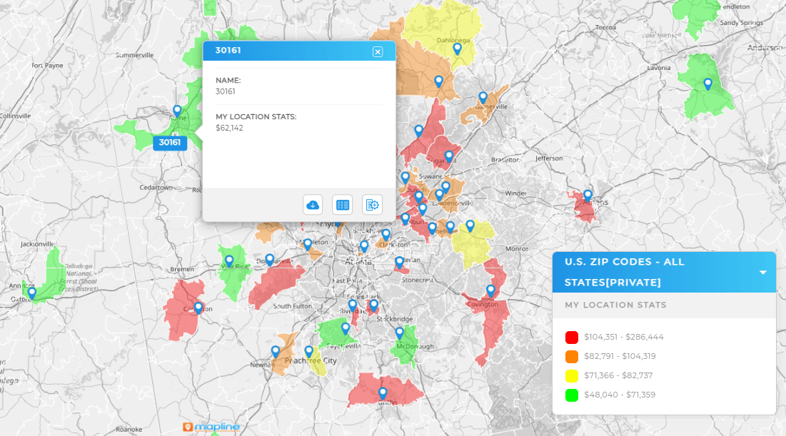
World-Class Mapping Features
Most free mapping tools stop at plotting. Mapline includes basic routing, territories, and customer segmentation—perfect for sales teams, delivery drivers, and service planning.
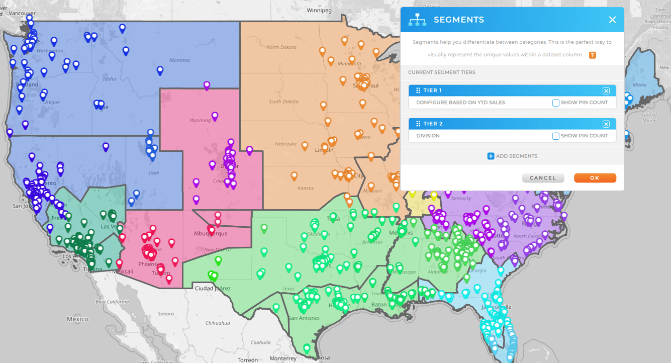
Data-Driven Insights with Visual Controls
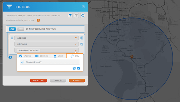
While other tools just show pins on a map, Mapline lets you drill into your data, apply filters, and analyze trends visually—right from the map.
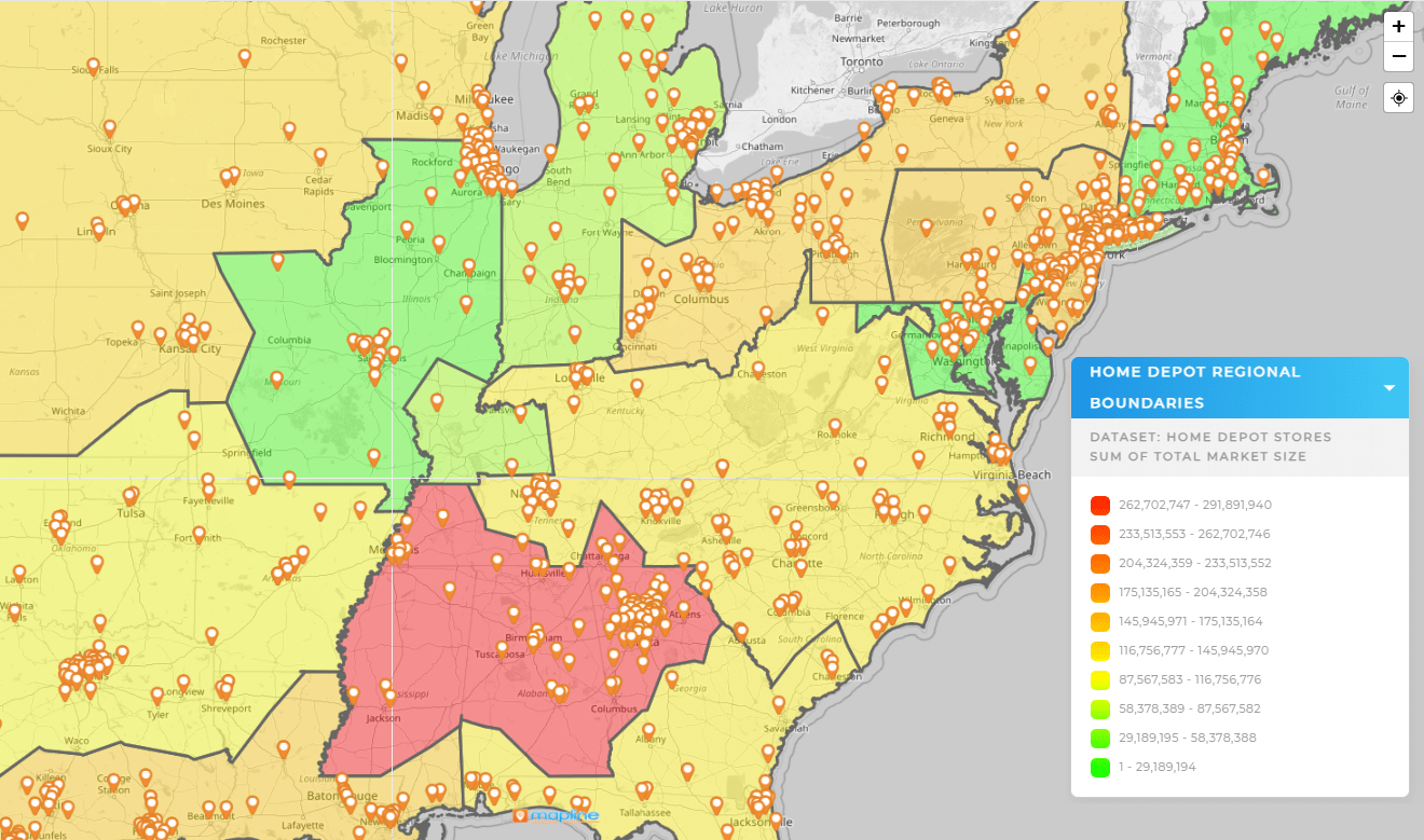
Why Mapline Is the Smarter Choice
If you want to create a map from a spreadsheet—and you want more than a bare-bones visual—Mapline is your best bet. Here’s why:
- No formatting headaches—Mapline recognizes addresses, ZIPs, and coordinates automatically
- Create pin maps, heat maps, and territory maps in seconds
- Customize your view with filters, dashboards, and layers
- Collaborate with your team or embed maps in your tools
And best of all? You can start for free.
Don’t just take our word for it:


- “Mapline is the best thing I ever did for my business.”– Sam Anthony, Your News
- “When we started using Mapline, we were immediately able to identify human errors just by seeing them on the map.”– Adam Aldridge, Operations Manager
- “Mapline is critical in the success of our company, because it allows us to play matchmaker between sales and operations.”– Ashley Weitman, Elevo
- “Mapline has helped us do a really great job of determining how many customers we can support in an area.”– Kyle Moody, Royal Cup
- “Our company has tapped into a vein of gold with Mapline, and I am just really thankful. I wish all of my business dealings throughout the day were like Mapline.”– Lydia Rogers, Greenworks Commercial
- “Mapline is incredibly valuable to the business. Quite literally, mapping out [the] opportunities we can easily tap into with the existing resources that we have.”– Kat Hackett, Elevo
- “I’m not a spreadsheet person, so Mapline literally saved my life.”– Lydia Rogers, Greenworks Commercial
- “Mapline continues to impress us and is exceeding expectations with its capabilities! The onboarding process was simple and the training we received was outstanding!”– Mike Reese, KisX Card
- “Just being able to gather, pull, and map data, all within minutes. You wanna talk about a time-saver? (Which is also money-saving!)”– Lydia Rogers, Greenworks Commercial
- “I contacted 40 different mapping software companies and sat through probably 15 demos, and Mapline was the clear choice.”– John Jordan Miller, Skidmore Pump
- “Thank you Mapline for such an AMAZING program that is saving us money and building confidence in our future growth!”– Lydia Rogers, Greenworks Commercial
Yes, but only if your formatting is perfect and you’re okay with static maps. There’s no support for interactive pins or geographic overlays.
Yes, but it’s not a true geographic heat map. You’ll only see color-coded cells, not regions on a map.
Upload your file to Mapline. It detects locations, plots your pins, and lets you style your map without code.
Mapline maps are interactive by default. Simply upload your spreadsheet, customize your map, and share the link with your team.
Mapline is the only mapping platform built specifically for business operations—not just visualization. While other tools stop at basic pin plotting or static maps, Mapline turns your location data into a living, interactive system for performance tracking, territory management, and decision-making. You can build multi-layered maps, filter by custom fields, visualize patterns with heat maps, and even schedule teams—all from one interface. No other mapping platform offers this level of speed, flexibility, and business intelligence in a single solution.


