Location intelligence software turns raw spatial data into actionable business insights. From market area analysis and territory planning to real-time operations and forecasting, this technology enables teams to make faster, smarter decisions backed by geographic context.
Whether you’re mapping customer locations, optimizing field operations, or exploring new growth opportunities, location intelligence tools give you the edge. And with modern mapping software for business, it’s easier than ever to build dashboards, draw territories, and model “what if” scenarios in real-time.
In this guide, we’ll explore the key components of location intelligence software, how it fits into real-world workflows, and the powerful benefits it unlocks across departments—from sales to supply chain.
Understanding Location Intelligence: Beyond the Basics
Location intelligence isn’t just about putting dots on a map. It’s a sophisticated approach to visualizing and analyzing data through a spatial lens, connecting customer behavior, business performance, and market trends to physical locations.
By combining business data with geographic context, teams gain the clarity to:
- Discover patterns hidden in spreadsheets
- Prioritize expansion based on real market coverage
- Allocate resources based on territory performance
- Optimize operations by analyzing real-time location data
- Forecast demand using past geographic trends
At the heart of these capabilities is location intelligence software—your all-in-one platform for map-based business decisions.

Pro Tip: Start with the outcome you want—then map backwards. Location intelligence software is most effective when tied to a clear business objective: reducing delivery times, improving rep coverage, increasing regional sales, or identifying new market potential. By aligning your maps and data layers with a specific goal, you’ll filter out noise and focus on insights that drive measurable results. The map isn’t the final product; it’s the launchpad for smarter action.
Key Features of Location Intelligence Software
At the core of any powerful location intelligence platform are the tools that transform raw data into actionable insight. These features go beyond simple mapping—they help businesses visualize performance, optimize operations, and uncover patterns that drive smarter decisions. From geographic dashboards and territory boundaries to real-time data and advanced analytics, each tool serves a specific function within your workflow. Whether you’re managing a field team, forecasting demand, or analyzing customer behavior, the right features streamline your strategy. In the sections below, we’ll explore the most impactful capabilities modern location intelligence software has to offer—and how each one translates into tangible business value.
Location Analytics Tools and Dashboards
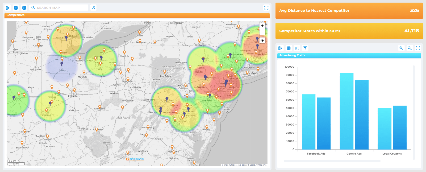
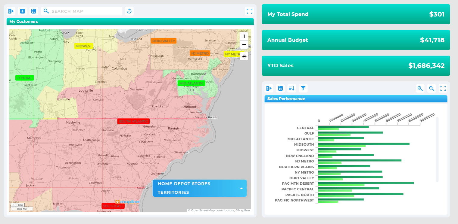
Location analytics tools bring your data to life—allowing you to layer sales metrics, customer attributes, and external datasets directly onto a map.
Use geographic data dashboards to:
- Visualize KPIs by region, rep, or location
- Monitor real-time performance in key territories
- Pinpoint growth trends based on spatial patterns
- Identify underperforming regions or resource gaps
Unlike static reports, geographic dashboards offer interactive views that update in real time, helping decision-makers react faster and with more precision.
Geo Mapping Software and Territory Mapping
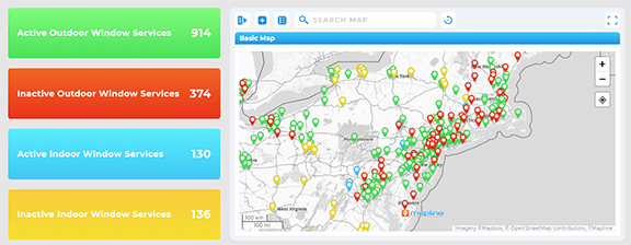
Territory mapping software enables teams to define, adjust, and analyze boundaries with just a few clicks.
Use geo mapping software to:
- Divide service areas among reps, trucks, or stores
- Balance workload based on real demand, not assumptions
- Redraw regions instantly in response to growth or team changes
- Overlay external data like competitor locations or demographic trends
When your territory maps align with real-world logistics, you reduce travel time, improve service quality, and support your team with smarter, fairer assignments.
Real-Time Location Data for Operational Clarity
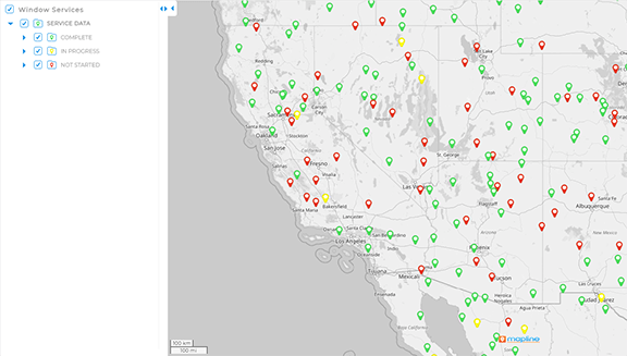
Mapping tools for operations aren’t just for planning—they’re critical for day-to-day execution. Real-time location data ensures your maps reflect current activity, not outdated spreadsheets.
This gives ops managers and field teams the ability to:
- Track vehicles or reps as they move through territories
- See which deliveries are complete, in progress, or delayed
- React quickly to changes—weather events, cancellations, or last-minute requests
- Make decisions based on live data rather than guesswork
Combined with mobile-friendly dashboards, real-time data transforms how teams on the ground stay connected and efficient.
Market Area Analysis and Location-Based Forecasting
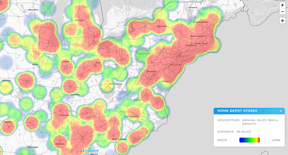
Location intelligence is especially powerful for strategic planning. When evaluating new markets, location-based forecasting and market area analysis help you model potential ROI before making costly investments.
Use these tools to:
- Analyze population, income, or competitor density in target areas
- Map customer behavior to find lookalike markets
- Predict revenue potential based on existing territory performance
- Simulate changes to market share with different expansion strategies
Instead of relying solely on intuition, leadership can use hard data to validate decisions—backed by visual models that make complex data easy to interpret.
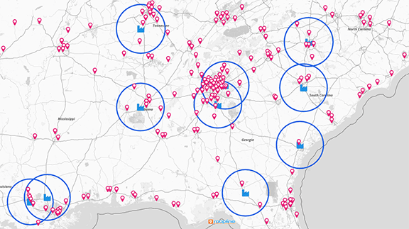
Mapping Customer Locations and Business Location Insights
Understanding where your customers are—and how they interact with your brand—is essential to growth. Location intelligence software brings customer data to life, revealing hidden trends you can’t see in a spreadsheet.
Mapping customer locations enables you to:
- Spot geographic clusters of loyal customers
- Identify underserved areas with growth potential
- Compare sales trends across regions
- Refine ad targeting based on geographic behavior
Business location insights go even further by connecting internal performance (e.g., store sales, service requests) with external factors (e.g., foot traffic, population growth). The result? More informed decisions about store placement, delivery zones, staffing, and beyond.
Spatial Business Tools for Every Department
Location intelligence isn’t just for analysts or IT teams—it’s a versatile business asset that brings value across every department. By using spatial business tools to visualize operations, customer behavior, and performance by location, teams can make more informed decisions, faster. Whether you’re leading sales, marketing, operations, or strategy, location intelligence gives you the context and clarity to align your actions with real-world data. These tools make it easy to spot inefficiencies, identify opportunities, and scale more effectively. Let’s explore how each department can leverage Geo BI software to unlock smarter workflows and better outcomes.
Sales: Smarter Territories and Stronger Pipelines
Geo BI helps sales teams visualize performance by region, track rep activity, and allocate resources more effectively. By mapping customer locations, territories, and lead density, sales leaders can eliminate overlap, ensure full coverage, and assign reps based on workload and potential. This not only boosts productivity but also improves team morale and accountability. Sales reps get a clearer view of their pipelines, while managers gain insights into where to focus coaching and support. The result? More closed deals and a better-aligned sales strategy.
Marketing: Precise Targeting and Regional Growth
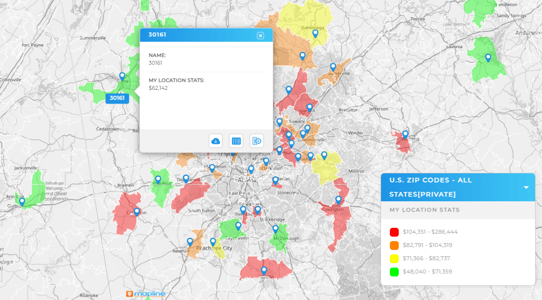
Marketing teams can use location analytics to segment audiences geographically and identify high-potential areas for growth. With Geo BI, campaigns become more personalized and effective—targeting the right people in the right places with the right message. Visualizing market penetration, campaign performance, and regional demand helps marketers adjust strategies in real time. It also uncovers underserved areas where brand awareness can be improved. This leads to higher ROI, reduced ad spend waste, and stronger customer connections.
Operations: Real-Time Visibility and Route Efficiency
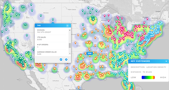
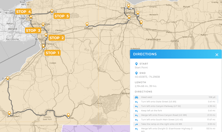
Operations teams benefit from real-time location data that helps manage delivery routes, service schedules, and field team activity. Geo BI makes it easy to track movement, optimize resource allocation, and respond to changes on the fly—whether it’s a weather delay, traffic issue, or emergency request. With geographic dashboards, dispatchers and managers can monitor performance at a glance and make fast, data-informed decisions. The outcome is increased operational efficiency, fewer delays, and improved customer satisfaction.
Leadership and Strategy: Data-Driven Expansion and Risk Management
Executives and strategic planners use spatial business tools to forecast growth, evaluate new markets, and monitor performance across regions. With access to geographic data dashboards, leadership can simulate expansion scenarios, assess potential risk factors, and visualize ROI before making large-scale investments. Geo BI also helps detect shifts in demand or operational bottlenecks that might not appear in standard reports. This leads to more confident decision-making, stronger long-term planning, and a clearer path to scalable success.

Comparison: Basic Data Visualizations vs. True Location Intelligence Software
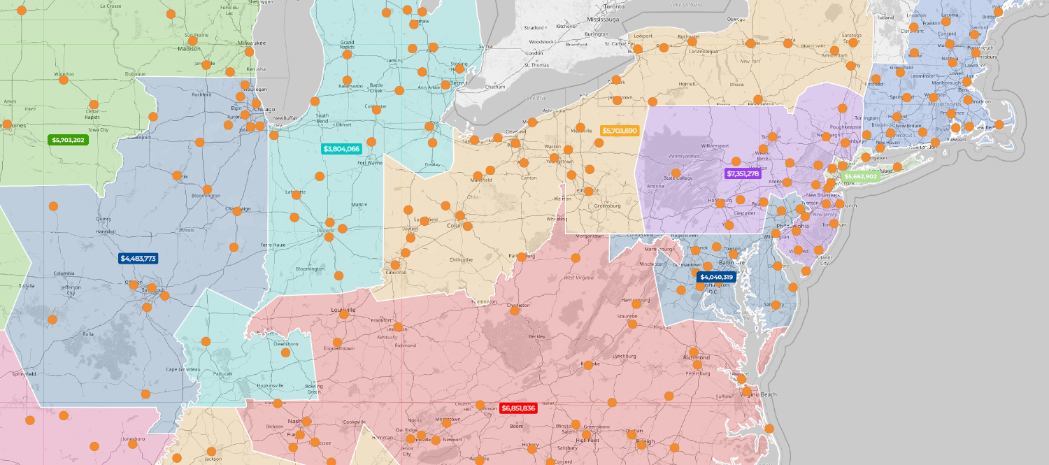
Most business intelligence tools stop at charts, graphs, and static dashboards. They visualize data—but they don’t tell you where it’s happening, or why it matters in a geographic context. Mapline’s Geo BI goes further by embedding location into every layer of analysis. You still get clean, interactive dashboards—but now they’re infused with real-time location data, territory insights, and spatial forecasting. That means you’re not just seeing what’s happening—you’re understanding where, when, and how to act.
| Feature | Basic BI Tools | Mapline’s Geo BI |
|---|---|---|
| Dashboards | Static reports and charts based on tabular data | Interactive, map-based dashboards layered with geographic data |
| Territory Mapping | Not supported or requires add-ons | Built-in tools to create, optimize, and rebalance sales and service territories |
| Market Area Analysis | Requires manual data prep and interpretation | Visual tools to assess opportunity by region, customer density, or demographics |
| Spatial Forecasting | No native support for location-based modeling | Forecast demand, performance, or staffing based on location trends |
| Real-Time Location Data | Limited to spreadsheet uploads or delayed syncs | Live data feeds show current activity, team movements, and KPI shifts |
| Multi-Layer Mapping | Flat visualizations with limited geographic context | Layer customer, operational, and third-party data for full spatial analysis |
| User Access Control | Generic dashboard permissions | Granular visibility by role, region, or dataset for secure, relevant insights |
Mapline’s Geo BI isn’t just a prettier dashboard—it’s a smarter way to run your business. By making geography a core part of your data strategy, you unlock insights that basic BI tools simply can’t reach.
Expanded Benefits: Why Mapline Goes Further
Mapline’s location intelligence platform delivers advanced benefits beyond traditional GIS software:
- Mass Re-Optimization: Reassign territories or routes across your entire team in minutes
- Rescheduling Logic: Adjust plans dynamically based on time windows, delays, or cancellations
- Multi-Layer Insights: Combine multiple datasets (sales, traffic, demographics) on one map
- Permission-Based Sharing: Give each team access to the exact map layers they need
- No GIS Degree Needed: Simple, no-code tools built for business users—not data scientists
These features save time, reduce manual work, and empower everyone—from your field reps to your executive team—to act with confidence.
Real-World Impact: What Brands Gain
Brands that adopt location intelligence software see tangible improvements across the board:
- 25–40% increase in delivery efficiency by optimizing routes and workloads
- 30% faster decision-making from real-time dashboards and spatial modeling
- Higher customer satisfaction with better coverage and on-time service
- Faster market expansion with data-backed planning and forecasting tools
Whether you’re a national brand or a growing regional team, these gains compound month after month.
Leverage Location Intelligence Software In Your Business Data Analytics
Location intelligence software helps businesses unlock the full value of their data—through maps, dashboards, and location-driven decisions. From planning and forecasting to real-time execution, it’s a game-changing tool across sales, ops, and strategy teams alike. And with tools like Mapline, it’s never been easier to bring your data to life.
Location intelligence software is used to visualize, analyze, and act on geographic data to support smarter business decisions. It helps teams plan territories, track operations, forecast demand, and identify market trends.
Traditional GIS tools are often complex and designed for analysts. Location intelligence platforms like Mapline are built for business users, focusing on speed, simplicity, and direct business impact.
Yes. Mapping customer locations and layering demographic or behavior data helps marketing and sales teams identify high-opportunity areas and refine targeting strategies.
You can use internal data (sales, customers, inventory) and external datasets (census, traffic, weather, etc.) to build a complete geographic picture.
No—many small and mid-size businesses benefit from location intelligence tools to improve efficiency, reduce costs, and scale smarter.


