- Blog
- Geo Mapping
- How to Make a Map from Excel Data in 30 Seconds or Less
If you’ve ever tried to create a map from Excel data, or wanted to create Google Sheets maps, you already know how frustrating it can be. You’ve probably run into:
- Complex formulas
- No true mapping features
- Hours wasted formatting data that still doesn’t look right
The good news? You don’t have to deal with that anymore. With the right tool, you can create a map from Excel or Google Sheets in 30 seconds or less. Here’s how.
How to Create a Map From Excel Spreadsheet Data
If you’re an Excel user, you may have wondered how to create a map in Excel using built-in tools. Here’s how it works:
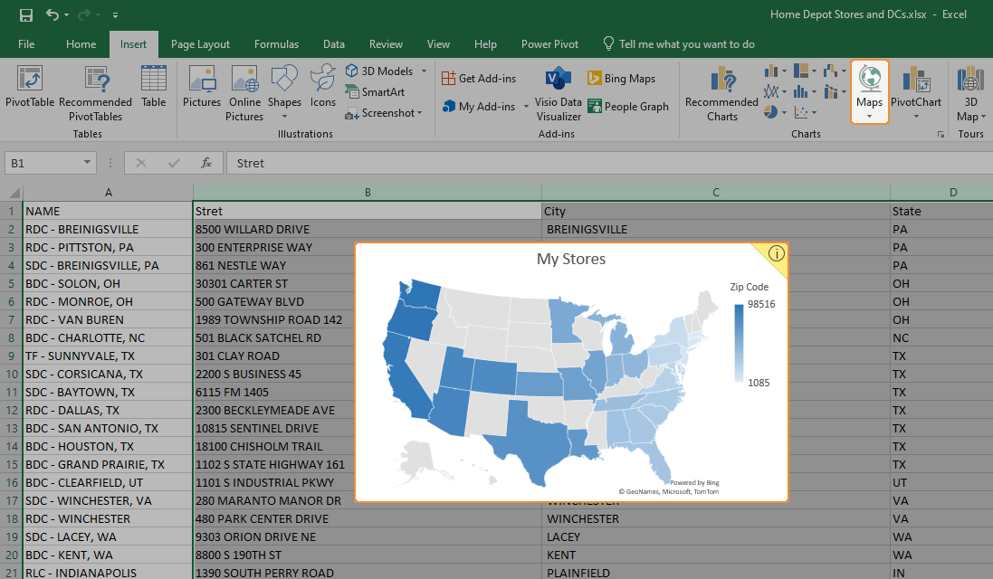
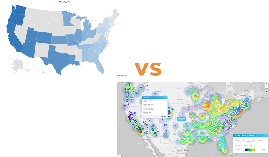
You can highlight the columns you want to map and go to Insert > Maps. This creates a color-coded map directly in your spreadsheet, which is fine if you just need a quick visual for a meeting or presentation.
But the built-in features are limited. Here are a few key drawbacks:
- Excel only supports filled or bubble maps—not pins, routes, or territories
- Mapping only works if your data is perfectly formatted. To create a map from Excel spreadsheet data, you must use full place names (e.g., “California,” not “CA”) and standardized ZIP or city formats
- It doesn’t support interactivity; you can’t click a region for more detail or zoom in
- Larger datasets cause issues. Once your file exceeds a few hundred rows, the map becomes unstable or breaks entirely
So while it’s technically possible to create a map in Excel, the results are static, limited, and unreliable for real-world use. As you can see, it’s spreadsheet software, not mapping software.

Pro Tip: If you’ve been wondering how to create a map from Excel data that includes pins, filters, or even routing, you’ll need a platform like Mapline that supports real geospatial functionality.
How to Create a Google Sheets Map
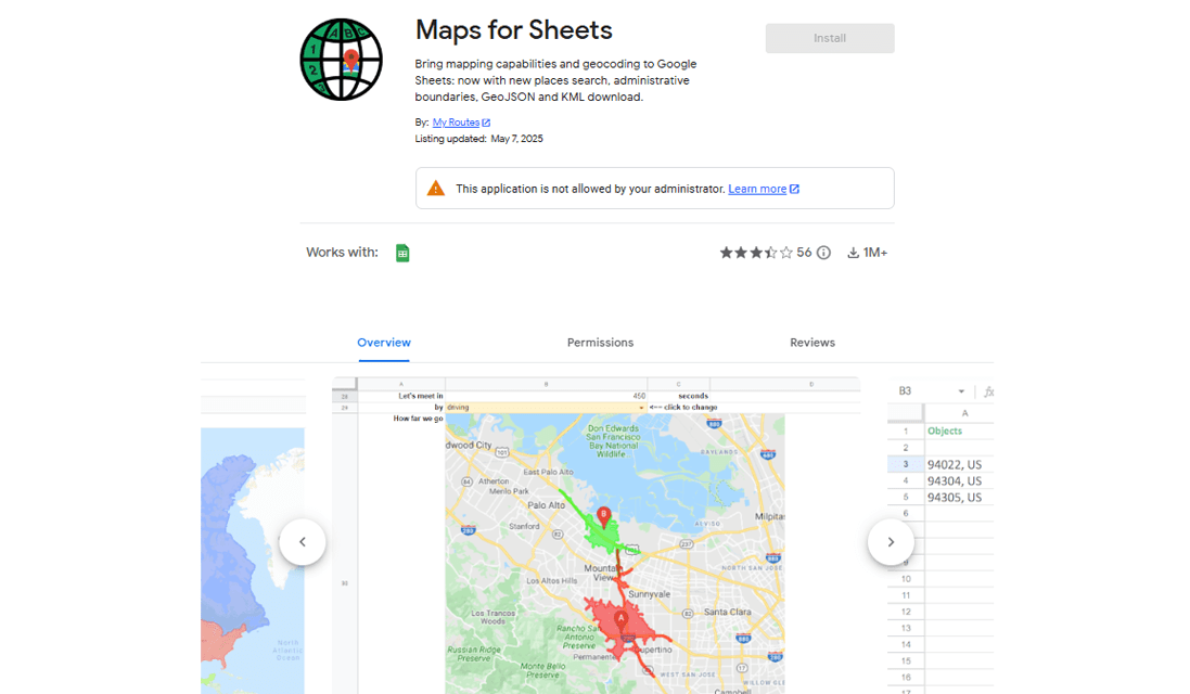
If you’re working in Google Sheets, you’ve likely found the same issue: mapping is anything but easy. There’s no native “map” function. Even if you use Google My Maps or a plugin, you’re still running into roadblocks.
Here’s why making Google Sheet maps can be frustrating:
- There’s no built-in way to add a map the way you would insert a chart
- Even with third-party tools, advanced features like heat map Excel visuals, dashboards, or routing tools are usually missing
- To make even a basic map, your formatting must be flawless—clear headers, no merged cells, and consistent data
- If you’re not tech-savvy, using a plugin to create a pin map from Google Sheets can feel confusing and time-consuming
Whether you’re using Excel or Sheets, trying to create a map of locations from Excel spreadsheet data often leads to more hassle than insight.
Alternatively, you can use Mapline to create a pin map from Excel file or Google Sheets data with just a few clicks, even if you’ve never built a map before.
Stop Wasting Time Wrestling with Spreadsheets
You’re building a map because you need answers—fast. But traditional spreadsheet tools make that hard.
Yes, you can make a heat map in Excel. You can create a map with pins from Excel. You can even plot cities on a map in Excel—but all of it takes time, tinkering, and tools that weren’t built for real mapping needs.
Most Excel and Google Sheets maps fall short when it comes to:
- Live updates
- Easy pin plotting
- Route visualization
- Custom territories
- Real-time collaboration
That’s why thousands of teams use mapping platforms like Mapline to go from spreadsheet to interactive map—instantly.
Create a Pin Map from Excel Data in 30 Seconds or Less
If you’re trying to:
- Plot cities on a map
- Make a heat map
- Create a zip code map
- Create a route map
You’re in the right place. Let’s walk through how to turn your Excel or Google Sheet into an interactive, real-time map in 30 seconds or less—one that updates automatically, handles thousands of locations, and makes your data easier to understand.
Step 1: Format Your Excel Data
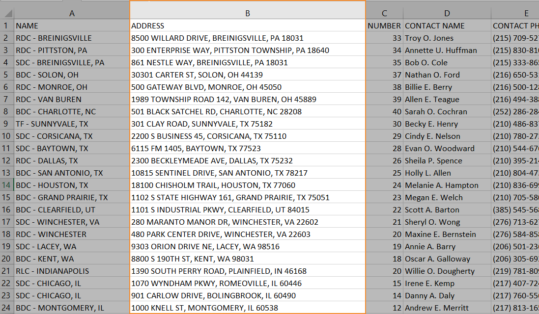
Your spreadsheet should have at least one column with location data—this could be:
- Full addresses
- City and state
- ZIP codes
- Latitude and longitude
It doesn’t matter how your location data is formatted. You could even include street address, city, state, and zip all in the same cell and Mapline will recognize it. And if there are errors in your data, no worries! Mapline will clean it up for you.
Step 2: Upload to Mapline (No Setup Required)
Head to mapline.com and either log in or create a free account. Then:
- From the main menu, click ADD NEW ITEMS → NEW MAP Name your map and click OK
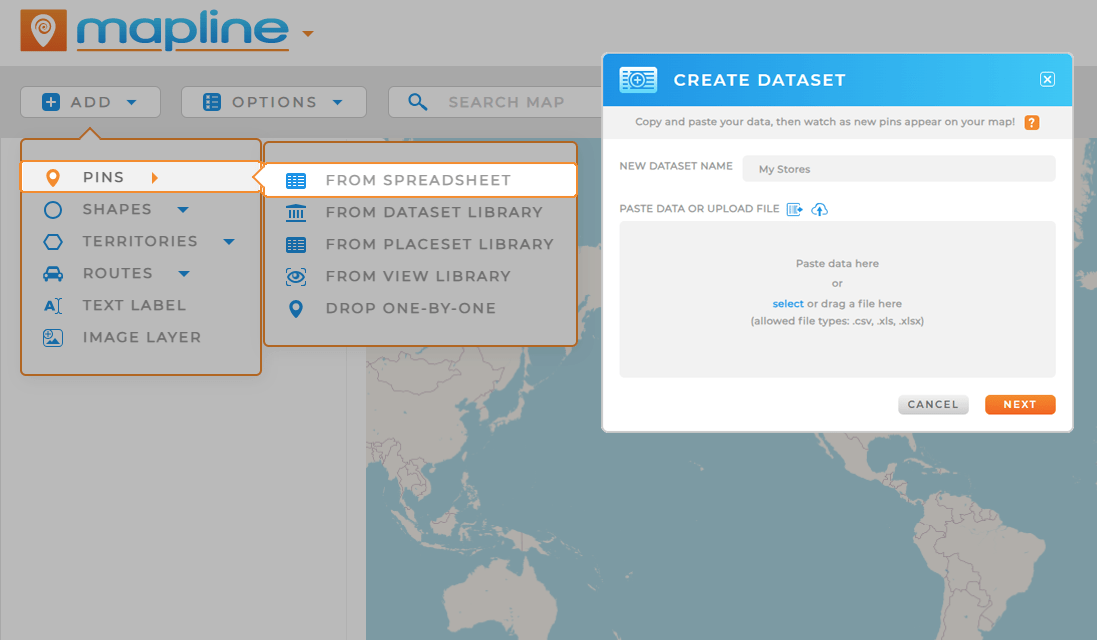
- From the ADD menu, select PINS → FROM SPREADSHEET
- Select your file and name your dataset
- Mapline auto-detects your location column and pins your points—no setup, no coding
And that’s it! You just made a map from Excel data in under 30 seconds.
Step 3: Choose How You Want It to Look
Now that your map is live, you can:
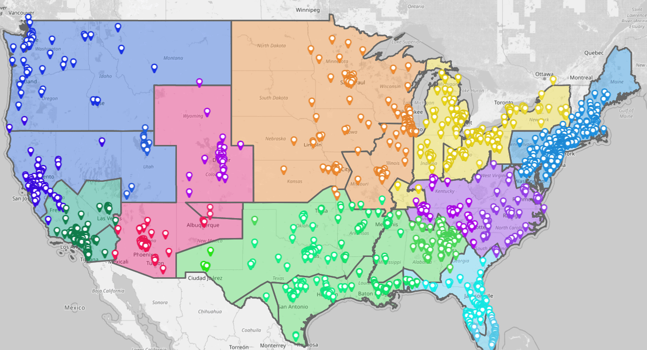
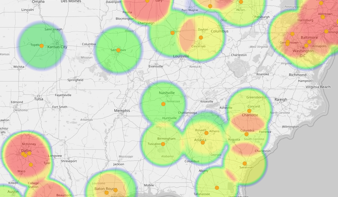
- Generate a heat map (great for visualizing density or performance)
- Customize pin colors by sales rep, region, or status
- Add filters to show only certain ZIP codes, cities, or tags
- Build a map dashboard that updates in real-time when your Excel sheet does
Step 4: Embed or Share Your Map
Mapline makes it easy to:
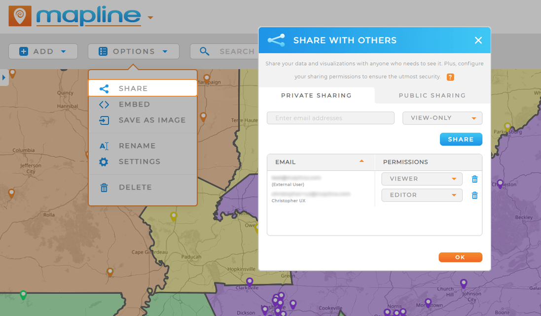
- Share a live map link with your team
- Embed the map in presentations or reports
- Schedule auto-refreshes so your Excel-to-map connection stays synced
- Create a heat map in Excel format by exporting image snapshots or printing
Why Not Just Use Excel?
Because Excel wasn’t built for mapping.
If you’ve tried to create a map in Excel using conditional formatting or Power BI add-ons, you’ve probably found that:
- It’s clunky
- It’s time-consuming
- It’s not built for visual, interactive maps
Mapline gives you the full power of location intelligence—without needing a GIS degree.
Start Now, It’s Free
You can create your first map from Excel for free—no credit card, no downloads. Just upload your spreadsheet and start exploring your data the way it was meant to be seen: On a map.
With Mapline, you can:
- Create a pin map from Excel file
- Create a map of locations from Excel spreadsheet data
- Build heat maps, route maps, and ZIP code overlays in seconds
- Visualize regions by ZIP code, city, or customer type
- Share or embed maps with real-time data sync


