- Blog
- Geo Mapping
- Postal Code Mapping Software: Unlocking Market Insights at Scale
Every business collects customer, sales, and operational data — but without a geographic lens, valuable insights remain hidden. Postal code mapping software provides a powerful way to transform raw data into interactive visuals, highlighting patterns that drive smarter strategies. By mapping customers, territories, or sales performance by zip code, companies can spot revenue gaps, improve coverage, and plan market expansion more effectively. From retail to logistics, postal code maps uncover the “where” behind your business performance at scale.
What Is Postal Code Mapping Software?
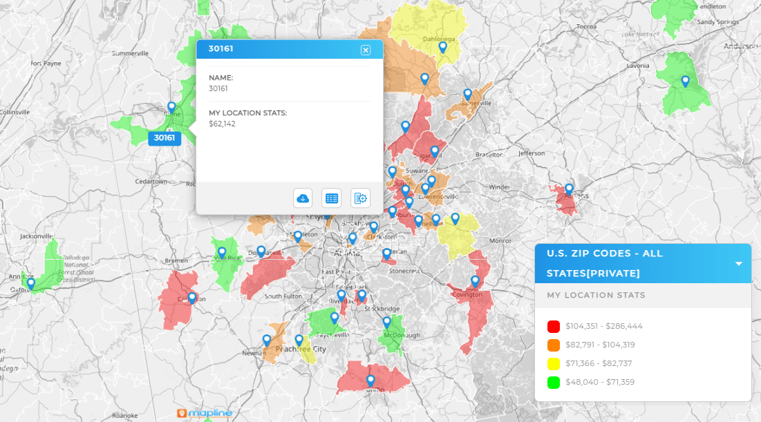
Postal code mapping software allows businesses to upload data and instantly visualize it on a map by zip code. Instead of spreadsheets filled with postal codes, companies see a clear, geographic view of customers, territories, or sales performance. Tools like Mapline make it easy to build an interactive zip code map without needing GIS expertise. By using a zip code mapping tool, leaders can move beyond raw data and discover location-based insights that impact strategy, efficiency, and revenue growth.


Pro Tip: Use Mapline’s Geo Mapping to turn spreadsheets into interactive zip code maps. With easy-to-use tools, you can plot zip codes on a map, uncover coverage gaps, and design strategies that drive measurable growth.
Why Businesses Use Postal Code Maps
Numbers on their own can’t reveal the full story. Businesses need to see how data changes across regions. With area zip code maps, executives can identify where demand is strongest, which markets are underserved, and where growth opportunities exist. Mapping by postal code connects strategy directly to geography, making it possible to align teams, balance workloads, and forecast with precision. Whether it’s evaluating sales territories, planning distribution hubs, or tracking performance, map zip codes functionality provides the clarity leaders need.
Key Benefits of Postal Code Mapping
Organizations across industries rely on postal code maps to make informed decisions. By visualizing data geographically, leaders can quickly identify patterns that would otherwise stay hidden in spreadsheets. Postal code mapping makes it easier to spot coverage gaps, compare performance across regions, and target high-potential markets. It also supports better territory planning, ensuring sales and service teams are deployed where they’ll have the greatest impact. For growing enterprises, these insights help optimize resources, reduce costs, and create new opportunities for expansion. Ultimately, postal code mapping software becomes a critical tool for scaling smarter and competing more effectively.
Spot Coverage Gaps Faster with Postal Code Mapping Software
A map with zipcode overlays reveals where teams are under-serving customers. By plotting customer addresses or sales data, leaders can see which areas need more attention, helping avoid lost opportunities and customer churn.

Optimize Sales Territories by Zip Code
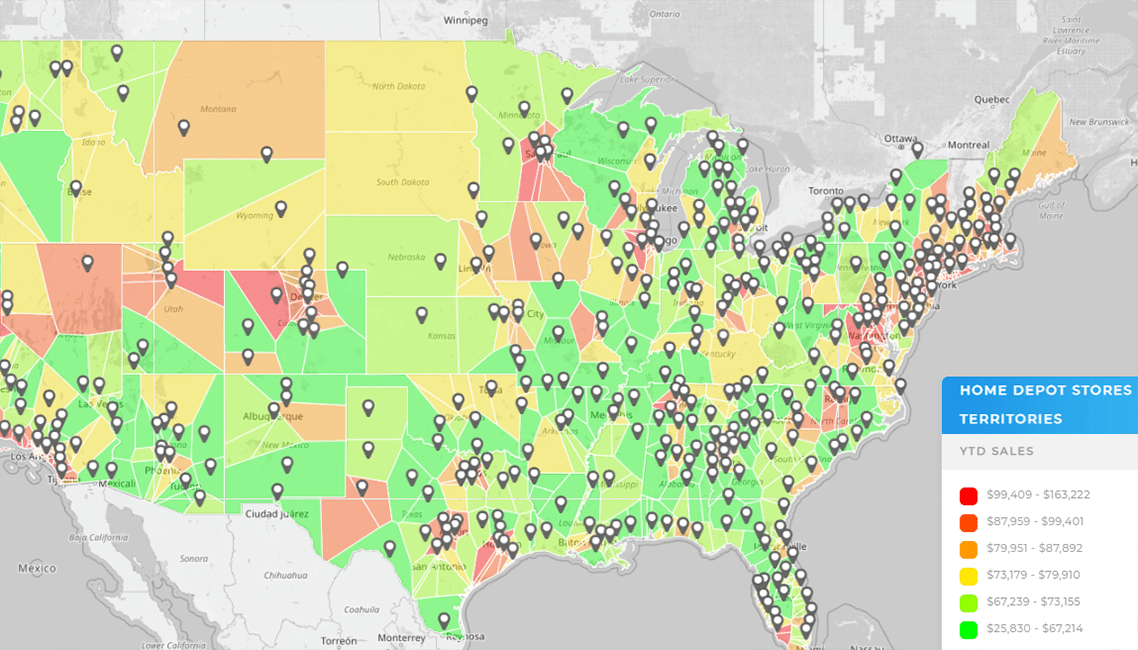
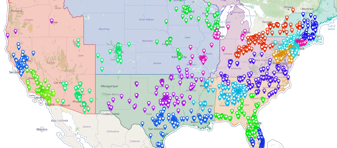
With the ability to plot zip codes on a map, sales managers can adjust territories based on workload, opportunity, or geography. This ensures reps are covering the right areas while improving efficiency and morale.

Drive Smarter Site Selection with Postal Code Overlays and Customer Data
When expanding into new regions, postal code maps provide a competitive advantage. A zip code mapping tool shows customer density, demographics, and competitor presence by region, helping leaders make confident site selection decisions.

Strengthen Market Penetration Strategies with a Postal Code Map
By analyzing performance by postal code, organizations can identify where their market share is strong — and where there’s room to grow. An interactive zip code map makes it easy to compare regions, track campaigns, and invest where results will be strongest.

It’s a tool that transforms data by postal code into interactive maps, making it easier to analyze customer distribution, sales performance, and growth opportunities.
It reveals geographic trends like customer concentration or underserved markets, helping leaders make data-driven decisions.
Yes. Tools like Mapline allow you to start free, then upgrade as your mapping needs grow.
Retail, logistics, healthcare, and service industries all benefit from postal code maps that improve coverage and planning.
Spreadsheets show raw numbers, while an interactive zip code map turns those numbers into visuals that are easier to analyze and act on.
No. Mapline’s zip code mapping tool is designed for business users without technical training.
Yes. By visualizing performance by zip, managers can optimize territories and allocate resources more effectively.
A zip code heat map shows intensity of activity (like sales or demand), while a postal code map simply displays boundaries and data by region.


