AFRICA COUNTRIES
- Territory Guide
- AFRICA COUNTRIES
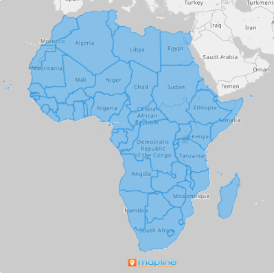
Take your analytics to new heights by adding Africa’s countries to your map—because when your business stretches across the continent, you need to see the whole picture. Africa’s diverse markets offer incredible opportunities, and visualizing your sales data within these countries lets you keep a close eye on your sales teams while optimizing operations with ease. Imagine pinpointing exactly where your strategies are working and where they need a boost—all in one glance!
And here’s the best part: it only takes a minute, maybe even less, to add African countries to your map. Ready to supercharge your strategy? Let’s get started now!
WHAT ARE AFRICA’S COUNTRIES?
Africa is the second-largest continent, brimming with diversity and opportunity. Comprising 53 countries spread across five distinct regions, each offers unique possibilities for businesses looking to expand or optimize their operations. Here’s how they break down:
- Northern Africa – Algeria, Egypt, Libya, Morocco, Sudan, Tunisia, and Western Sahara
- Western Africa – Benin, Burkina Faso, Cape Verde, Gambia, Ghana, Guinea, Guinea-Bissau, Ivory Coast, Liberia, Mali, Mauritania, Niger, Nigeria, Senegal, and Sierra Leone
- Central Africa – Angola, Cameroon, Central African Republic, Chad, Congo, Equatorial Guinea, Gabon, and São Tomé and Príncipe
- Eastern Africa – Burundi, Kenya, Madagascar, Malawi, Mauritius, Mozambique, Rwanda, Seychelles, South Sudan, Tanzania, Uganda, Zambia, and Zimbabwe
- Southern Africa – Botswana, Lesotho, Namibia, South Africa, and Swaziland
Whether you’re looking to streamline your shipping and delivery routes or seeking greater visibility into business opportunities across the continent, a comprehensive map of African countries is your secret weapon. With this map, you’re not just navigating—you’re positioning yourself to win in the vast and vibrant markets of Africa!
ADD AFRICA COUNTRIES
Drive data-driven business decisions as you leverage your map of African countries to your analysis. Imagine having the power to understand each country in detail! With this powerful visualization, you can efficiently allocate your resources including sales personnel and marketing budgets to countries where they are needed most, maximizing your return on investment.
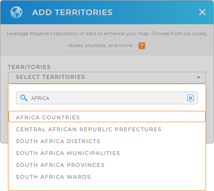
Have a detailed view of your sales territories by adding a new territory from Mapline’s repository to your map. Type AFRICA into the search bar to select AFRICA COUNTRIES.


Pro Tip: Explore the different territories in Africa available in Mapline’s repository to enhance your data and territory analysis. By leveraging African country boundaries and other territory boundaries from individual countries like Zimbabwe districts or South Africa municipalities, new opportunities will be discovered to help you with informed decision-making.
CHOOSE COUNTRY COLORS
Now, let’s apply color styles to your country map. Colors are essential for business analytics and optimizing operations, as they help spark ideas to help you craft better sales strategies to improve your sales performance.
Select the color styles that best suits your needs – uniform color, random colors, custom colors, or heat map colors. Lastly, click OK to finalize your selection.
How easy was that?

GET NEW TERRITORY INSIGHTS
Unlock deeper insights with these powerful capabilities that help you spot trends, uncover hidden opportunities, and make smarter decisions with confidence:
- Set up an automated trip planning system to optimize your sales visits for maximum profitability
- Calculate cost-saving routes to service your customers efficiently
- Draw custom shapes territories for an in-depth location analysis


