LESOTHO DISTRICTS
- Territory Guide
- LESOTHO DISTRICTS
Elevate your brand presence by analyzing your business on a map of Lesotho districts. With this powerful visualization, get ready to unlock new perspectives and uncover hidden patterns that directly impact your operations. A district-level analysis gives you the regional insights you need to fine-tune your strategies, allowing you to tap into underserved markets and maximize your impact. By seeing how your business performs on a district map, you’re not just reacting to trends—you’re shaping them!
Ready to make smarter moves? Mapline can guide you every step of the way by adding these boundaries to your map in seconds!
WHAT ARE LESOTHO DISTRICTS?
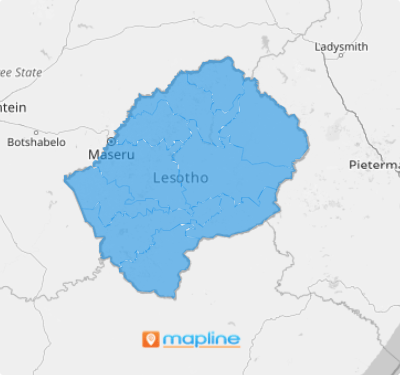
Lesotho, a landlocked nation within South Africa, is divided into 10 districts. Known for its manufacturing-based economy and valuable natural resources, Lesotho offers unique opportunities for businesses. Visualizing your strategies within these boundaries can ignite key insights like sales and profits across the districts.
A district-level analysis is your key to unlocking new potential. With the valued insights you’ll gain, you can streamline your operations, target hyper-focused markets, and be on top of the competition. The market in Lesotho is suitable for every type of business ready to dig deeper and strategize smarter—are you ready to seize those mind-blowing opportunities?
ADD LESOTHO DISTRICTS
In just a few seconds, you can add district boundaries to your map and dive straight into analysis with powerful visuals. Whether you’re mapping sales, profits, or logistics, Mapline lets you get right into the data analysis that drives smarter decisions.
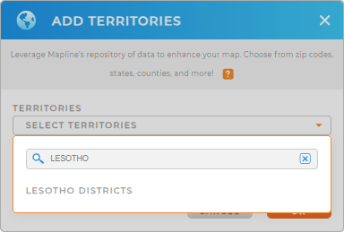
No more waiting around! simply create the map you need by adding a new territory from Mapline’s repository and start unlocking insights immediately. Just type LESOTHO in the search bar to quickly add LESOTHO DISTRICTS.
Hey, that was easy!


Pro Tip: Unlock the full potential of your territory analysis by strategically adding regions from different countries, including Lesotho districts when you access Mapline’s Repository.
CHOOSE DISTRICT COLORS
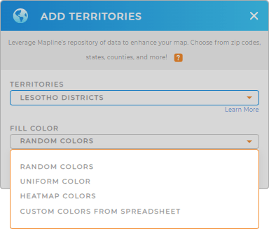
Take your map analysis to the next level by adding territory colors. Color-coding your map can make your data pop and give you deeper insights. Use static colors to clearly define each district boundary. Transform raw data into clear, actionable insights with dynamic colors. They help highlight different values including sales, profits, or performance metrics.
Ready to see your data in a whole new light? Start color-coding your map now by choosing the color styles that best match your type of analysis.

GET NEW TERRITORY INSIGHTS
Reach new heights when unlocking a new level of data analysis using these powerful capabilities to your map of Lesotho districts:
- Stir up intelligent forecasts with market demographics
- Compare performance metrics across different districts right in your territory report
- Draw custom shapes to get an in-depth data analysis within a specific area


