SOUTH SUDAN STATES
- Territory Guide
- SOUTH SUDAN STATES
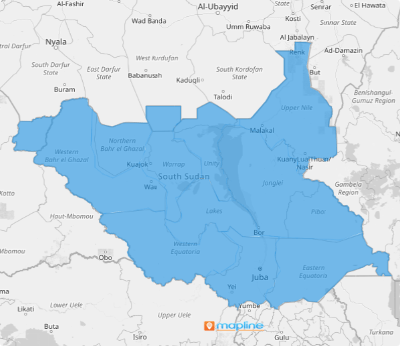
Add South Sudan states to your map and unlock powerful, location-specific insights that can transform your business. With state boundaries visualized, you can identify high-potential hotspots, address challenges proactively, optimize resource allocation, and more! With a detailed view of each state, you can streamline operations, make smarter decisions, and drive success across all regions.
Empower your business to thrive with data-driven precision with state-level analysis! Let’s add state boundaries to your map now!
WHAT ARE SOUTH SUDAN STATES?
South Sudan, a landlocked nation in East Africa, is a vibrant country shaped by its rich history and cultural diversity. Following a peace agreement signed on February 22, 2020, the country is divided into 10 states, two administrative areas, and one region with special administrative status.
Many successful brands turn to in-depth state-level analysis to gain hyper-focused insights that drive smart, informed decision-making. By diving deep into a map of South Sudan states, you can unlock a comprehensive understanding of local demand patterns.
ADD SOUTH SUDAN STATES
A state-focused map can be a game-changer for your business, providing clear insights to identify high-activity areas, streamline logistics, and uncover flourishing opportunities in untapped markets. Whether you’re optimizing deliveries or strategizing expansion, understanding your data within state boundaries is your secret weapon for success.
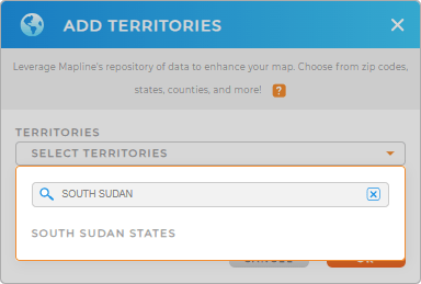
To add a new territory from Mapline’s repository, use the search bar and type SOUTH SUDAN to quickly add SOUTH SUDAN STATES to your map.
Now that you have the right territory added to your map, let’s customize your map with colors.


Pro Tip: Dive into Mapline’s repository of African territories to elevate your data and territory analysis! Explore territory boundaries from many African countries including South Sudan states to discover insights that will enhance your decision-making.
CHOOSE STATE COLORS
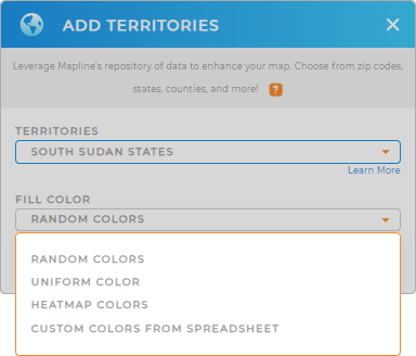
Creating your own custom map has never been simpler or more fun! Customize it to suit your needs by assigning unique colors to different geographical boundaries and values. Whether you’re highlighting territories, visualizing data, or just bringing your vision to life, you can easily craft a personalized color-coded map that tells your story at a glance.
Get ready to explore your world—your way! Just choose the best color styling option that fits with your level of analysis. When you have configured your settings, click OK. Now, get ready to reap all the great insights in store for you as you analyze your data on a map of South Sudan states.

GET NEW TERRITORY INSIGHTS
Now, here are some of the best ways that most brands leverage their South Sudan state maps
- Consolidate all your business information in one place for a cohesive view of your operations
- Perform advanced calculations to make data-driven decisions
- Access territory reports to get accurate insights on your team’s activities


