
A Better Look on Algeria Map Showing Municipalities
Analyze Municipality Boundaries – and Beyond!
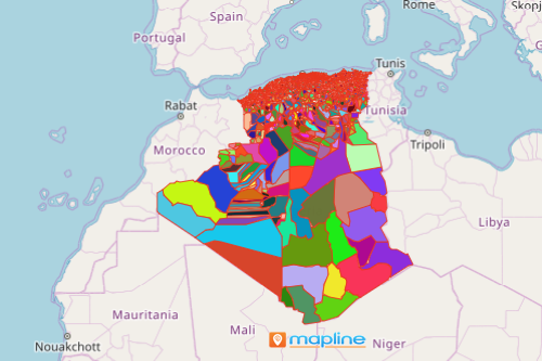
When you look on an Algeria map showing municipalities, what else can you see aside from the obvious? Sure, you can see all the 1,541 municipalities. But are they really what you’re looking for? What if using the same map, you can see trends, improve efficiency, and mitigate risks? Is it really possible? Yes! Simply by mapping municipalities of Algeria using smart mapping tools! Segmenting and filtering addresses are just two of the most successful ways to see trends. For example, as you study cases of Covid-19, you can segment or filter the population data based on whether they have been fully or partially vaccinated. You can also segment the population based on categories such as elderlies, with comorbidities, and others. The result is a more organized presentation of information.
Equally effective tool to apply when mapping Algeria municipalities is the territory reports. This is applied when the end goal is to drive better strategic decisions based on the information presented. For instance, to analyze the trend of ongoing Covid cases, a territory report by municipality is of vital importance. Instantly access positivity rate reports, drive new methods of safety protocols, and establish more organized health and safety policies to mitigate potential risks.
Create an Algeria Map Showing Municipalities and More!
Uncomplicate map creation by simply following these steps. Then, create summary reports of your territories in seconds.
- Create a Mapline account and login.
- Click the orange “Add New Items” button.
- Select “New Map” on the drop down arrow.
- Give your map a name and click “OK.”
- Click the “Add” button from the left sidebar.
- Select the “Territories” option.
- Click “From Mapline’s Repository.”
- From the “Territories” select “Algeria Municipalities.” Use the search bar for a quicker result.
- Select how you want your boundaries to be colored in “Fill Color” (Random Colors, Uniform Color, Dynamic heat map colors, or Custom colors from spreadsheet).
- Click “OK.”
Discover more significant information by applying powerful mapping tools when mapping municipalities of Algeria. Sign up now and learn more on how to identify trends in your territories and improve efficiency within your organization.