ALGERIA MUNICIPALITIES
- Territory Guide
- ALGERIA MUNICIPALITIES
Keep your analytics sharp and dynamic by mapping out Algeria municipalities! Uncover trends, pinpoint opportunities, and make smarter decisions with a clear, region-focused view. Leading brands know that a municipal territory map is key to truly understanding their customer base. The insights they uncover empower them to craft targeted campaigns that amplify their brand presence across Algeria.
Don’t just follow the trends—set them. Start analyzing the municipality boundaries in Algeria and beyond, and watch how it transforms your approach.
WHAT ARE ALGERIA MUNICIPALITIES?
Algeria, the largest country in Africa, is home to 44 million people spread across its vast expanse. Its municipalities, also known as communes, form the third level of administrative subdivisions, established in 2002. With 1,541 unique municipalities to explore, each brimming with potential, the opportunities for targeted marketing campaigns and business expansion are limitless!
Now, imagine you’re a sales manager aiming to boost your performance in the Algerian market. Dive into a map of Algeria’s municipalities to uncover hidden opportunities and emerging trends! Gain a strategic edge by visualizing regional patterns and making smarter, data-driven decisions. This kind of detailed analysis not only sharpens your strategies but also enhances your operational efficiency.
Isn’t that incredible?
ADD ALGERIA MUNICIPALITIES
You’re on to a great start as you add Algeria municipalities to your map. Conduct hyper-local market research with a municipality-level analysis and see the results in minutes! By visualizing these boundaries, it will be easier to monitor your sales performance across multiple regions and seamlessly shift your focus to areas needing more attention.
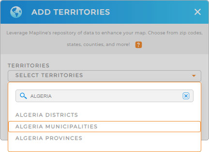
To start off strong, add a new territory from Mapline’s repository, type ALGERIA in the search bar and select ALGERIA MUNICIPALITIES.
Wow, that was fast!


Pro Tip: Mapline’s worldwide territory repository is a goldmine of geographic boundaries, offering a vast selection from countries across the globe—including Algeria provinces, Algeria districts, and municipalities. By exploring these boundaries, you unlock a wealth of insights that can power your decision-making process.
CHOOSE MUNICIPALITY COLORS
Now, speed up your analysis with colors! With a color-coded map, you can quickly grasp complex data. Because the insights are easily recognizable, they facilitate data-driven decisions for improved sales and marketing strategies.
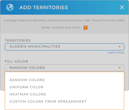
Whether you choose random colors, uniform color, heat map colors, or custom colors from spreadsheet, you’re a sure winner as you apply the right color styling to your analysis. Once you have configured your the type of colors for your territories, click OK.
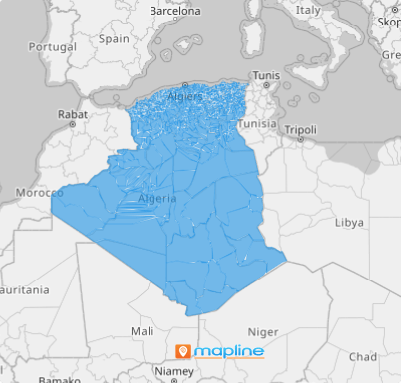
Now, there’s your map of Algeria municipalities!

GET NEW TERRITORY INSIGHTS
To maximize the use of your Algeria municipality map, try adding these capabilities for increased territory analysis:
- Calculate driving distance to optimize logistics
- Create a new dashboard to share information with your team
- Customize pin colors for quick identification


