ARGENTINA PROVINCES
- Territory Guide
- ARGENTINA PROVINCES
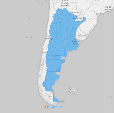
Mapping out Argentina provinces can revolutionize how you manage your sales territories. By visualizing these regions, you can identify high-potential areas, streamline your sales routes, and strategically allocate your sales force. Imagine knowing exactly which provinces need more attention and which ones are thriving. Tap into the power of a map of Argentina provinces today to maximize your sales efficiency and drive growth.
Let’s bring your territory map to life in under a minute and jumpstart your province-level mapping journey with ease and precision!
WHAT ARE ARGENTINA PROVINCES?
In Argentina, provinces are like the states in the USA, dividing the country into different regions. In more technical terms, there are 23 provinces, each of which is a federated state named in the Constitution of the Argentine Nation. Together with the Autonomous City of Buenos Aires, these regions make up the first-order territorial divisions of Argentina.
Using these territory maps can help your sales team focus on specific areas, identify top-performing regions, and pinpoint places that need more resources. This way, you can allocate your sales efforts where they are needed the most and maximize your reach. Mapping Argentina provinces can transform your daily sales strategies by providing clear, actionable insights into regional performance, helping you make informed decisions and optimize your sales operations.
ADD ARGENTINA PROVINCES
Adding Argentina Provinces to your map provides a detailed view of your sales territories, helping you make data-driven business decisions.
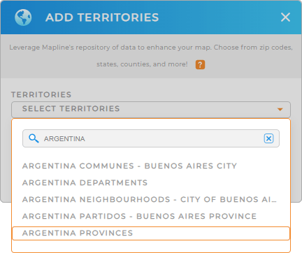
First, add a new territory from Mapline’s repository. Type ARGENTINA into the searchbar and select ARGENTINA PROVINCES from the drop-down menu.
This is a fantastic way to quickly add province boundaries to your map. You’re almost done, there’s just one more quick step!


Pro Tip: Mapline’s extensive list of territory boundaries allows you to add precise regional divisions to your map. Use the worldwide territory repository to explore different regional boundaries in the country, including Argentina communes, Argentina departments, Argentina partidos, Argentina provinces, and Argentina neighborhoods.
CHOOSE PROVINCE COLORS
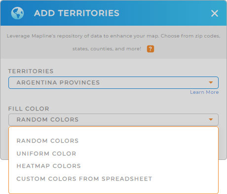
Territory colors are essential for business analytics and optimizing operations as they help you visualize sales performance at a glance. Color-code your Argentina Provinces to quickly identify top-performing and underperforming areas.
Select your desired color styling, then click OK.
This powerful visual tool enhances your ability to make strategic decisions based on clear, color-coded data. Now, you don’t need to spend hours or even days to assess when you can pinpoint factors in your territories only within minutes or seconds! How exciting is that?

GET NEW TERRITORY INSIGHTS
That’s how easy it is to create a map of Argentina Provinces! But it doesn’t stop there. Now, you have the power to unlock more valuable insights that were previously hidden in your data by using these powerful capabilities:
- Tap a pin that grabs your attention, and instantly, all the key details appear right in front of you
- Gain a powerful perspective, helping you uncover insights and seize new opportunities
- Supercharge your on-site tracking and ensure your team stays in compliance


