SYRIA DISTRICTS
- Territory Guide
- SYRIA DISTRICTS
Add Syria districts to your map to pinpoint regional opportunities, identify emerging trends, and make data-driven decisions with confidence. Unlock a whole new level of insight with this dynamic territory map! Instantly visualize your sales performance, market trends, and customer distribution — all in one powerful view. Spot hidden patterns, uncover new opportunities, and dive deeper into the areas that drive your success. It’s more than just a map — it’s your ultimate tool for smarter, faster business decisions.
Let’s unlock transformative insights as we add these district boundaries to your map in seconds. Then, watch your analysis drive remarkable business growth!
WHAT ARE SYRIA DISTRICTS?
Syria, a historic and culturally rich nation in West Asia, lies at the crossroads of the Eastern Mediterranean and the Levant. Its 14 governorates are divided into 61 districts. Each district and subdistrict is managed by officials appointed by the governor and approved by the Minister of the Interior.
Now, imagine the power of a district-level map of Syria in your hands. Whether you’re strategizing for growth, identifying untapped opportunities, or optimizing resources, this map becomes your key to unlocking transformative insights.
ADD SYRIA DISTRICTS
Want to visualize market penetration at a glance? What about understanding customer density where your product or service is most popular? You can make these happen and so much more! Adding Syria districts to your map can make this analysis not only simple but incredibly powerful.
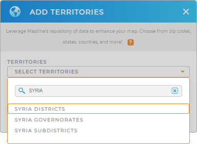
Let’s add a new territory from Mapline’s Repository. Get the right territory added by typing SYRIA in the search bar and selecting SYRIA DISTRICTS.
Woah, that was unbelievably fast!


Pro Tip: Mapline’s global territory repository is packed with territory boundaries from all around the world, including Syria governorates, Syria districts, and Syria subdistricts. Leverage these territory maps to uncover insights in different levels of analysis.
CHOOSE DISTRICT COLORS
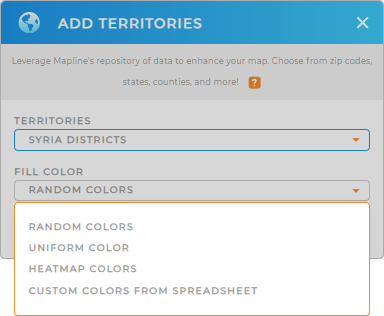
Now, let’s choose your territory colors. Applying colors to district boundaries is an essential step for clear and quick data visualization. Whether you’re analyzing sales, market trends, or customer distribution, color-coding can elevate your insights.
Ready to visualize your data like never before? Apply color styling and transform your analysis!
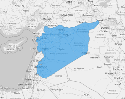
Click OK and get ready to reap valuable insights as you begin your data analysis on your map of Syria districts.

GET NEW TERRITORY INSIGHTS
Here are some powerful ways to focus on your analysis:
- Color-code your locations based on market segments
- Create awesome charts that are easy to understand.
- Display various types of visualizations in one place


