BHUTAN DISTRICTS
- Territory Guide
- BHUTAN DISTRICTS
Give your sales territory planning a competitive edge by mapping insights across Bhutan’s districts. Uncover opportunities, optimize strategies, and drive smarter decisions with a clear regional perspective! Most brands use a district map for sales territory planning and management for enhanced visibility, optimized resource allocation, and improved sales performance. Since district maps clearly define the boundaries of each sales territory, territory assignments can be more organized, reducing overlap and confusion amidst your sales reps. That’s one headache gone!
You can start a district-level mapping in just a few seconds. So add this territory to your map now!
WHAT ARE BHUTAN DISTRICTS?
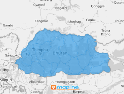
Bhutan is located in South Asia. The 20 districts of Bhutan serve as the primary administrative division. They are in charge of running elections and creating local governments, among many other rights and powers. District maps are used by many brands as they provide clearly define the boundaries.
Suppose you want to expand your business and want to tap more opportunities. By visualizing your locations a on a map of Bhutan districts, you gain clear-cut ideas on areas that need more resources to catapult your business to success while providing a sustainable livelihood for the communities.
ADD BHUTAN DISTRICTS
Enhance your team’s efficiency and overall success by being strategic. To achieve that, you need to visualize how your sales reps, customers, and target markets connect. Here at Mapline, we make it easy for you to achieve that simply by adding boundaries to your map. In fact, in two simple steps, you’ll be done!
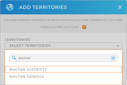
First, add a new territory from Mapline’s repository. Type BHUTAN into the search bar to narrow down the selections. Then click to add BHUTAN DISTRICTS.


Pro Tip: Tap into Mapline’s worldwide repository of administrative boundaries including Bhutan gewogs and districts to enrich your data analysis. Make comparisons from different territories to get a full understanding of your market and business operations within a given area.
CHOOSE DISTRICT COLORS
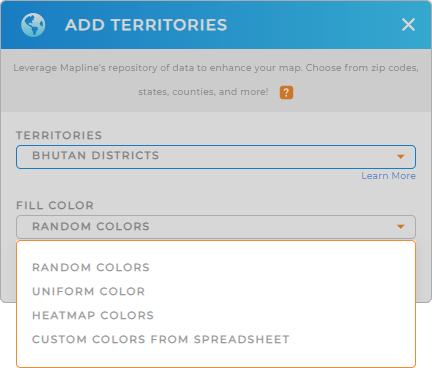
The second step is to color-code your territories. Colors are so powerful that they ignite ideas making your district map a wealth of insights to craft a solid structure for sales territories. Segment your territories by sales team leaders using static colors for a unified approach. You can also apply dynamic colors. Since the colors are tied to your data, you can ensure a balanced workload for each sales rep.
To color-code your map, configure the color styling fitted to your type of analysis. When you’re done, click OK.
Now, start crafting solid sales territory plans!

GET NEW TERRITORY INSIGHTS
Here are more powerful capabilities to help you get the full advantage of your map of Bhutan districts:
- Leverage Mapline Data to add a sum of sales for each district
- Segment your chart by district to visualize sales
- Filter your data to view performance metrics or specific ad campaigns


