BOLIVIA MUNICIPALITIES
- Territory Guide
- BOLIVIA MUNICIPALITIES
Take your analysis to the next level by adding Bolivia municipalities to your map. This isn’t just about expanding your geographic view—it’s about unlocking a deeper understanding of how these boundaries influence your business growth. Imagine visualizing your business performance on a municipality map and instantly grasping how these local factors affect your strategies. With this insight, you can tailor your approach to meet the specific needs of each area, optimize your operations, and drive your growth with precision.
Get ready to transform your business strategy by turning complex data into actionable insights with Bolivia municipality map!
WHAT ARE BOLIVIA MUNICIPALITIES?
Bolivia is divided into 340 municipalities. Analyzing your next moves on a municipality territory map is a game-changer. This isn’t just about seeing more—it’s about seeing better, with a deeper spatial analysis that provides a crystal-clear view of your local reach. Imagine having the power to instantly visualize how your business interacts with each of these municipalities. This level of detail allows you to understand precisely where your impact is strongest and where you can expand. With this insight, you can step up your game and craft strategies that target specific areas, meet local demands, and reach more customers effectively.
Apply those valuable insights from your municipality-level analysis to your business strategies immediately! Here’s how to add Bolivia municipalities in a flash!
ADD BOLIVIA MUNICIPALITIES
Imagine having the first to access factors affecting your business! Then, you can pivot plans and strategies leading to more customized marketing that will propel your business forward. A map of geographic boundaries allows you to help you strategize your positioning and expansion plans.
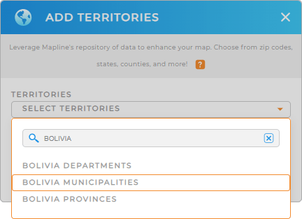
Mapline has the simplest ways to add a new territory from Mapline’s repository. In just a few clicks, you’ll be done! Type BOLIVIA into the search bar and select BOLIVIA MUNICIPALITIES to add it to your map.
How fast is that?


Pro Tip: Tap into the many potentials of Mapline’s global territory repository to advance your spatial analysis capabilities. Explore diverse geographic insights as you add Bolivia departments, municipalities, or Bolivia provinces for more informed decision-making.
CHOOSE MUNICIPALITY COLORS
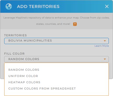
Color-coding your municipality map is a powerful way to highlight critical points in your data. For example, if you’re a sales manager, you can quickly pinpoint high and low-performing regions or other KPIs impacting your bottom line. Your analysis is trimmed down that fast so you can focus more on tasks like developing new business plans, designing new marketing strategies, or optimizing logistics.
Choose the color styling that best suits your analysis, then click OK.
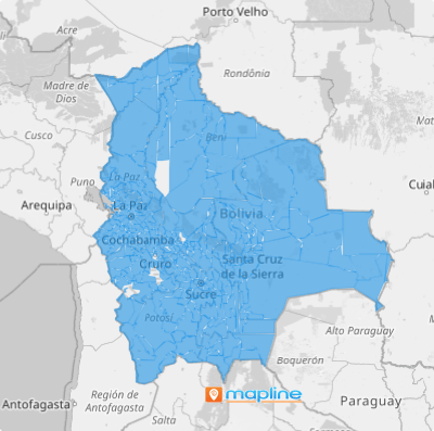
There’s your map of Bolivia municipalities. Now, get your analysis mode turned on!

GET NEW TERRITORY INSIGHTS
Maximize your Bolivia municipality map when you use these capabilities to unlock more valuable insights:
- Quickly generate bar graphs, line charts, or pie charts to display the exact data you need
- Customize your routes to prioritize time-sensitive client needs
- Leverage Mapline Data to uncover market opportunities unique to Bolivia


