BRAZIL FEDERAL DISTRICT REGIONS
- Territory Guide
- BRAZIL FEDERAL DISTRICT REGIONS
Mapping Brazil Federal District Regions is the perfect way to enhance your territory management!
Let’s say you’re a logistics company optimizing its delivery routes by analyzing customer distribution and demand trends within these regions. With this feature, businesses can efficiently allocate resources, identify growth opportunities, and streamline operations for maximum efficiency.
This focused approach enhances operational efficiency and customer satisfaction by optimizing logistics operations based on regional nuances and demands.
WHAT ARE BRAZIL FEDERAL DISTRICT REGIONS?
Brazil federal district regions are specialized administrative divisions within the state of Rio de Janeiro. Unlike traditional municipalities, these regions provide a more focused and detailed perspective for businesses operating within the state.
For instance, a logistics company might utilize these regions to optimize delivery routes, ensuring timely and efficient transportation of goods across different areas within the federal district.
By mapping these regions, businesses can also gain valuable insights into localized market trends, customer demographics, and competitive landscapes, enabling them to tailor their sales and marketing strategies accordingly. Additionally, these boundaries facilitate effective territory management, enhancing businesses operations and maximizing profitability within specific regions of Rio de Janeiro.
ADD BRAZIL FEDERAL DISTRICT REGIONS
Whether you’re pinpointing the perfect expansion spot or refining your strategy, mapping these regions allows you to gain the clarity and confidence to seize opportunities, outpace competitors, and elevate your business to new heights. Your key to success in one of South America’s most dynamic markets starts here!
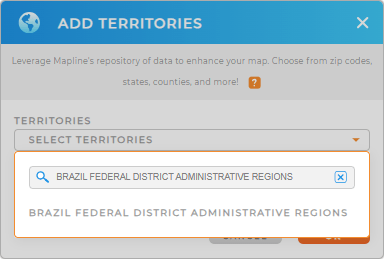
Adding Brazil Federal District Regions to your Mapline map only takes a few seconds. Simply add a new territory from Mapline’s repository, type BRAZIL into the search bar, and select BRAZIL FEDERAL DISTRICT ADMINISTRATIVE REGIONS.
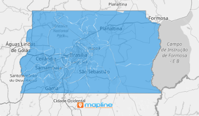
And BAM! These regions import onto your map automatically. But we’re not quite done yet– let’s check out how to color-code your territories.


Pro Tip: Mapline offers a diverse range of territory boundaries beyond Brazil federal district regions, including Brazil meso regions, Brazil municipalities, and Brazil neighborhoods. Explore these options to customize your maps and further enhance your analysis!
CHOOSE REGION COLORS
Now, let’s customize your map by choosing the perfect color scheme for your Federal District Regions!
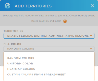
Whether you’re highlighting customer demographics, sales performance, or competitive landscapes, Mapline provides intuitive color styling options to suit your needs. Make your territories visually impactful and easy to interpret with just a few clicks.
Just select the type of color-coding you need, then click OK. Your map will auto-fill with your color selection.

GET NEW TERRITORY INSIGHTS
With these regions on your map, you’ll gain valuable insights into regional performance and market dynamics, all within a few clicks. Here are just a few examples of how to get the most from your data:
- Understand your market coverage by creating center points from your existing map pins
- Enhance your insights with deeper context and clarity by customizing views
- Easily pull data from your favorite platforms


