Brazil Municipalities – North Region
- Territory Guide
- Brazil Municipalities – North Region
Explore the vibrant populations of Brazil North Region municipalities and unlock insights that can reshape your business strategies! By mapping these municipalities in Mapline, you gain a deeper understanding of regional demographics, market potential, and distribution networks.
This level of spatial analysis empowers you create custom-tailored campaigns, optimize your operations, identify emerging opportunities, and more! Here’s how to harness the power of geo intelligence to drive your business forward.
WHAT ARE BRAZIL NORTH REGION MUNICIPALITIES?
Brazil’s municipalities in the North Region are administrative divisions within the northern part of Brazil, encompassing states such as Amazonas, Pará, Roraima, and others. These municipalities represent local government jurisdictions responsible for governance, services, and infrastructure development.
Brands can leverage a map of these municipalities to optimize their sales and operational strategies. For example, a brand might need to target specific geographic areas with tailored campaigns or streamline logistics and resource management. Territorial insights enable you to level-up your understanding of market dynamics, improve service delivery, and more!
ADD MUNICIPALIITIES TO MAP
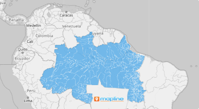
Generate a map of Brazil’s North Region municipalities in seconds! With this map, you’re one step ahead of identifying all the important factors affecting the local area.
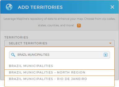
Gain the competitive edge you need to fuel growth and dominate your industry! First, add a new territory from Mapline’s repository. Then, type BRAZIL into the searchbar and select BRAZIL MUNCIPALITIES.
That’s all there is to it! Now let’s check out how to customize your new territory boundaries before adding them to your map.


Pro Tip: Mapline offers three municipality boundary options: one for the North Region, another is Rio de Janeiro municipalities, and a comprehensive Brazil municipalities. Select the municipality boundary that best aligns with your needs.
CHOOSE MUNICIPALITY COLORS
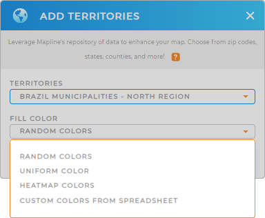
By adding colors, your municipal boundaries a become rich source of insights for important decision-making. Selecting the right color style isn’t just about making your map visually appealing; it’s about sparking ideas that can uncover growth opportunities, offer fresh business perspectives, or facilitate the creation of sustainable plans.
Whether you opt for random or uniform colors, heatmaps, or custom-based colors, applying color styles will enhance your understanding of municipal territories on a deeper level. When you’re finished, simply click OK. Easy peasy!

GET NEW TERRITORY INSIGHTS
And that’s all there is to creating a municipal map of the North Region in Brazil! Now, you can now focus your efforts on analysis:
- Customize your form’s button settings to capture and organize information exactly how you need it
- Transform your HubSpot data into actionable insights
- Elevate your analytics by blending the versatility of a spreadsheet with the power of location intelligence


