CAMEROON DEPARTMENTS
- Territory Guide
- CAMEROON DEPARTMENTS
Turn geography into your competitive edge as you add Cameroon departments to your map. Whether you’re looking for untapped opportunities, strategizing expansion, or optimizing operations, custom district maps of Cameroon provide the clarity and insights you need to thrive. Many successful brands operating in the country leverage a department-level analysis to help them capture market penetration insights, outsmart competitors, and elevate their service quality. The result? Happier customers and a stronger reputation!
Let’s add these boundaries to your map in seconds and start analyzing for valuable insights to enhance your business.
WHAT ARE CAMEROON DEPARTMENTS?
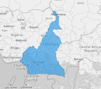
Cameroon is a country in Central Africa. The regions of Cameroon are divided into 58 divisions or departments. These are headed by presidentially appointed divisional officers, who perform the governors’ duties on a smaller scale.
Mapping Cameroon departments is your gateway to unlocking unparalleled insights into local markets. By analyzing department boundaries, you can uncover trends, understand customer behaviors, and analyze market dynamics with precision. This granular approach empowers you to make smarter decisions, fine-tune your strategies, and position your brand to outpace competitors.
ADD CAMEROON DEPARTMENTS
Ready to elevate your analysis? Here at Mapline, you can visualize Cameroon departments seamlessly and more efficiently. In just minutes, you can transform your analysis into actionable insights, paving the way for strategic growth and success.
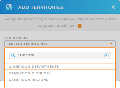
Let’s get it done by adding a new territory from Mapline’s repository. Type CAMEROON in the search bar and select CAMEROON DEPARTMENTS.
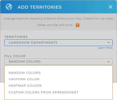
With the right territory selected, get ready to apply territory colors.


Pro Tip: Mapline’s worldwide territory repository houses different territory boundaries including Cameroon regions, Cameroon districts, and departments. Integrate these boundaries into your map and intensify your analysis to uncover location-driven insights that drive your decision-making.
CHOOSE DEPARTMENT COLORS
With a color-coded department map, you can create a vibrant, interactive visualization that will lead you to connect the dots. Enhance the visual clarity of your territories, elevating your map’s ability to capture targeted insights with laser-like accuracy.
Mapline provides exceptional color styling options to choose from. Apply the color-coding style that best matches your level of analysis to visualize and interpret complex data at a glance.
Click OK once you’ve configured your settings.

GET NEW TERRITORY INSIGHTS
With your map of Cameroon departments in tow, the next best thing is to apply these awesome capabilities to wring out more valuable insights:
- Leverage Mapline’s API to get real-time updates from different marketing channels
- Automate tasks and minimize manual effort with button coloumns
- Extract valuable information in an instant with territory report


