CAMEROON DISTRICTS
- Territory Guide
- CAMEROON DISTRICTS
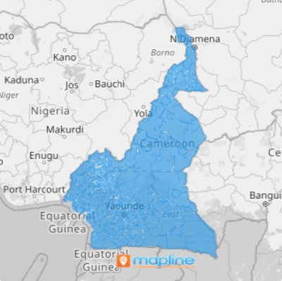
A map of Cameroon districts empowers you to foresee challenges and act right away. Each district, being the smallest administrative division in the country, provides pinpoint accuracy on local markets. By harnessing this level of detail, you can adjust your strategies, meeting every hyper-local demand and turning potential obstacles into opportunities.
Uncover a wellspring of insights that align and optimize your business operations and strategies with this granular approach. Let’s check out and see how analyzing these small boundaries can help improve your strategies big time!
WHAT ARE CAMEROON DISTRICTS?
Cameroon, a vibrant country in Central Africa, is divided into 20 districts, each overseen by local heads who navigate the intricate tapestry of this diverse land. These districts are the smallest administrative units, often nestled within vast, challenging sub-divisions and regions. By diving deep into these district boundaries, you gain a competitive edge that’s nothing short of superhuman.
Hone in on high-potential areas and you’ll uncover hidden factors that can turbocharge your sales performance, not just in one district, but as your insights ripple outwards to other regions. Transform perceived obstacles into opportunities and discover endless possibilities that your competitors might overlook.
ADD CAMEROON DISTRICTS
Start seeing valuable insights from your vantage point when you visualize how these districts impacts your business. Then, improve your strategies based on informed decisions derived from actionable insights from the patterns observed on your map.
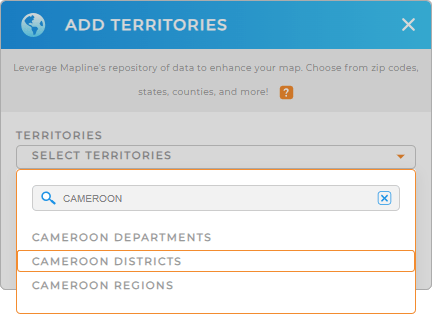
In just a few seconds you can add a new territory from Mapline’s repository. Type CAMEROON into the search bar and select CAMEROON DISTRICTS.
How fast it is to add boundaries to your map in Mapine!


Pro Tip: In addition to Cameroon districts, Mapline’s territory repository provides various territory boundaries. Explore other territories in Cameroon including Cameroon departments and Cameroon regions to gain comprehensive insights into your geographic data.
CHOOSE DISTRICT COLORS
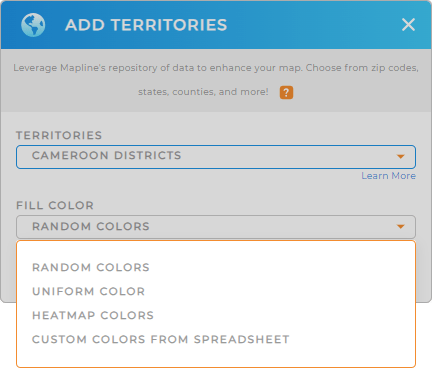
The next step is to apply colors to your map. Of course, you want to make your map visually presentable. But colors do more than that! For instance, if you want to visualize your customer density, you can apply heat map colors. If you want to identify where you should focus your efforts, you can apply custom colors.
Adding your preferred color styles is so easy, that you can just choose your preferred type of color from the drop-down menu. How convenient is that?

GET NEW TERRITORY INSIGHTS
Make your map of Cameroon districts a reservoir of inexhaustible insights when you apply these capabilities:
- Create precise sales territories to supercharge your territory planning
- Customize the data on your charts to achieve actionable insights
- Streamline schedules and optimize deliveries for cost-efficient delivery planning


