CANADA PROVINCES
- Territory Guide
- CANADA PROVINCES
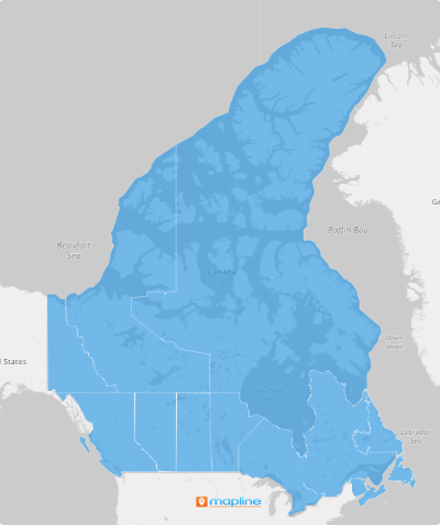
Boost your analytics with a map of Canada provinces! Dive into detailed analysis so you can strategize based on rich data insights that drive ROI. Spot regional trends in seconds, and drive smarter decision-making for your team. Gain a competitive edge by incorporating a detailed territory map of Canada’s provinces into your business strategy. Unlock powerful insights, optimize operations, and make smarter, data-driven decisions with precision!
Ready to get started? Let’s explore how to quickly add Canada provinces to your map and analyze your data right away.
WHAT ARE CANADA PROVINCES?
Canada is divided into 10 provinces, each with its own local government and unique characteristics. Leveraging a map of these provinces can you strategically plan and execute smart initiatives based on real-time data. Mapping these territories allows you to see the bigger picture and focus your efforts on the most impactful areas, improving overall efficiency and performance.
Imagine having a crystal-clear view of provincial boundaries that gives you a powerful edge in logistics and supply chain management. Effortlessly map the most efficient routes, pinpoint ideal distribution hubs, and create precision-targeted delivery zones—all tailored to each province’s unique landscape. With this level of insight, you’ll streamline operations, cut costs, and drive efficiency like never before!
ADD CANADA PROVINCES
Unlocking the power of business planning starts with mapping Canada provinces. See the landscape in stunning detail, equipping you with the clarity and precision of a strategic mastermind.
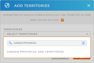
Here’s how to add these boundaries to your map in just a few clicks. First, add a new territory from Mapline’s repository and type CANADA into the searchbar. Select CANADA PROVINCES AND TERRITORIES.
Woah, that was fast! There’s just one more quick step, and you’re all set.


Pro Tip: Mapline’s Repository‘s extensive list of territories allows you to seamlessly add other Canada territory boundaries including Canada census tracts, Canada agricultural regions, and more to your map! Adding these boundaries empowers you to streamline your operations across Canada.
CHOOSE PROVINCIAL COLORS
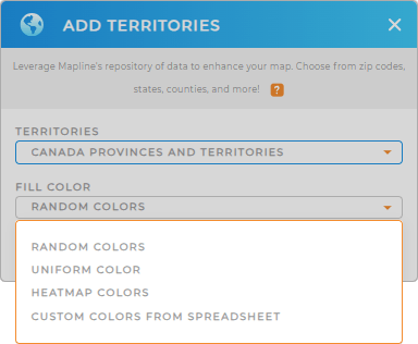
Now, let’s transform your map into a visual powerhouse. Easily spot trends, optimize team assignments, and minimize operating costs. This is a fantastic way to make critical data points stand out and streamline your decision-making process.
Simply choose your preferred color styling, click OK and your map is ready to go!

GET NEW TERRITORY INSIGHTS
The best part of having a map of Canada provinces is that you can start digging in and extract valuable information that can be used for decision making. Be in the know as you:
- Revolutionize the way you work with workflow actions
- Easily transform your datasets into visually compelling reports for a competitive edge
- Add a new form and boost team accountability


