CONGO-BRAZZAVILLE DISTRICTS
- Territory Guide
- CONGO-BRAZZAVILLE DISTRICTS
Map Congo-Brazzaville’s districts and watch game-changing insights unfold! Spot trends, reveal opportunities, and make smarter moves with crystal-clear precision. District boundaries provide a prime opportunity to understand your customers and identify their buying patterns. By integrating district-level data into your analysis, you gain the power to see exactly where your customers are, how they behave, and what they prefer. This granular approach is why more brands are turning to district boundaries for their market analysis. It’s all about precision. When you target specific districts, you can tailor your marketing campaigns to resonate more deeply with local audiences.
Dive in and transform your data into a strategic advantage!
WHAT ARE CONGO-BRAZZAVILLE DISTRICTS?
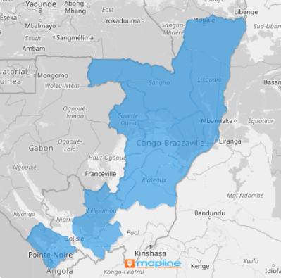
Congo-Brazzaville, commonly known as the Congo Republic (not to be confused with the Democratic Republic of Congo), is a diverse nation in Central Africa, segmented into 86 distinct districts. Harnessing these administrative divisions on a map is a game-changing strategy for deciphering consumer demographics and preferences. This granularity allows you to pinpoint where consumer behaviors diverge, enabling you to craft marketing strategies that are not only tailored but precisely targeted.
Imagine you’re a sales team manager aiming to zero in on hyper-local purchasing patterns. Gain a powerful lens into the specific needs and interests of various target markets as you analyze your performance on a district map. Map out those districts and start turning insights into impactful strategies!
ADD DISTRICTS
How awesome is that? Adding district boundaries to your map is a targeted approach to increase your operational efficiency and improve brand awareness resulting in higher conversion rates.
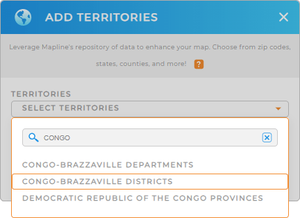
To get you started, first, click the ADD button on the left side of your map. Then click TERRITORIES and add a new territory from Mapline’s repository. Type CONGO into the search bar and select CONGO-BRAZZAVILLE DISTRICTS.
As simple as that and you have added the right territory to your map!


Pro Tip: Tap into Mapline’s vast territory repository to instantly add territories to your map including Congo-Brazzaville districts and Congo-Brazzaville departments. Turbocharge your business strategies and stay ahead of the game!
CHOOSE DISTRICT COLORS
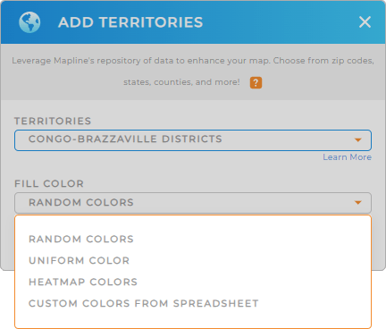
Now, speed up your analytics with colors. Territory colors are used to identify spatial patterns, trends, or concentrations within territories. In Mapline, you can choose a heat map to show resource allocation intensity, or custom colors to show how districts are visually represented on the map.
Choose your preferred color styles from the drop-down menu, then click OK.
Now, with your map of Congo Republic districts, you can get started with your analysis anytime, anywhere!

GET NEW TERRITORY INSIGHTS
Unlock the full potential of your map of Congo Republic districts with Mapline’s advanced capabilities:
- Add midpoints to your map to reduce travel time and cost for your team
- Dive into key areas, uncover insights, and make smarter decisions with folder reports
- Style your territories to highlight specific regions or showcase sales data


