DEMOCRATIC OF THE CONGO PROVINCES
- Territory Guide
- DEMOCRATIC OF THE CONGO PROVINCES
A map of the Democratic Republic of the Congo provinces can significantly impact your analytics with insight into provincial trends and demographics. Mapping each province opens doors for sharper business analytics, allowing you to elevate your marketing, streamline sales targeting, and boost operational efficiency. Leverage territory mapping to transform your strategy—fueling insightful decisions that give you a distinct edge over the competition.
Tap into the power of territory mapping and anchor your strategies to the insights gained that will set you apart from the competition. Here’s how.
WHAT ARE DEMOCRATIC REPUBLIC OF THE CONGO PROVINCES?
The Democratic Republic of the Congo, simply known as Congo or DRC, is the second largest country in Africa. It is divided into the city province of Kinshasa and 25 other provinces. Imagine the limitless insights you can gain by visualizing customer patterns within these provinces! Province territory mapping can provide valuable insights into important business aspects. Visualize market trends at a provincial level to identify opportunities and challenges. Compare performance across provinces to allocate resources effectively.
Unlock powerful insights into the Democratic Republic of the Congo’s provincial trends and demographics with a dynamic provincial map!
ADD DEMOCRATIC OF THE CONGO PROVINCES
Make your map of the Democratic Republic of the Congo provinces a storehouse of inexhaustible insights that help propel your regional market analysis forward to strategize accordingly. Gain the ability to analyze each province in greater detail and craft the most effective sales and marketing strategies to achieve the highest level of success!
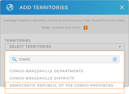
Start by adding a new territory from Mapline’s repository. Type CONGO into the search bar and select DEMOCRATIC REPUBLIC OF THE CONGO PROVINCES to add it to your map.
Just a few clicks left and your map is done.


Pro Tip: Access boundaries including the Democratic Republic of the Congo provinces from Mapline’s territory repository to help you dive deep into regional analysis, empowering you to achieve actionable insights for smarter decision-making.
CHOOSE PROVINCE COLORS
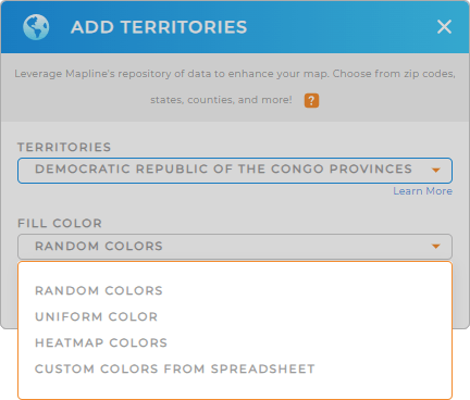
Get ready to understand how your business performs as you apply color styles to your territory. With advanced color styles, you can assign different colors to provinces based on criteria like sales volume, demographics, or market potential. You can also create heat maps to visualize areas with high and low activity or demand.
Select color styling from the drop-down menu. Choose one that best fits your type of analysis. Once you have configured your color styles, click OK.
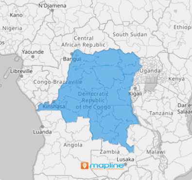
Now it’s time to identify insights one after another as you start analyzing your data on a map of the Democratic Republic of the Congo provinces!

GET NEW TERRITORY INSIGHTS
Get the most out of your provincial analytics as you check out these capabilities:
- Instantly visualize trends and patterns to adjust your strategies
- Run complex calculations on your data to gain actionable insights
- Add center of minimum distance points to your map to identify areas ideal for business expansion


