EL SALVADOR DEPARTMENTS
- Territory Guide
- EL SALVADOR DEPARTMENTS
Adding El Salvador departments to your map is a game-changer for gaining valuable business insights. Mapping out the departments of El Salvador gives you the power to spot market shifts, optimize logistics, and stay ahead of regional trends—turning insights into smarter, faster decisions. This enhanced perspective empowers you to adapt swiftly to emerging opportunities and challenges.
By leveraging this detailed geographic boundaries, you can stay ahead of the curve in today’s competitive landscape. Let’s review how to create an El Salvador department map for your data analysis now, and watch as insights and ideas emerge, guiding you toward more effective business strategies.
WHAT ARE EL SALVADOR DEPARTMENTS?
El Salvador is divided into 14 departments, which are the primary administrative subdivisions of the country. Each department has unique characteristics that make mapping them particularly beneficial for business analytics. For instance, San Salvador, the capital department, is a hub for commerce, finance, and industry, making it crucial for businesses looking to establish a strong presence in the market. Departments like La Libertad and Santa Ana are also significant due to their high population densities and economic activities, such as agriculture and tourism.
Incorporating department-level boundaries into your maps helps you understand these regional distinctions, enabling you to make informed decisions that enhance customer engagement and overall business performance. Identifying high-population areas can help you focus your marketing efforts where they will have the most impact. Or, understanding the economic landscape of each department allows you to tailor your strategies to local demands.
ADD DEPARTMENTS TO MAP
Leverage geographic insights effectively to achieve your business objectives with clarity and precision. By mapping El Salvador’s departments, you can uncover hidden opportunities, optimize your operations, and drive better business outcomes.
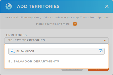
First, add a new territory from Mapline’s repository. Then, type EL SALVADOR into the searchbar and select EL SALVADOR DEPARTMENTS.
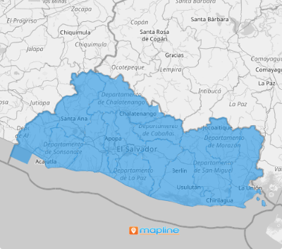
This is a fantastic visualization tool to help you pinpoint insights that drive growth for your business.


Pro Tip: Levearge Mapline’s worldwide repository of administrative boundaries to analyze regional data. Then, watch as you unlock new possibilities for business insights and operational improvements!
CHOOSE COLOR STYLES
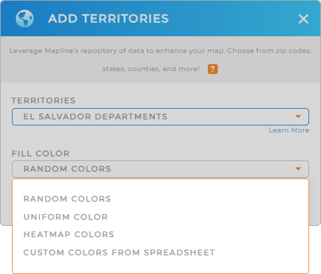
Allow your data to tell a story with custom color styling! Enhance comprehension in decision-making, giving you and your team the clarity you need to level-up sales and blow performance out of the water!
Simply select your desired type of color styling and click OK.
Now, your map is ready to enhance your data analysis! Isn’t that incredible?

GET NEW TERRITORY INSIGHTS
Take advantage of these capabilities so you can get the maximum benefit from using your map of El Salvador Departments:
- Edit, slice, or merge territories to create your own custom territory boundaries
- Quickly get an overview of the data within each territory when you access territory reports
- Customize your maps with custom shapes, coverage areas, territories, or routes to faciliatate quick analysis


