ERITREA REGIONS
- Territory Guide
- ERITREA REGIONS
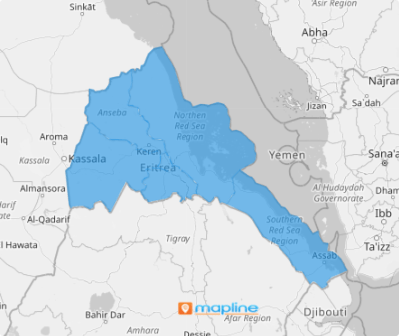
Make a map of Eritrea regions the foreground of your territory analysis! This region territory map is a go-to for many brands to help them unlock insights into competitive landscapes or sales trends. If you’re a business owner aiming to track team sales performance or evaluate the risks your stores face, or if you want to outpace your competitors, then look no further! This detailed map speeds up your analytical prowess in analyzing market saturation, identifying growth opportunities, or fine-tuning your strategies, empowering you to make strategic decisions fast!
And the best part is that you can add these regions to your map in just under a minute!
WHAT ARE ERITREA REGIONS?
Eritrea, a stunning nation on East Africa’s Red Sea coast, draws its name from the ancient Greek word for this very sea—a fitting tribute to its lengthy, strategic shoreline. The country is divided into six unique regions, each with distinct cultural and economic landscapes. By mapping these regions, brands gain a powerful tool to navigate Eritrea’s local markets, pinpoint customer demographics, and streamline logistics. This regional insight allows businesses to tailor their strategies effectively, fostering deeper connections with communities and unlocking new opportunities in a diverse and dynamic market.
Dive into your regional analysis today and uncover a wealth of valuable insights that can transform your decision-making. With a clearer view of customer behaviors, market trends, and local dynamics within individual regions, you’ll be empowered to make smarter, insight-driven choices that drive real impact.
ADD ERITREA REGIONS
Gain a clear understanding of how each region connects with your business and unlock the power to strategically tailor your approach for maximum efficiency and impact. Visualizing regional proximity not only reveals how geographic factors influence your business continuity but also highlights opportunities to optimize service and delivery strategies.
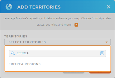
Effortlessly create and manage territories by adding a new territory from Mapline’s Repository. For a quicker result, type ERITREA in the search bar and select ERITREA REGIONS.
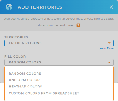
You’re halfway there. Let’s go splash some colors to your region map now.


Pro Tip: Mapline’s territory repository makes it possible to seamlessly add regional boundaries to your map. It houses hundreds of territories from countries across the globe, including Eritrea regions, to give you timely insight to stay ahead in today’s fiercely competitive business landscape.
CHOOSE REGION COLORS
Whether you’re tackling new challenges, examining demographic patterns, or seeking long-term solutions for your business, color-coding your regional map is the smartest approach. Colors can quickly help identify trends and opportunities, enabling you to make informed, strategic decisions that drive your business success.
Transform your territory analysis into a seamless experience as you choose the smartest color styles to help you uncover valuable location insights that can inform your decision-making.
With your new map of Eritrea regions, get ready to elevate your analysis!

GET NEW TERRITORY INSIGHTS
Make the best uses of a region-level analysis when you incorporate these powerful capabilities in your analytic toolkit:
- Auto-generate optimized routes for shortened travel time
- Easily create a system that helps you visualize trends and patterns to your data
- Create a system to view your business operations


