FRANCE CANTONS
- Territory Guide
- FRANCE CANTONS
Can you really get ahead of the competition just by looking at a map? With Mapline, you can! Mapping France’s cantons opens up a world of insights to help your business stay one step ahead. Mapline makes it easy to add and customize canton boundaries on your map, helping you discover growth opportunities and spot challenges. With an overlay of France cantons, you’ll gain the clear, competitive advantage that comes from seeing every detail of your market.
Ready to unlock the power of location analytics for your brand? Let’s get started by creating a map of France cantons.
WHAT ARE FRANCE CANTONS?
A canton is a small administrative division within a district or department, often used for local governance and statistical purposes. In France, cantons function as subdivisions of the country’s 342 districts, organizing France into 2,054 areas. While they no longer serve as standalone governmental units, cantons remain highly valuable for businesses, as they provide a granular view of specific regions, making it easy to pinpoint customer locations, analyze local market trends, and strategize territory-based efforts effectively.
ADD FRANCE CANTONS
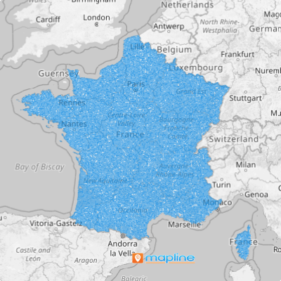
Add France cantons to your map now! This granular analysis enables you to optimize sales and marketing. Imagine having the visualization to tailor your campaigns to resonate with local audiences!
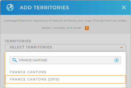
Believe it or not, it only takes a few clicks to add territories from Mapline’s repository. Just hit the ADD button in the upper left corner of your map. Instead of scrolling through lists, simply type FRANCE in the searchbar and select FRANCE CANTONS to add these areas to your map.


Pro Tip: Mapline provides a worldwide repository of territory boundaries for France, including cantons, France regions, France IRIS areas, France postal codes, and France departments, so you can select the level of detail that best fits your needs.
CHOOSE CANTON COLORS
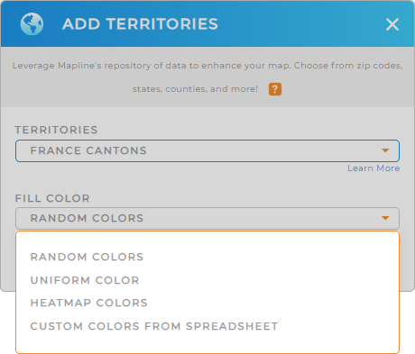
Colors add depth to your analysis, helping you instantly see competitive advantages and opportunities by region. Give your France canton map immediate clarity with custom color styles.
For example, color-code cantons by:
- Areas primarily served by competitors
- Untapped regions with high growth potential
- Overlapping areas served by multiple competitors
This helps you refine your strategy by showing exactly where you can take action. Once you’re ready, click OK, and your customized map of France cantons is ready to go!

GET NEW TERRITORY INSIGHTS
When you’re equipped with the right location insights, competing becomes much easier. Here’s what you can do with Mapline’s tools for territory maps:
- Get a clear overview of your competitors on your map
- Combine your current datasets with Mapline data to uncover patterns across territories
- Increase delivery efficiency with Mapline’s advanced routing capabilities, saving both time and cost


