GHANA REGIONS
- Territory Guide
- GHANA REGIONS
Be amazed by the wealth of insights you can gain by adding your data to a map of Ghana regions! Understanding the concentration and distribution of these administrative divisions empowers you to gather fresh ideas that can refine your strategies in regional market analysis, sales territory management, and logistics optimization. Integrate your data in this detailed regional map to unlock a new level of efficiency.
Get ready to revolutionize your business operations and make data-driven decisions that resonate with the unique characteristics of each region. This is your opportunity to transform insights into action and drive meaningful results across your business!
WHAT ARE GHANA REGIONS?
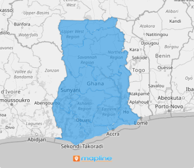
Ghana is a vibrant country in West Africa, bordered by the Gulf of Guinea and the Atlantic Ocean. Its administrative structure comprises four geographic terrestrial plains divided into 16 regions, which serve as the primary level of subnational government administration. Many brands leverage a map of Ghana regions to conduct region-level analysis that yields valuable insights, allowing them to tailor their strategies to resonate with local populations.
By focusing on these distinct boundaries, you, too can develop targeted strategies grounded in geographic insights! Embrace this regional analysis approach and in no time, you can craft strategies to improve your business growth in leaps and bounds!
ADD GHANA REGIONS
There’s no better way to drive business growth than adding this territory to your map now! Unlock a new dimension of insights for your business when your data is analyzed alongside region boundaries. This comprehensive map ensures you capture every critical insight needed to propel your business forward.
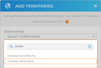
First, add a new territory from Mapline’s repository. Type GHANA into the search bar and choose to add GHANA REGIONS.
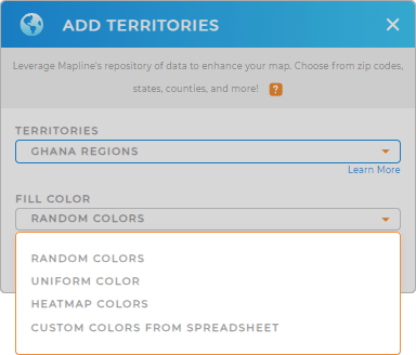
Now that you have the right territory, let’s move on to the last step –choosing your territory colors.


Pro Tip: Mapline’s Repository lets you add new territories from countries worldwide, including Ghana regions and Ghana districts, to gain invaluable insights into sales data, store risks, and competitive landscapes— within just a few seconds!
CHOOSE REGION COLORS
Color-coding your map not only enriches your analysis but also transforms data into actionable insights that propel your business forward. This clarity allows you to quickly spot trends, assess opportunities, and understand challenges, ultimately leading to smarter strategies and more effective actions.
To customize your map for the utmost usability, choose your preferred color styling option from the drop-down menu, then click OK.

GET NEW TERRITORY INSIGHTS
Here are some of Mapline’s powerful capabilities that you can readily apply as you do a region-level analysis to extract more insights:
- Access the key data within coverage areas
- Quickly generate bar graphs or line charts to glean valuable data insights
- Calculate midpoints to get more actionable insights


