GUERNSEY PARISHES
- Territory Guide
- GUERNSEY PARISHES
Unlock the full potential of a map of Guernsey parishes to improve your business strategies! Zoom in to the parish level for a closer look at local trends, giving you the edge to make smarter, more impactful decisions. Whether scouting for the perfect location to expand your business or fine-tuning your territory planning, this tool is your gateway to next-level growth.
Ready to discover your next winning move? Dive into the map and watch your business thrive!
WHAT ARE GUERNSEY PARISHES?
Guernsey is the second-largest island in the Channel Islands and part of the Bailiwick of Guernsey. It is divided into 10 vibrant parishes—each offering unique opportunities for growth and exploration. As a self-governing British Crown dependency, Guernsey’s parishes serve as civil administration districts, each managed by a Douzaine, a group of 12 or more dedicated Douzeniers.
For those in the tourism industry, this map is invaluable! Imagine having a detailed parish map to quickly analyze your data, uncovering hidden gems, and identifying high-potential areas. Whether you’re scouting locations or designing strategies to meet the needs of eager tourists, this tool helps you tap into market potential like never before!
ADD GUERNSEY PARISHES
Capture accurate geographic context by incorporating the parish boundaries into your map. The location insights can be used to make smarter, data-driven decisions, helping you craft strategies that elevate your business operations. Imagine the advantage of knowing exactly how your data interacts within each parish.
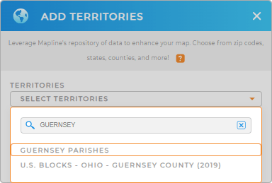
To create a territory map that’s a game changer for your business growth, first, add a new territory from Mapline’s repository. Then type GUERNSEY in the search bar and click on GUERNSEY PARISHES to add to your map.
How easy can it get? Now, let’s talk about style settings.


Pro Tip: Supercharge your territory planning as you leverage Mapline’s territory repository to access hundreds of territory boundaries from countries worldwide including Guernsey parishes. This is especially important if you’re looking for optimal solutions for global business expansion.
CHOOSE PARISH COLORS
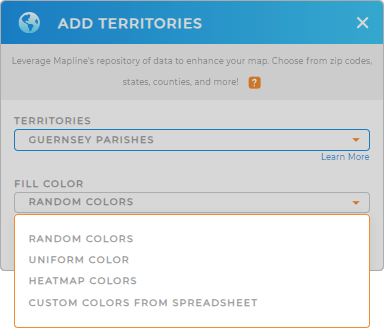
Mapline makes applying color style settings a breeze, allowing you to customize your map for instant insights. By adding distinct colors to highlight district boundaries, you’ll achieve exceptional data visualization that brings clarity to your analysis. These visual cues make it easier to spot trends and capture hyper-focused insights, giving you the power to make more informed and strategic decisions.
Just add the best color styling option, then click OK.
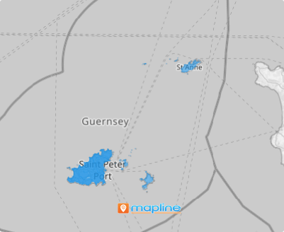
There you go! Now start digging into those valuable insights on your map of Guernsey parishes!

GET NEW TERRITORY INSIGHTS
Enhance your parish territory map even more by incorporating these powerful capabilities in your analytic toolkit:
- Set up a system that lets you visualize trends and patterns in a glance
- Add center of minimum distance to your map to help reduce mileage and pinpoint travel challenges
- Quickly generate sales reports


