JAMAICA PARISHES
- Territory Guide
- JAMAICA PARISHES
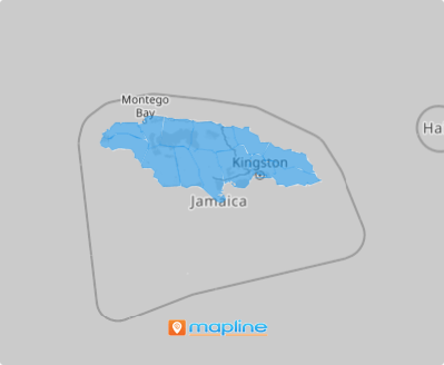
Add Jamaica parishes to your map and elevate your analytics to new heights! By visualizing these distinct regions, you can access precise, location-specific insights that can revolutionize your entire business operation. With a detailed view of each parish, you’ll quickly identify high-potential hotspots as well as areas that may require attention. This insight empowers you to fine-tune your strategies, ensuring your resources are allocated where they’ll have the greatest impact.
This map does more than just enhance your analytics; it amplifies your business’s potential to thrive in a competitive landscape. Unlock the power of a parish map today and watch your business strategies soar to great heights!
WHAT ARE JAMAICA PARISHES?
Jamaica, a breathtaking Caribbean island with 14 parishes, offers brands unique advantages when they leverage parish-level maps to gather critical insights within each boundary. By plotting data on these maps, patterns, and opportunities become immediately visible, creating a solid foundation for strategic decision-making and efficient business management. For instance, brands can identify parishes rich in hotels, restaurants, and entertainment venues—key contributors to the island’s economic vitality—and tailor hyper-focused strategies to maximize their impact in these vibrant areas.
What are you waiting for? Let’s map parish boundaries now to uncover connections between locations and gain valuable insights!
ADD JAMAICA PARISHES
Transform your map into a powerful visualization tool designed to capture insights for targeted marketing! With a robust map at your fingertips, you can strategically direct your marketing efforts and resources to the areas that need a boost!
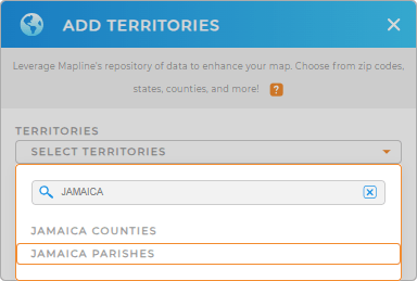
To leverage the power of this map, first, add a new territory from Mapline’s repository. Then, in the search bar, type JAMAICA and select JAMAICA PARISHES.
Now, the next step will leave you mind-blown!


Pro Tip: Tap into Mapline’s repository of worldwide territories to effortlessly add new territories. That includes the precise boundary details of Jamaica counties and parishes. With this efficiency, you can quickly gain insights and make informed decisions that drive your business forward!
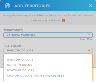
CHOOSE PARISH COLORS
By using colors strategically, you can transform complex data into accessible insights, making it easier to make informed, data-driven decisions. For instance, you can color-code parish boundaries based on sales representatives’ assignments performance, or other key metrics. Applying territory colors also sparks insights to quickly identify high-performing vs underperforming areas.
Choose the color styles that can significantly impact how you can refine your strategies and optimize your sales efforts for maximum impact.
That wraps up how you easily add Jamaica parishes to your map. Now, the path to insight is clearer than ever!

GET NEW TERRITORY INSIGHTS
Achieve more precise insights for decision-making as you add these capabilities to your map of Jamaica parishes:
- Understand key data within your coverage areas
- Add a new chart to quickly access and share the exact information you need
- Create a cohesive plan to track events in your industry


