KENYA COUNTIES
- Territory Guide
- KENYA COUNTIES
Make a map of Kenya counties an essential part of your analytic toolkit and uncover a wealth of insights that will catapult your business to success. Imagine being able to understand the huge difference between meeting customer satisfaction and exceeding them – all because you get to understand what your customers really need! That’s the power of county territory analysis! By visualizing the local perspectives within the context of specific counties, you can explore opportunities that may have previously remained hidden. Glean more valuable insights as you adopt this approach and engage with your customers in more meaningful and impactful ways.
Let’s delve deeper into the transformative power of detailed mapping and discover how it can elevate your business to new heights!
WHAT ARE KENYA COUNTIES?
The Republic of Kenya is an East African nation bordered by Tanzania, Uganda, South Sudan, and Ethiopia. In 2013, Kenya restructured its national administrative divisions, resulting in the formation of 47 counties, each corresponding to the country’s 47 legally recognized districts. This reorganization has allowed for more localized governance and resource management, enhancing the country’s development potential.
Dive into hyper-local analysis onto these specific administrative divisions to gain insights that can transform your strategies to improve your marketing, logistics, and overall business operations.
ADD KENYA COUNTIES
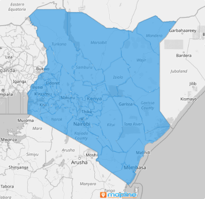
In just a few clicks, Kenya counties can be easily added to your map. Once added, you’ve enhanced the power of your territory map to let you unlock powerful insights into regional trends, enabling you to craft strategies that resonate with the needs of your target market.
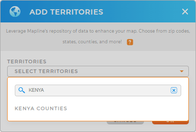
Let’s add these administrative boundaries to your map now! Just click the ADD button on the left side of your map. Then, click TERRITORIES to add a new territory from Mapline’s repository. Type KENYA in the search bar. You’ll be directed to click on KENYA COUNTIES.


Pro Tip: Integrate various regional boundaries from Mapline’s extensive collection of territory boundaries, including Kenya counties, into your map for a richer and more informative analysis.
CHOOSE COUNTY COLORS
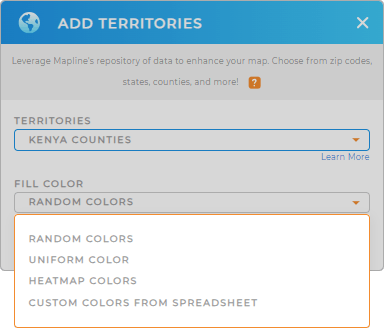
Now that you’ve added the right territory, it’s time to apply territory colors. Colors help elevate your ability to capture insights with precision. This is the power of color-coded analytics! Get ready to transform your understanding of business operations, marketing strategies, and logistics. When you choose the best color styles that Mapline offers. Whether you choose random colors, uniform color, custom colors, or heat map colors, you’re a sure winner when you apply a fill color.
Click OK when you have configured your settings. Now, explore your data on your map of Kenya counties.

GET NEW TERRITORY INSIGHTS
Optimize your business operations by leveraging these advanced mapping capabilities.
- Understand the impact of distance on your ROI
- Customize your pin colors to easily identify your customers at a glance
- Run distance calculations and explore information from multiple datasets all at once!


